MyTopo
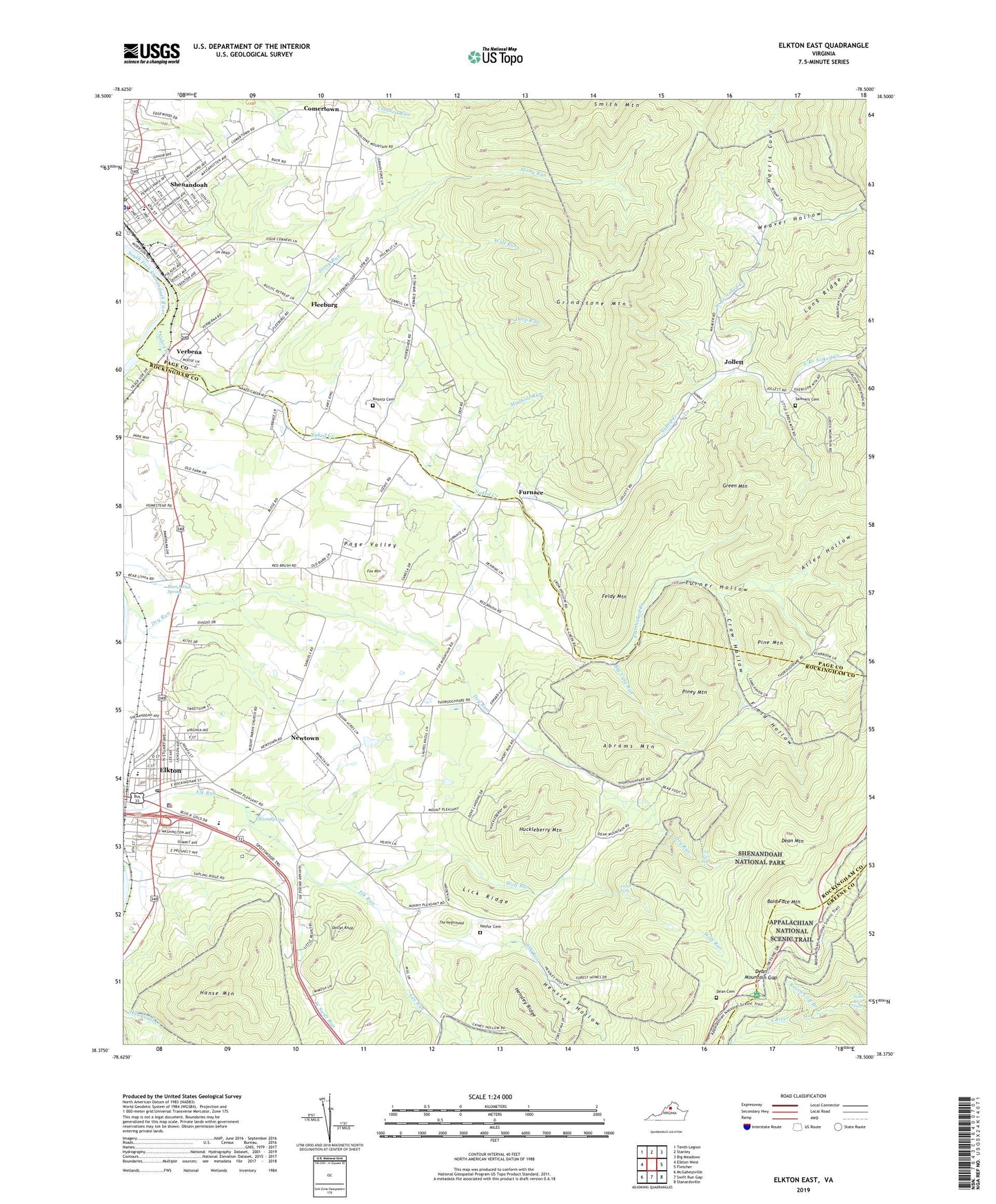
Elkton East Virginia US Topo Map
Couldn't load pickup availability
2022 topographic map quadrangle Elkton East in the state of Virginia. Scale: 1:24000. Based on the newly updated USGS 7.5' US Topo map series, this map is in the following counties: Rockingham, Page, Greene. The map contains contour data, water features, and other items you are used to seeing on USGS maps, but also has updated roads and other features. This is the next generation of topographic maps. Printed on high-quality waterproof paper with UV fade-resistant inks.
Quads adjacent to this one:
West: Elkton West
Northwest: Tenth Legion
North: Stanley
Northeast: Big Meadows
East: Fletcher
Southeast: Stanardsville
South: Swift Run Gap
Southwest: McGaheysville
This map covers the same area as the classic USGS quad with code o38078d5.
Contains the following named places: Abrams Mountain, Allen Hollow, Bald Face Mountain, Bald Face Mountain Overlook, Bear Lithia Church, Bear Lithia Spring, Big Creek, Big Ugly Run, Big Ugly Run Trail, Cedar Falls, Coffman Church, Comertown, Crow Hollow, Dean Cemetery, Dean Mountain, Dean Mountain Gap, Deep Run, District 5 Shenandoah, Dollys Knob, Dry Run, Dry Run Falls, East Branch Naked Creek, Elkton, Elkton Elementary School, Elkton Emergency Squad Station 30, Elkton Middle School, Elkton Police Department, Elkton Post Office, Elkton Spring, Elkton Town Hall, Falls Hollow, Feldy Mountain, Field Hollow, Fields United Methodist Church, First Christian Church, Fleeburg, Fox Mountain, Furnace, Green Mountain, Grindstone Mountain, Hanse Mountain, Hanse Mountain Trail, Harris Cove, Harris Cove Utz Gap Trail, Hensley Church, Hensley Church Trail, Hensley Hollow, Hensley Hollow Trail, Huckleberry Mountain, Independent Church, Jollett, Koontz Cemetery, Lee Run, Lick Ridge, Mount Lebanon Church, Mount Paran Church, Mount Pleasant Church, Mudhole Run, Naked Creek, Naked Creek Church, Naylor Cemetery, Newtown, Oak Grove Church, Pine Mountain, Piney Mountain, Raven Cliff Branch, Samuels Cemetery, Shenandoah Assembly of God Church, Shenandoah Elementary School, Shenandoah Police Department, Shenandoah Post Office, Shenandoah Volunteer Fire Company, Shenandoah Volunteer Rescue Squad, Shenelk Plaza Shopping Center, South Branch Naked Creek, South River Falls, South River Falls Trail, South River Overlook, South River Picnic Area, Stony Run, Stony Run Trail, The Negrohead, Town of Elkton, Town of Shenandoah, Turner Hollow, Verbena, Weaver Church, Weaver Hollow, Weaver School, West Branch Naked Creek, West Swift Run, Wolf Run, ZIP Code: 22827