MyTopo
Waynesboro East Virginia US Topo Map
Couldn't load pickup availability
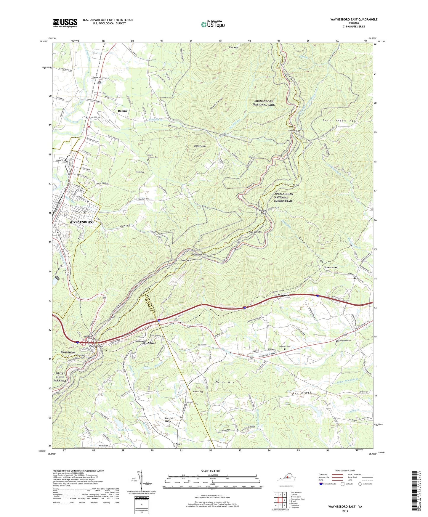
2022 topographic map quadrangle Waynesboro East in the state of Virginia. Scale: 1:24000. Based on the newly updated USGS 7.5' US Topo map series, this map is in the following counties: Albemarle, Augusta, Nelson, Waynesboro (city). The map contains contour data, water features, and other items you are used to seeing on USGS maps, but also has updated roads and other features. This is the next generation of topographic maps. Printed on high-quality waterproof paper with UV fade-resistant inks.
Quads adjacent to this one:
West: Waynesboro West
Northwest: Fort Defiance
North: Crimora
Northeast: Browns Cove
East: Crozet
Southeast: Covesville
South: Greenfield
Southwest: Sherando
This map covers the same area as the classic USGS quad with code o38078a7.
Contains the following named places: Afton, Afton Census Designated Place, Afton House, Afton Overlook, Afton Post Office, Baldwin Dam, Baldwin Pond, Basic City, Basic United Methodist Church, Beagle Gap, Beagle Gap Overlook, Bear Den Mountain, Blair Park, Blue Ridge Acres, Blue Ridge Chapel, Blue Ridge Farm, Blue Ridge Tunnel, Brooksville, Brookville Manor, Brookville Tunnel, Calf Mountain, Calf Mountain Overlook, Casa Maria, Church of the Foursquare Gospel, Critzers Shop, Dooms, Dooms Census Designated Place, Dooms Fire Department Company 9, Eastside Speedway, Emmanuel Cemetery, Emmanuel Church, Fairfax Hall School, First Church of God, Glen Kirk Church, Greenwood, Greenwood Hollow, Greenwood Post Office, Greenwood School, Greenwood Tunnel, Hayes Branch, Jarman Gap, Jones Hollow, Lebanon Cemetery, Lebanon Presbyterian Church, McCormick Gap, McCormick Gap Overlook, Mikes Knob, Mirador, Mirador Heliport, Mount Lebanon Cemetery, Mount Lebanon Church, Mount Zion Church, Mountain View School, Newtown, Oakleigh, Pea Ridge, Piedmont, Providence School, Ramsey, Ramsey Mountain, Rockfish Gap, Rockfish Gap Visitors Center, Rosehill, Round Top, Sawmill Ridge, Sawmill Ridge Overlook, Sawmill Ridge Trail, Sawmill Run, Sawmill Run Overlook, Sawmill Run Ranger Station, Sawmill Run Shelter, Scott Mountain, Shenandoah Heights Baptist Church, Shenandoah Heights Elementary School, Smyrna Church, Steele Run, Swannanoa, The Country Store, Tiverton, Tunnel Branch, Turk Branch, Turk Branch Trail, Turks Mountain, WANV-FM (Staunton), Wavertree Hall, WPVA-FM (Waynesboro), WVTU-FM (Charlottesville), ZIP Code: 22943