MyTopo
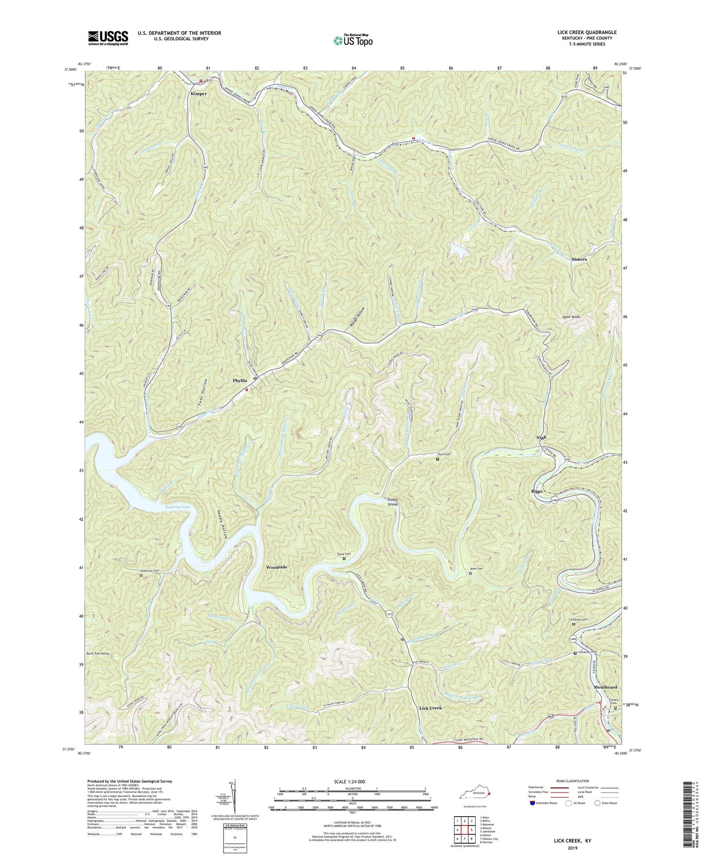
Lick Creek Kentucky US Topo Map
Couldn't load pickup availability
2022 topographic map quadrangle Lick Creek in the state of Kentucky. Scale: 1:24000. Based on the newly updated USGS 7.5' US Topo map series, this map is in the following counties: Pike. The map contains contour data, water features, and other items you are used to seeing on USGS maps, but also has updated roads and other features. This is the next generation of topographic maps. Printed on high-quality waterproof paper with UV fade-resistant inks.
Quads adjacent to this one:
West: Millard
Northwest: Meta
North: Belfry
Northeast: Matewan
East: Jamboree
Southeast: Harman
South: Elkhorn City
Southwest: Hellier
This map covers the same area as the classic USGS quad with code o37082d3.
Contains the following named places: Anderson Cemetery, Barrett Fork, Becky Branch, Big Creek, Biggs, Biggs Post Office, Blueford Fork, Camp Evangel, Cane Fork, Card Creek, Cedar Bottom Church, Childress Cemetery, Cow Branch, Crooked Branch, Dicks Fork, Edo Church, Edo Post Office, Elk Foot Creek School, Elkfool Branch, Elkhorn Creek, Elswick Fork, Feds Hollow, Fedscreek Division, First Fork Big Creek, First Fork Millers Creek, Fish Trap Post Office, Fishtrap Lake, Flanary Branch, Flanary Cemetery, Gabriel Branch, Gabriel Branch School, Good Cemetery, Grange Store Post Office, Grapevine Creek, Grapevine School, Grapevine Volunteer Fire Department, Happy Hollow, Head of Grapevine School, Head of Johnson Creek, Head of Johnson Creek School, Honey Fork, Horse Narrows Branch, Hunt Branch, Hunt Cemetery, Hunt Knob, Ironia Post Office, Island Creek, Island Creek School, Jessie Branch, Kimber Post Office, Kimper, Kimper Volunteer Fire Department, Kimper Volunteer Fire Department Station 2, King Post Office, Lane Branch, Left Fork Grapevine Creek, Left Fork Island Creek, Left Fork Levisa Fork, Lick Creek, Lick Creek Post Office, Lick Creek School, Lick Creek Station, Little Card Creek, Long Fork, Long Fork School, Lower Camp Branch, Marts Branch, Merry Branch, Middle Fork Elkhorn Creek, Miletree Branch, Miller Creek School, Millers Creek, Morgan Branch, Mountain View Church, Mouth of Big Creek School, Mouth of Card Post Office, Mouth of Card School, Mouth of Sims Creek School, Mouthcard, Mouthcard Baptist Church, Mouthcard Post Office, Mouthcard School, Nigh, Phyllis, Phyllis Post Office, Pond Fork, Pritchett Fork, Rattlesnake Branch, Red Bud Post Office, Right Fork Riles Branch, Riles Branch, Road Fork, Rose Cemetery, Rough Hollow, Rowton Post Office, Sanders Branch, Schoolhouse Branch, Second Fork Millers Creek, Shop Branch, Simers, Simers Post Office, Sims Creek, Sims Creek School, Stump Island, Tantrough Branch, Trace Fork, Upper Camp Branch, Wolfpen Branch, Woodside, ZIP Codes: 41540, 41548, 41554