MyTopo
Hightown Virginia US Topo Map
Couldn't load pickup availability
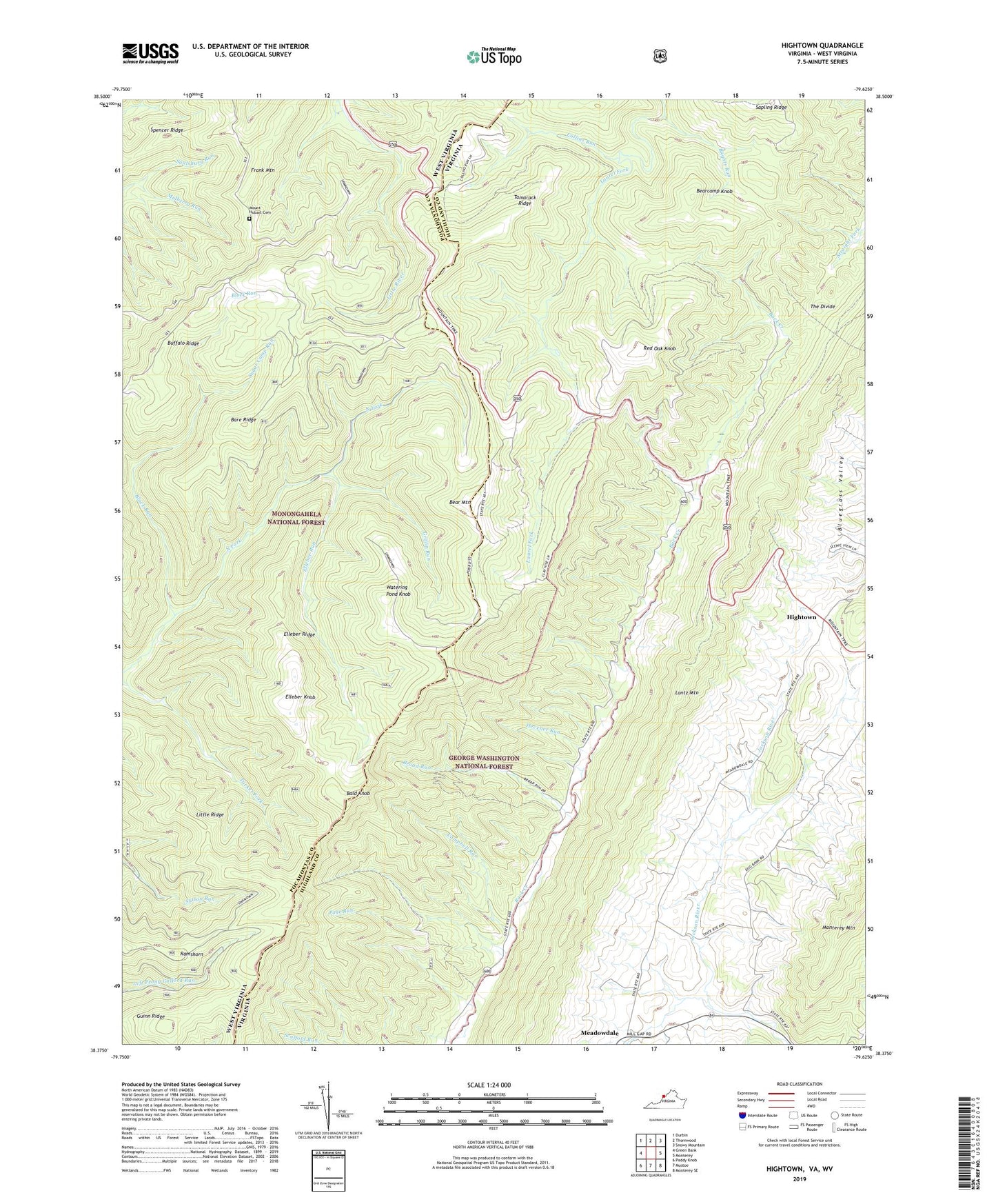
2019 topographic map quadrangle Hightown in the states of Virginia, West Virginia. Scale: 1:24000. Based on the newly updated USGS 7.5' US Topo map series, this map is in the following counties: Highland, Pocahontas. The map contains contour data, water features, and other items you are used to seeing on USGS maps, but also has updated roads and other features. This is the next generation of topographic maps. Printed on high-quality waterproof paper with UV fade-resistant inks.
Quads adjacent to this one:
West: Green Bank
Northwest: Durbin
North: Thornwood
Northeast: Snowy Mountain
East: Monterey
Southeast: Monterey SE
South: Mustoe
Southwest: Paddy Knob
Contains the following named places: Bald Knob, Bare Ridge, Bear Mountain, Bearcamp Knob, Blights Run, Block Run, Blue Grass District, Broad Run, Campbell Run, Collins Run, Elleber Knob, Elleber Ridge, Elleber Run, Frank Mountain, Griffin Run, Guinn Ridge, Hevener Run, Hightown, Little Ridge, Meadowdale, Mount Hobart Methodist Church, Mountain Path, Mulberry Run, Page Run, Pisgah Church, Ramshorn, Rattlesnake Hollow, Rattlesnake Trail, Red Oak Knob, Sapling Ridge, Spencer Ridge, Sugar Camp Run, Summit School, Tamarack Ridge, The Divide, Top Allegheny Chapel, Top of Allegheny, Vanderpool Gap, Watering Pond Knob, Wilmoth Cemetery, ZIP Code: 24465