MyTopo
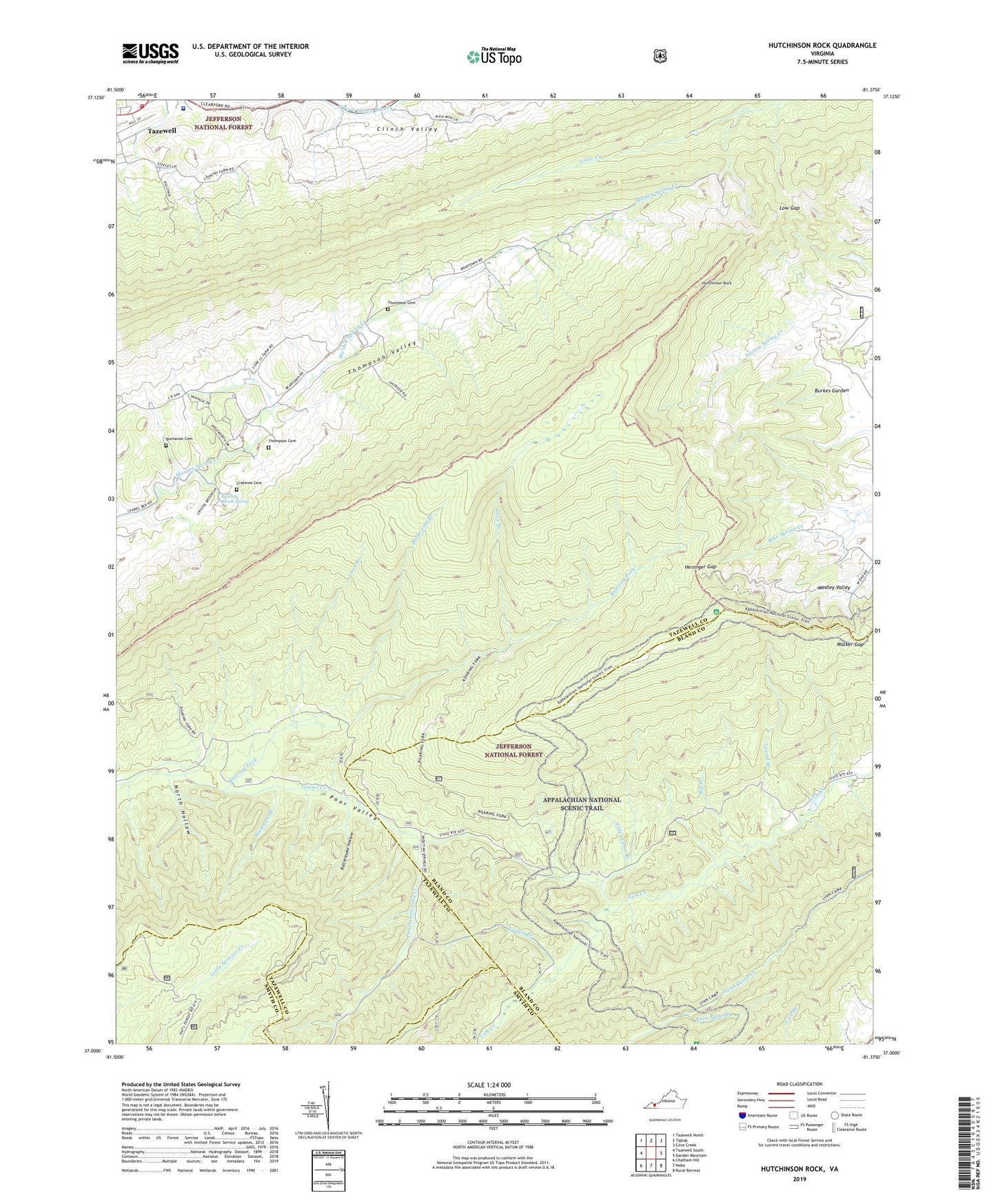
Hutchinson Rock Virginia US Topo Map
Couldn't load pickup availability
Also explore the Hutchinson Rock Forest Service Topo of this same quad for updated USFS data
2022 topographic map quadrangle Hutchinson Rock in the state of Virginia. Scale: 1:24000. Based on the newly updated USGS 7.5' US Topo map series, this map is in the following counties: Tazewell, Bland, Smyth. The map contains contour data, water features, and other items you are used to seeing on USGS maps, but also has updated roads and other features. This is the next generation of topographic maps. Printed on high-quality waterproof paper with UV fade-resistant inks.
Quads adjacent to this one:
West: Tazewell South
Northwest: Tazewell North
North: Tiptop
Northeast: Cove Creek
East: Garden Mountain
Southeast: Rural Retreat
South: Nebo
Southwest: Chatham Hill
This map covers the same area as the classic USGS quad with code o37081a4.
Contains the following named places: Alder Cabin Branch, Bald Hill, Barkcamp Branch, Beartown Ridge, Beartown Wilderness, Beavers Brook Spring, Big Branch, Bobs Spur, Buchanan Cemetery, Carilion Tazewell Community Hospital, Chestnut Ridge, Clinch Valley, Coon Branch, Cove Branch, Crabtree Cemetery, Garden Mountain, Ghost Knob, Gospel Tabernacle, Hall Ridge, Heninger Gap, Hutchinson Rock, Jeffersonville Volunteer Rescue Squad, Joe Neets, John Spur, Knot Mole Branch, Knot Mole Shelter, Laurel Branch, Lifeline Ambulance Service Tazewell, Low Gap, Marys Church, Mount Victory Church, Mountain View Church, North Hollow, Punch and Judy Creek, Rattlesnake Hollow, Redoak Ridge, Rich Mountain, Roaring Fork, Slickrock Branch, Station Spring Creek, Steel Hill, Tazewell County Fire and Rescue Substation, Thompson Cemetery, Thompson School, Totten Branch, Walker Gap, Wynne Peak