MyTopo
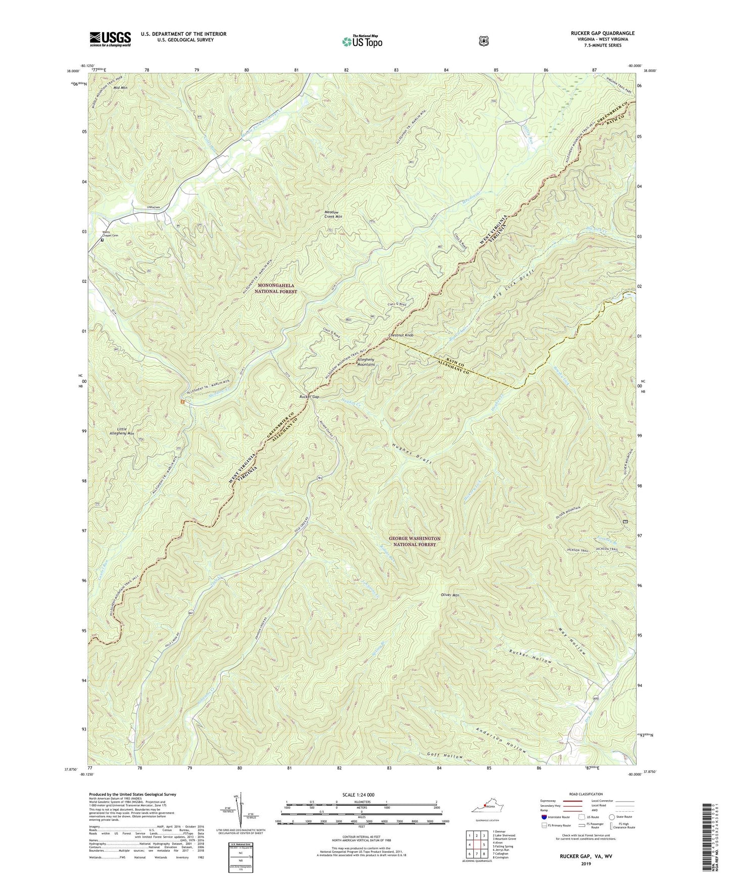
Rucker Gap Virginia US Topo Map
Couldn't load pickup availability
Also explore the Rucker Gap Forest Service Topo of this same quad for updated USFS data
2022 topographic map quadrangle Rucker Gap in the states of Virginia, West Virginia. Scale: 1:24000. Based on the newly updated USGS 7.5' US Topo map series, this map is in the following counties: Alleghany, Greenbrier, Bath. The map contains contour data, water features, and other items you are used to seeing on USGS maps, but also has updated roads and other features. This is the next generation of topographic maps. Printed on high-quality waterproof paper with UV fade-resistant inks.
Quads adjacent to this one:
West: Alvon
Northwest: Denmar
North: Lake Sherwood
Northeast: Mountain Grove
East: Falling Spring
Southeast: Covington
South: Callaghan
Southwest: Jerrys Run
Contains the following named places: Allegheny Mountain Trail, Big Lick Draft, Brushy Lick, Chestnut Knob, Coles Run, Diley Trail, Falling Spring District, Hickory Lick, Jackson Trail, Lake Sherwood Trail, Laurel Run, May Hollow, Oliver Mountain, Oliver Mountain Trail, Pond Lick Run, Robins Run, Rucker Gap, Rucker Hollow, Watts Chapel Cemetery