MyTopo
Lunenburg Virginia US Topo Map
Couldn't load pickup availability
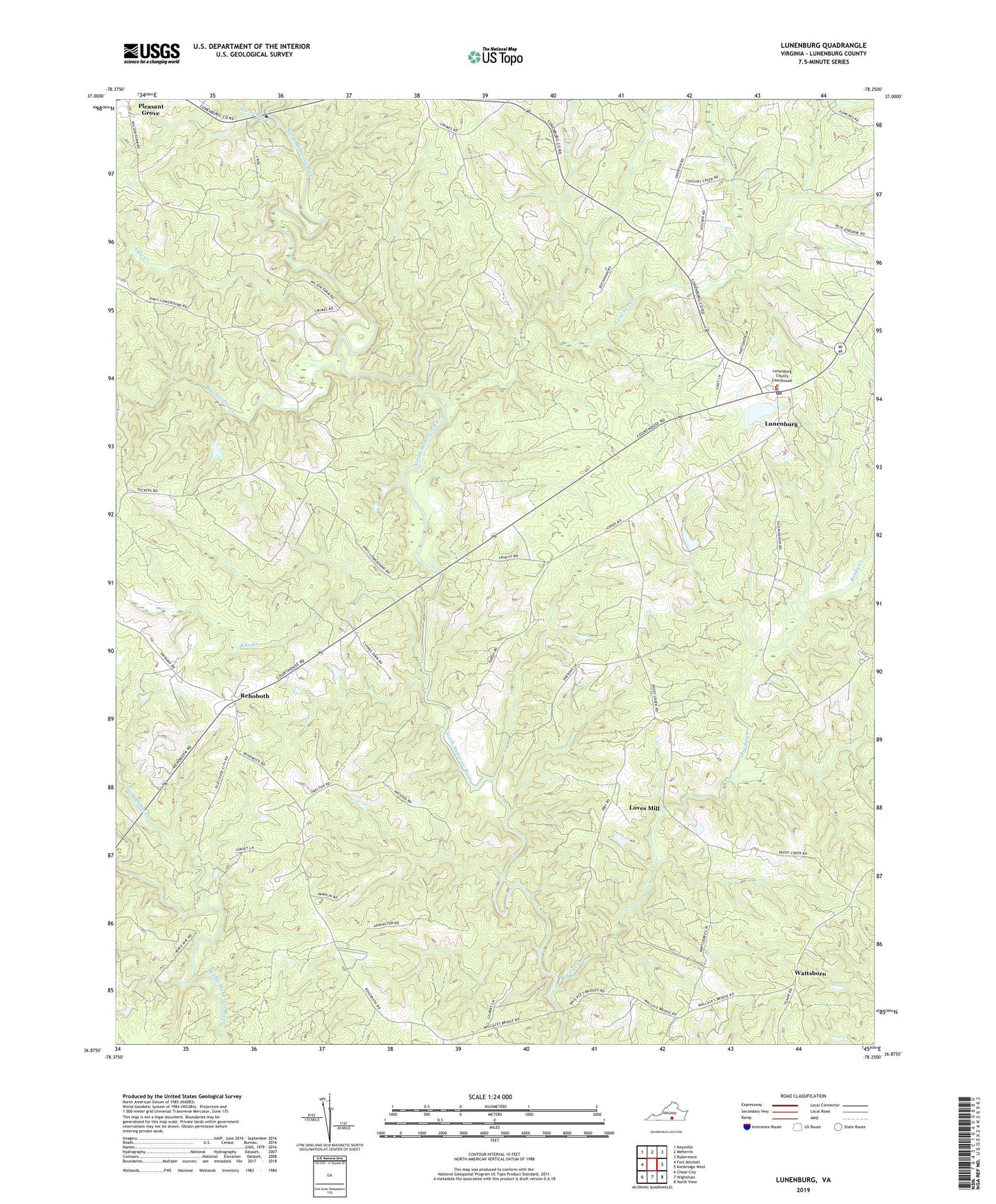
2019 topographic map quadrangle Lunenburg in the state of Virginia. Scale: 1:24000. Based on the newly updated USGS 7.5' US Topo map series, this map is in the following counties: Lunenburg. The map contains contour data, water features, and other items you are used to seeing on USGS maps, but also has updated roads and other features. This is the next generation of topographic maps. Printed on high-quality waterproof paper with UV fade-resistant inks.
Quads adjacent to this one:
West: Fort Mitchell
Northwest: Keysville
North: Meherrin
Northeast: Rubermont
East: Kenbridge West
Southeast: North View
South: Wightman
Southwest: Chase City
Contains the following named places: Bethany Church, Bethlehem Reformed Zion Union Apostolic Church, Big Juniper Creek, Calvary Church, Couches Creek, Crymes Store, Hurricane Creek, Kits Creek, Loves Mill, Loves Mill District, Lunenburg, Lunenburg Census Designated Place, Lunenburg County Courthouse, Lunenburg County Sheriff's Office, Lunenburg Courthouse Historic District, Lunenburg Post Office, Lyle Creek, McCormicks Mill, Mount Olivet Church, New Hope Church, New Rehoboth Church, Reedy Church, Reedy Creek, Reedy Creek Christian Church, Rehoboth, Rosewood, Saint Johns Creek, Thowhorn Dam, Traffic, Tussekiah Church, Victoria Fire Department, Wattsboro, ZIP Codes: 23952, 23974