MyTopo
Loretto Virginia US Topo Map
Couldn't load pickup availability
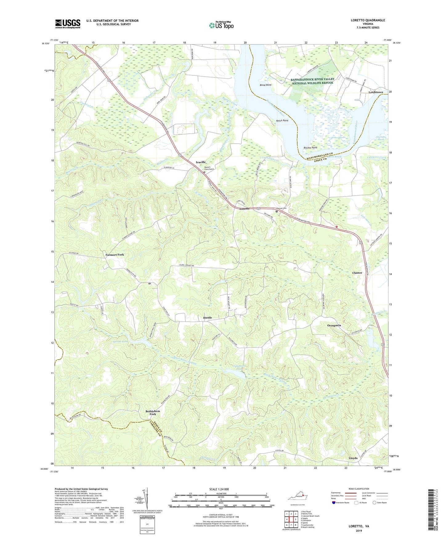
2022 topographic map quadrangle Loretto in the state of Virginia. Scale: 1:24000. Based on the newly updated USGS 7.5' US Topo map series, this map is in the following counties: Essex, Westmoreland, Caroline. The map contains contour data, water features, and other items you are used to seeing on USGS maps, but also has updated roads and other features. This is the next generation of topographic maps. Printed on high-quality waterproof paper with UV fade-resistant inks.
Quads adjacent to this one:
West: Supply
Northwest: Port Royal
North: Rollins Fork
Northeast: Colonial Beach South
East: Champlain
Southeast: Mount Landing
South: Cauthornville
Southwest: Sparta
This map covers the same area as the classic USGS quad with code o38077a1.
Contains the following named places: Baylors Creek, Baylors Dam, Baylors Pond, Bethlehem Church, Bethlehem Fork, Black Water Swamp, Blind Point, Carmel Cemetery, Chance, Cockerel Creek, Devils Reach, Drakes Marsh, Elmwood Creek, Farmers Fork, Hunters Mill Dam, Hunters Millpond, Hustle, Hustle Post Office, Iraville, Ketch Point, Laundrums Creek, Line Creek, Lloyds, Loretto, Mount Olive Church, Mount Pleasant, Mount Pleasant Landing, Mount Salem Church, North District, Occupacia, Ritchie Point, Saunders Wharf, Spindle Pond, Spindles Mill Dam, Stillwater Creek, Taliaferro Mill Dam, Taliaferro Pond, Tappahannock - Essex Volunteer Fire Department Station 3, Taylors, Vauters Church, Vauters Churchyard, Zion Church, ZIP Codes: 22436, 22476, 22509