MyTopo
Supply Virginia US Topo Map
Couldn't load pickup availability
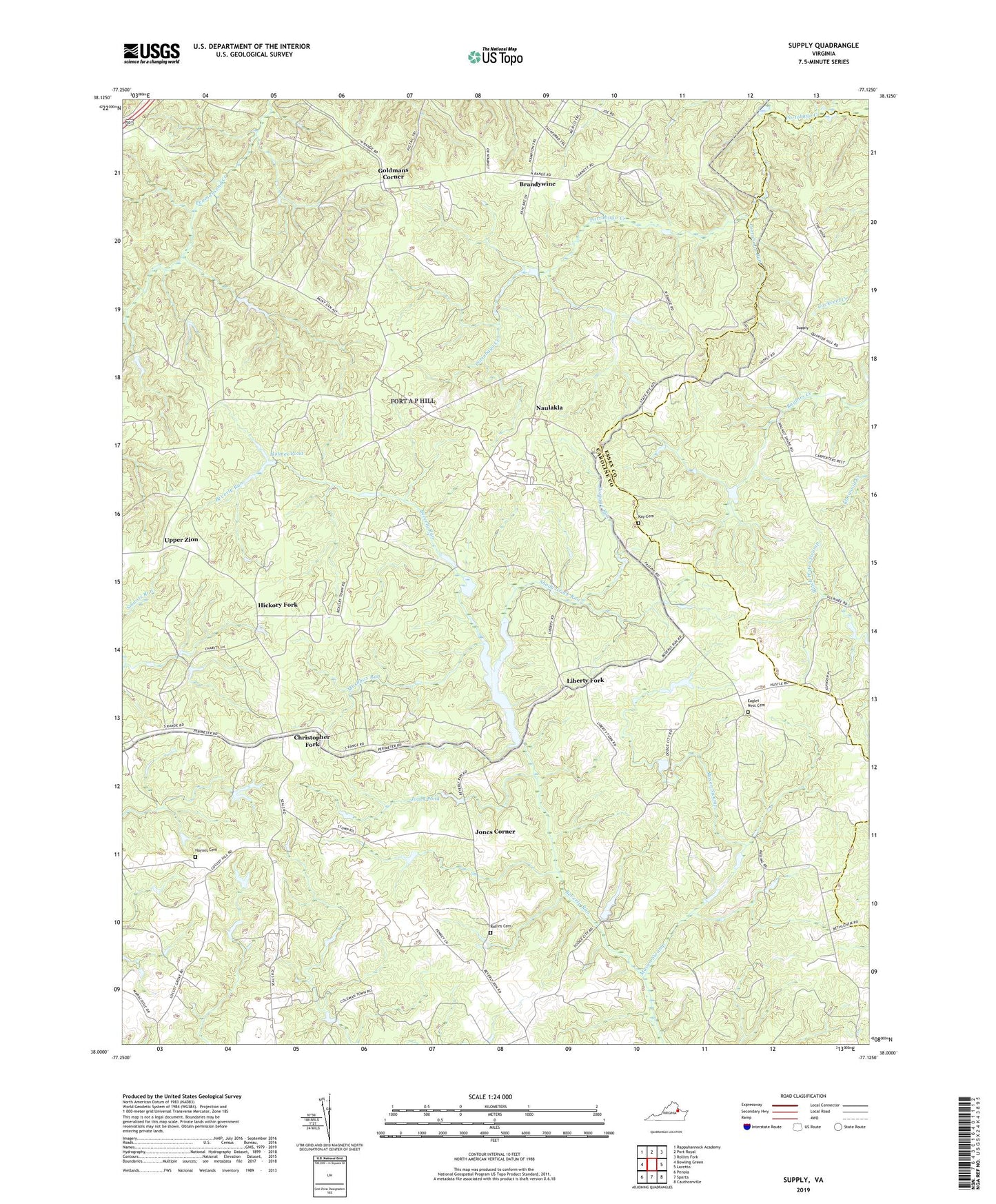
2022 topographic map quadrangle Supply in the state of Virginia. Scale: 1:24000. Based on the newly updated USGS 7.5' US Topo map series, this map is in the following counties: Caroline, Essex. The map contains contour data, water features, and other items you are used to seeing on USGS maps, but also has updated roads and other features. This is the next generation of topographic maps. Printed on high-quality waterproof paper with UV fade-resistant inks.
Quads adjacent to this one:
West: Bowling Green
Northwest: Rappahannock Academy
North: Port Royal
Northeast: Rollins Fork
East: Loretto
Southeast: Cauthornville
South: Sparta
Southwest: Penola
This map covers the same area as the classic USGS quad with code o38077a2.
Contains the following named places: Brandywine, Broomstraw Trail, Christopher Fork, Daniel Corner, Eagles Nest Cemetery, Ebenezer Church, Enon Church, Goldmans Corner, Haynes Cemetery, Hickory Fork, Holmes Pond, Jacks Fork, Jones Corner, Jones Pond, Kay Cemetery, Liberty Fork, Martins Corner, Mashbox Run, Mason Swamp, Mount Zion Church, Naulakla, P D Pitts Dam, Passing, Penny Corner, Portage Run, Portobago Run, Rollins Cemetery, Salem Church, Shady Grove Run, Supply, Sycamore School, Upper Zion, White Lake, White Lake Dam, Whites