MyTopo
Pound Virginia US Topo Map
Couldn't load pickup availability
Also explore the Pound Forest Service Topo of this same quad for updated USFS data
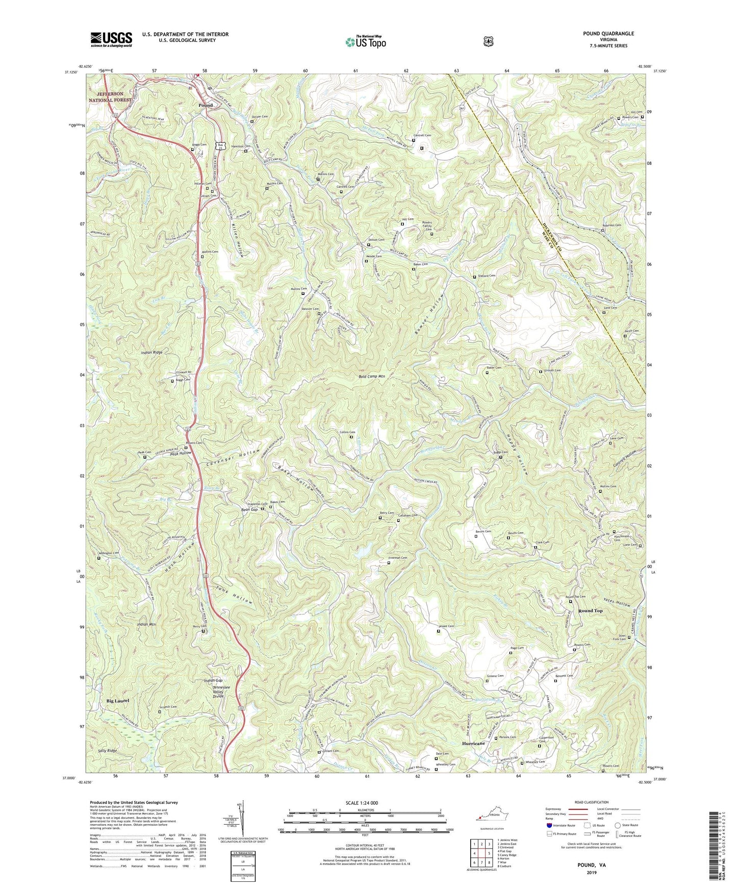
2022 topographic map quadrangle Pound in the state of Virginia. Scale: 1:24000. Based on the newly updated USGS 7.5' US Topo map series, this map is in the following counties: Wise, Dickenson. The map contains contour data, water features, and other items you are used to seeing on USGS maps, but also has updated roads and other features. This is the next generation of topographic maps. Printed on high-quality waterproof paper with UV fade-resistant inks.
Quads adjacent to this one:
West: Flat Gap
Northwest: Jenkins West
North: Jenkins East
Northeast: Clintwood
East: Caney Ridge
Southeast: Coeburn
South: Wise
Southwest: Norton
This map covers the same area as the classic USGS quad with code o37082a5.
Contains the following named places: Addington Cemetery, Addison Chapel, Ambrose Branch, Baker Cemetery, Baker Hollow, Baker School, Barn Branch, Bean Gap, Bennett Cemetery, Berry Cemetery, Bevins Cemetery, Big Branch, Big Laurel, Boggs Cemetery, Boggs School, Bold Camp Creek, Bold Camp Mountain, Bowser Hollow, Callaham Cemetery, Cane Branch, Cantrell Cemetery, Cavenger Hollow, Clark Cemetery, Clinchfield Moss Mines, Collins Cemetery, Collins School, Culbertson Cemetery, Dale Branch, Dale Cemetery, District 2, Dotson Cemetery, Dotson Creek, Dotson Fork, Dotson School, Duckcamp Branch, Duncan Gap, Fairview Church, Firbie Chapel, Freeman Cemetery, Gilliam Cemetery, Gilliam School, Greene Cemetery, Hamilton Cemetery, Happy Hollow, Harmony Chapel, Hash Hollow, Hays Branch, Hill Cemetery, Hillman Cemetery, Hubbard Chapel, Hugh, Hurricane, Hurricane Branch, Hutchinson Cemetery, Indian Creek, Indian Gap, Indian Ridge, James Woodrow Adams Elementary and Middle School, Jessee Cemetery, Keith Cemetery, Killen Hollow, Lane Branch, Lane Cemetery, Lanes Store, Left Fork Lick Fork, Lick Branch, Lick Fork Pond, Lick Fork School, McFall Fork, Meade Cemetery, Meade Fork, Meade School, Meadow Branch, Moss Mine Number One Dam, Mullins Cemetery, Mullins Fork, North Fork Pound River, Old Regular Church, Page Cemetery, Parsons Cemetery, Peak Cemetery, Peak Hollow, Peaks Store, Perry Cemetery, Potcamp Branch, Pound, Pound Police Department, Pound Post Office, Pound Rescue Squad, Pound Volunteer Fire Department, Powers Cemetery, Powers Family Cemetery, Pyles Memorial Church, Red Onion State Prison, Rickey Branch, Riley Branch, Riner School, Robinson Cemetery, Rock Creek, Round Top, Round Top Cemetery, Screech Cemetery, Short, Skeen School, Skeen Union Church, South Fork Pound River, Stallard Branch, Stallard Cemetery, Stapleton Cemetery, Steel Fork, Steel Fork Cemetery, Store House Branch, Strouth Cemetery, Tank Hollow, Trace Fork, Turkey Branch, Vanover Cemetery, Wheatley Cemetery, Yates Hollow, ZIP Code: 24293