MyTopo
Rochelle Virginia US Topo Map
Couldn't load pickup availability
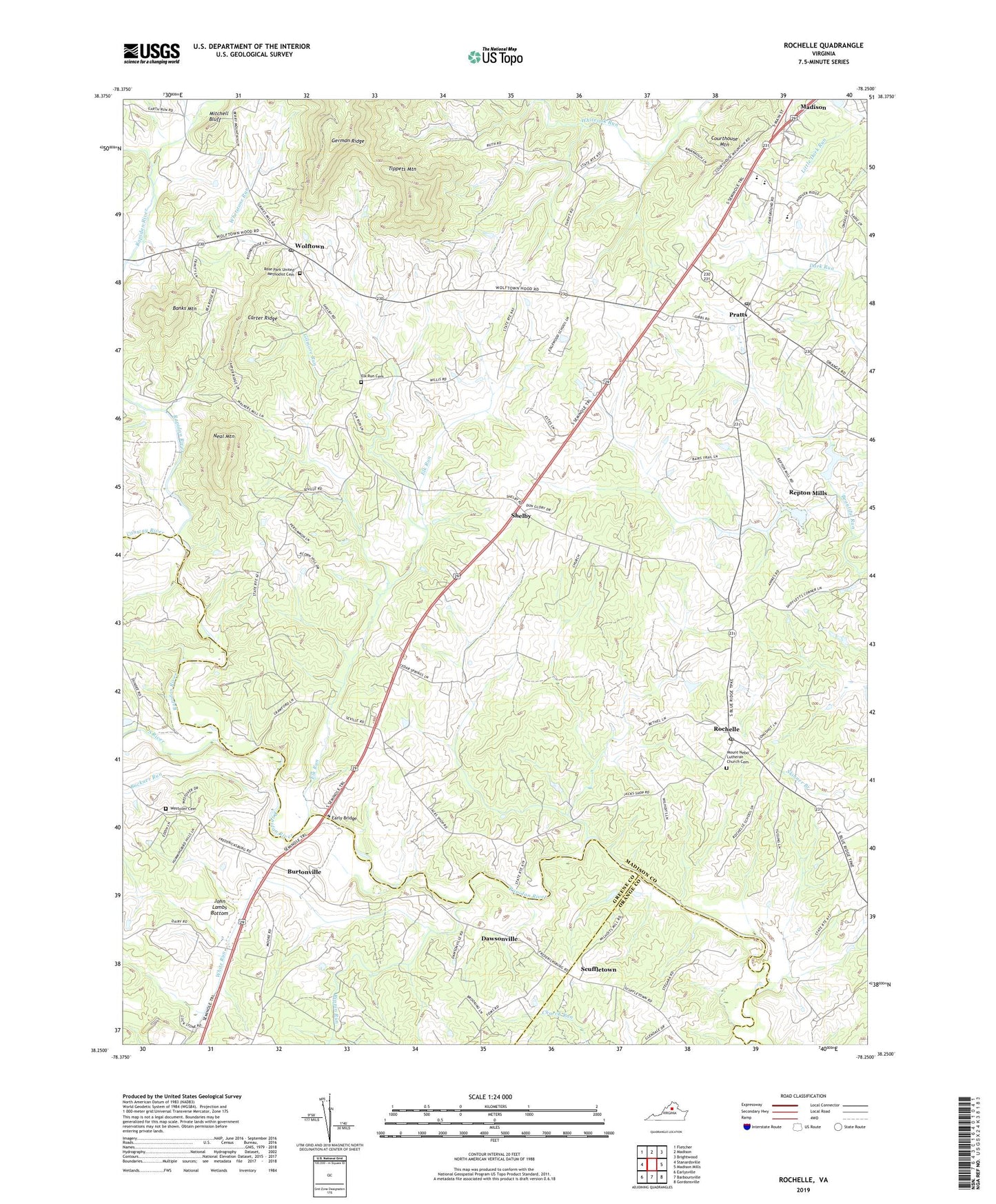
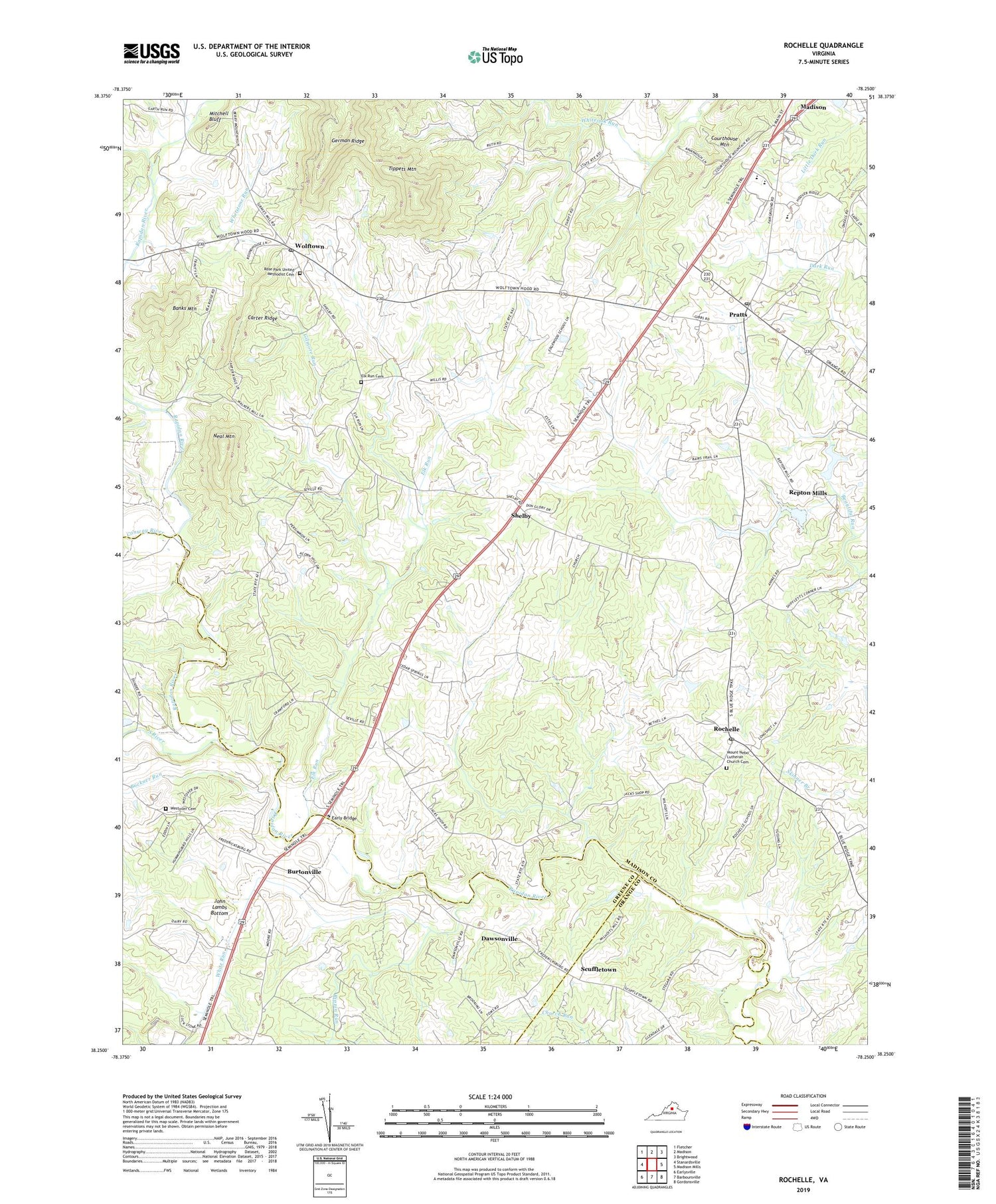
2019 topographic map quadrangle Rochelle in the state of Virginia. Scale: 1:24000. Based on the newly updated USGS 7.5' US Topo map series, this map is in the following counties: Madison, Greene, Orange. The map contains contour data, water features, and other items you are used to seeing on USGS maps, but also has updated roads and other features. This is the next generation of topographic maps. Printed on high-quality waterproof paper with UV fade-resistant inks.
Quads adjacent to this one:
West: Stanardsville
Northwest: Fletcher
North: Madison
Northeast: Brightwood
East: Madison Mills
Southeast: Gordonsville
South: Barboursville
Southwest: Earlysville
Contains the following named places: Banks Mountain, Beautiful Run Number 1b Dam, Beautiful Run Number 2a Dam, Buckner Run, Burtonville, Carter Ridge, Conway River, Courthouse Mountain, Dawsonville, Dawsonville Post Office, Dawsonville School, Early Bridge, Elk Run, Elk Run Baptist Church, Elk Run Cemetery, Erald, Erald Post Office, Garth Run, Gilmore Run, Holy Trinity Church, John Lambs Bottom, Madison County High School, Madison Primary School, Midway School, Mitchell Bluff, Mount Nebo Lutheran Church, Mount Nebo Lutheran Church Cemetery, Mount Sinai Baptist Church, Neal Mountain, Old Pratts, O'Neal, Pleasant Grove Church, Pratts, Pratts Post Office, Repton Mills, Rippin Run, Rochelle, Rochelle Christian Church, Rochelle Post Office, Rock Hall Baptist Church, Rose Park United Methodist Cemetery, Rose Park United Methodist Church, Rosebrook, Rosebrook Post Office, Scuffletown, Shelby, Shifflet Corner, South River, Tippets Mountain, Westover Cemetery, Westover Church, Whetstone Run, White Run, Wilhoit, Wilhoits Ford, William H Wetsel Middle School, Wolftown, Wolftown Post Office, ZIP Codes: 22731, 22738