MyTopo
Sedley Virginia US Topo Map
Couldn't load pickup availability
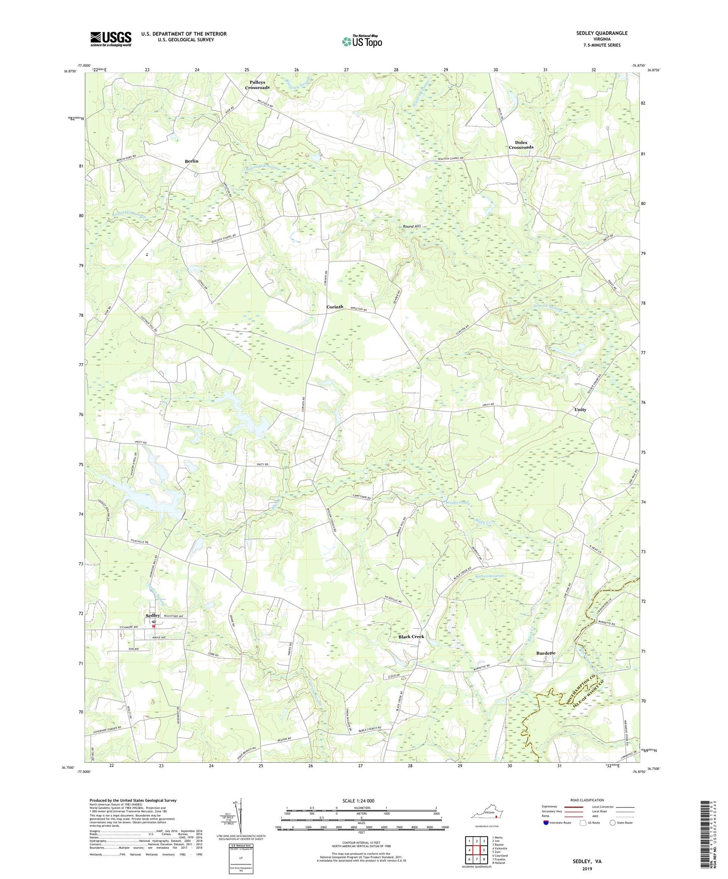
2019 topographic map quadrangle Sedley in the state of Virginia. Scale: 1:24000. Based on the newly updated USGS 7.5' US Topo map series, this map is in the following counties: Southampton, Isle of Wight. The map contains contour data, water features, and other items you are used to seeing on USGS maps, but also has updated roads and other features. This is the next generation of topographic maps. Printed on high-quality waterproof paper with UV fade-resistant inks.
Quads adjacent to this one:
West: Vicksville
Northwest: Manry
North: Ivor
Northeast: Raynor
East: Zuni
Southeast: Holland
South: Franklin
Southwest: Courtland
Contains the following named places: Berea Church, Berlin, Beulahland Church, Black Creek, Burdette, Cattail Swamp, Cedar Grove Church, Corinth, Corinth Friends Church, Cottage Hill School, Doles Crossroads, Ebenezer School, Jericho School, Johnson Dam, Johnson Millpond, Longbranch School, Mount Carmel Church, Nottoway Elementary School, Pulleys Crossroads, Rosenwald School, Round Hill, Round Hill Swamp, Sandy Hill School, Seacock Corner, Sedley, Sedley Census Designated Place, Sedley Post Office, Sedley Volunteer Fire Department Station 8, Unity, Wades Pond, Whitefields Dam, Whitefields Millpond