MyTopo
Speedwell Virginia US Topo Map
Couldn't load pickup availability
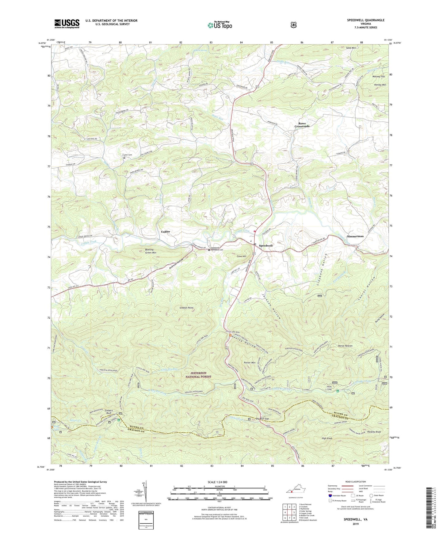
2019 topographic map quadrangle Speedwell in the state of Virginia. Scale: 1:24000. Based on the newly updated USGS 7.5' US Topo map series, this map is in the following counties: Wythe, Grayson. The map contains contour data, water features, and other items you are used to seeing on USGS maps, but also has updated roads and other features. This is the next generation of topographic maps. Printed on high-quality waterproof paper with UV fade-resistant inks.
Quads adjacent to this one:
West: Cedar Springs
Northwest: Rural Retreat
North: Crockett
Northeast: Wytheville
East: Cripple Creek
Southeast: Brierpatch Mountain
South: Elk Creek
Southwest: Middle Fox Creek
Contains the following named places: Andrews Hollow, Big Branch, Bowen Branch, Bowling Green Mountain, Cave Hill, Chaney Branch, Claybank Hollow, Collier, Comers Rock, Comers Rock Recreation Area, Divide Trail, Dry Run, Dry Run Gap, East Dry Run Fork, Edgewood School, Etter School, Flemming Church, Flemming School, Harvey School, Henley Hollow, High Knob, Horse Heaven, Horse Heaven Trail, Hungry Mother Dam, Hussy Mountain Horse Camp, Jackson Hollow, Lick Mountain Church, Lick Mountain School, Little Dry Run, Little Dry Run Trail, Little Dry Run Wilderness, Perkins Knob, Perkins Knob Trail, Pool Spring Branch, Porter Mountain, Rocky Hollow Trail, Rosenbaum Church, Rowe Crossroads, Sand Mountain, Simmerman, Sindion Point, Speedwell, Speedwell District, Speedwell Elementary School, Speedwell Methodist Cemetery, Speedwell Methodist Church, Speedwell Post Office, Speedwell Volunteer Fire Department, Stroupes Store, Sugar Run, Ward Branch, West Dry Run Fork, Wolfpen Branch, Wyrick Spring, Zion Cemetery, Zion Church, Zion School, ZIP Codes: 24323, 24374