MyTopo
Wytheville Virginia US Topo Map
Couldn't load pickup availability
Also explore the Wytheville Forest Service Topo of this same quad for updated USFS data
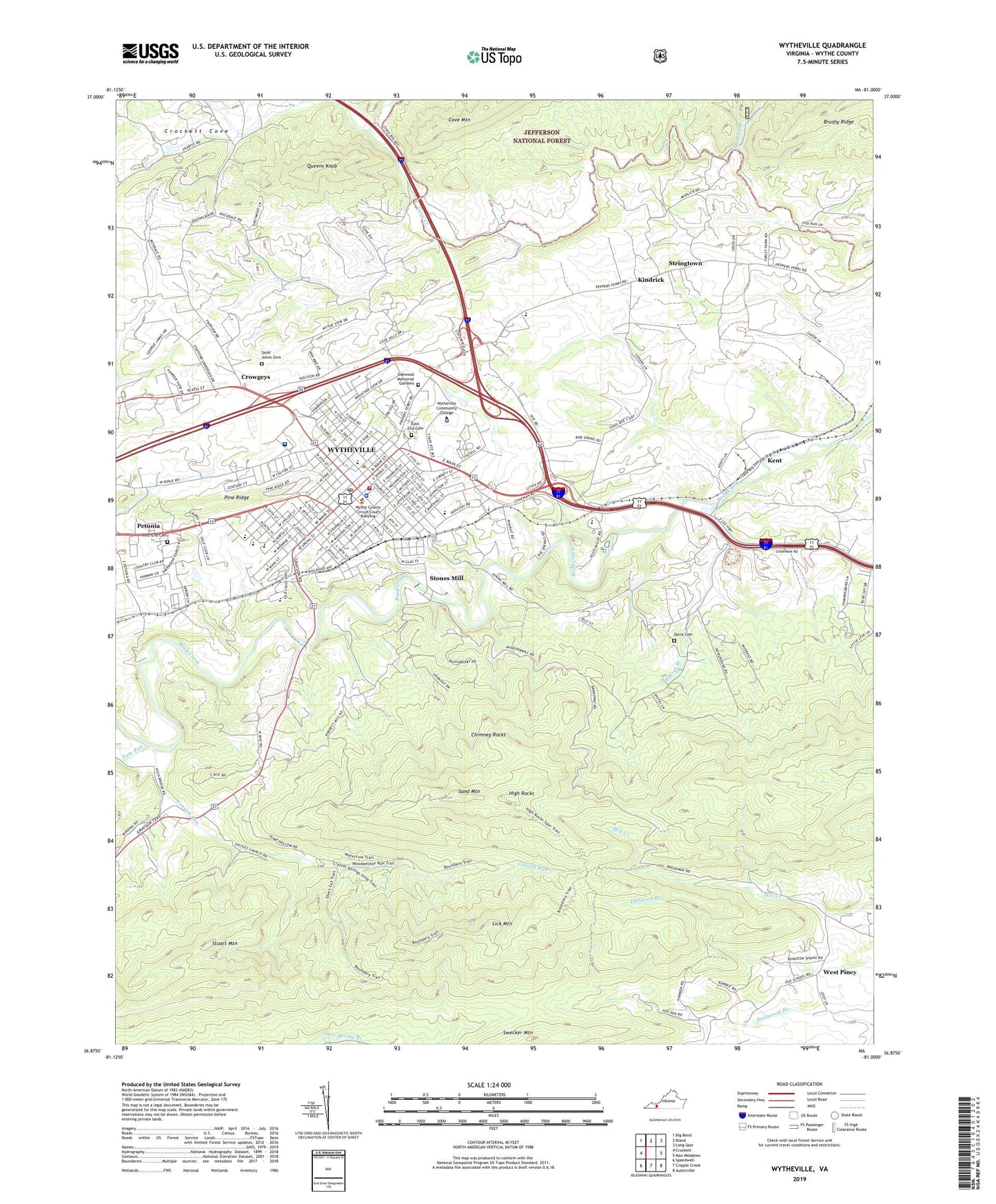
2022 topographic map quadrangle Wytheville in the state of Virginia. Scale: 1:24000. Based on the newly updated USGS 7.5' US Topo map series, this map is in the following counties: Wythe. The map contains contour data, water features, and other items you are used to seeing on USGS maps, but also has updated roads and other features. This is the next generation of topographic maps. Printed on high-quality waterproof paper with UV fade-resistant inks.
Quads adjacent to this one:
West: Crockett
Northwest: Big Bend
North: Bland
Northeast: Long Spur
East: Max Meadows
Southeast: Austinville
South: Cripple Creek
Southwest: Speedwell
This map covers the same area as the classic USGS quad with code o36081h1.
Contains the following named places: Bethel African Methodist Episcopal Church, Bethel Church, Bethlehem Baptist Church, Bibleway Baptist Church, Camp High Rock, Cedar Hill Church, Cedar Hill School, Chimney Rocks, Church of Christ, Church of God, Crowgeys, Davis Cemetery, East End Cemetery, East Wytheville District, Echo Valley Christian School, Edgemont Center, Evansham Shopping Center, Evergreen Church, Fellowship Church, First Assembly of God Church, First Christian Church, Franklin Street United Methodist Church, Galilee Church, George Wythe High School, Glade School, Granite Christian Academy, Haven, High Rocks, Holy Trinity Lutheran Church, Jackson Presbyterian Chapel, Kent, Kindrick, Liberty Hill Church, Lick Mountain, Morning Star Church of God, Mount Zion Church, Mudlick Branch, Muskrat Branch, Oakwood Memorial Gardens, Petunia, Queens Knob, Rockdale School, Saint Johns Cemetery, Saint Johns Church, Saint Johns Episcopal Church, Saint Lukes Fork, Saint Marys Catholic Church, Saint Paul United Methodist Church, Sand Hill School, Sand Mountain, Scott Memorial Middle School, Spiller Elementary School, Stones Mill, Stringtown, Stuart Mountain, Swecker Mountain, Tate Run, Town of Wytheville, Venrick Run, West End Cemetery, West End United Methodist Church, West Piney, Wythe County, Wythe County Community Hospital, Wythe County Community Hospital Heliport, Wythe County Courthouse, Wythe County Jail, Wythe County Rescue Squad, Wythe County Sheriff's Office, Wythe County Technology Center, Wytheville, Wytheville Baptist Church, Wytheville City Hall, Wytheville Community College, Wytheville Community College Police Department, Wytheville Fire Department, Wytheville Golf Club, Wytheville Pentecostal Holiness Church, Wytheville Police Department, Wytheville Post Office, Wytheville Presbyterian Church, Wytheville Primary School, Wytheville Ranger Station, Wytheville Seventh Day Adventist Church, Wytheville Work Center, WYVE Radio Tower (Galax), WYVE-AM (Wytheville), ZIP Code: 24382