MyTopo
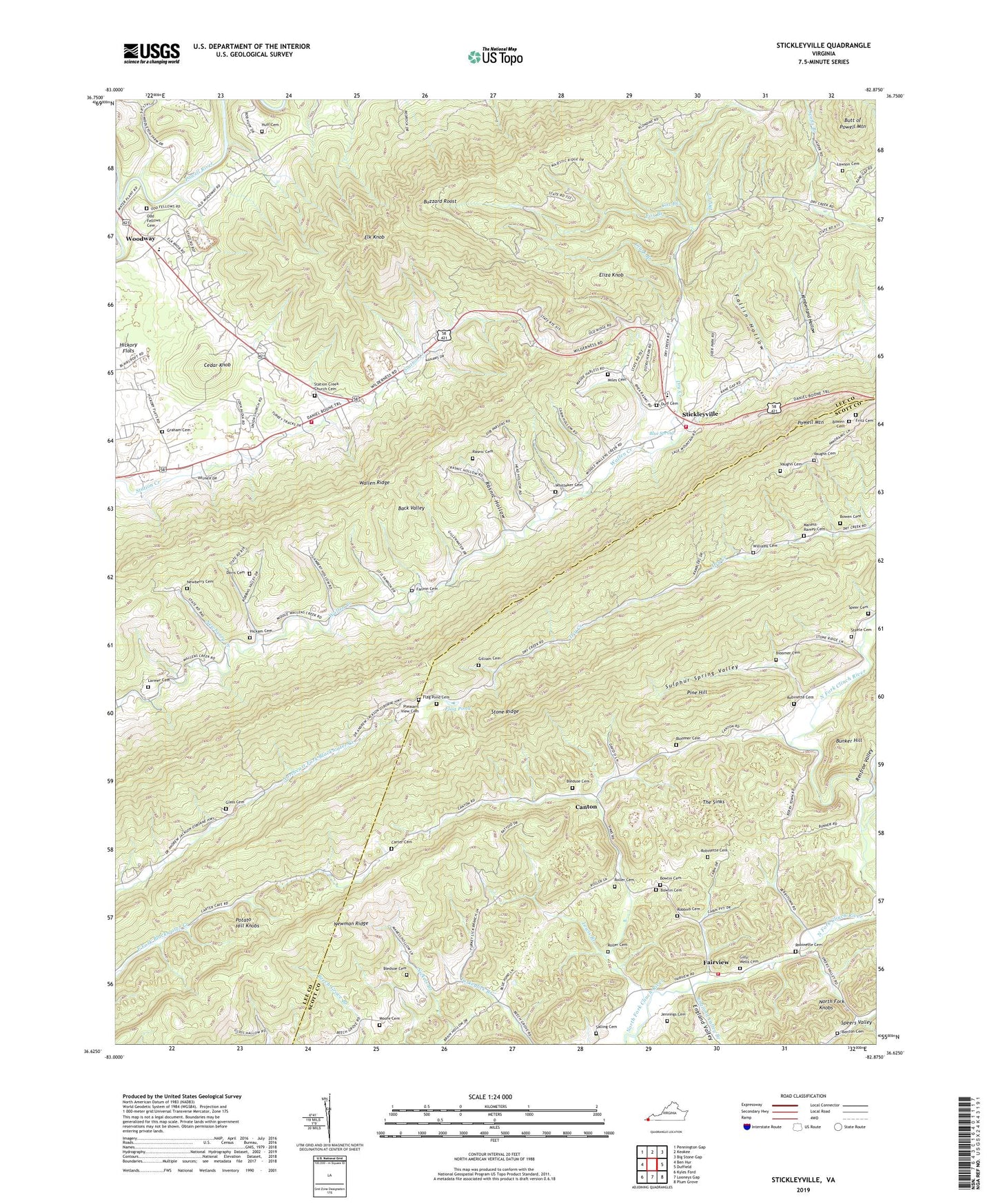
Stickleyville Virginia US Topo Map
Couldn't load pickup availability
Also explore the Stickleyville Forest Service Topo of this same quad for updated USFS data
2022 topographic map quadrangle Stickleyville in the state of Virginia. Scale: 1:24000. Based on the newly updated USGS 7.5' US Topo map series, this map is in the following counties: Lee, Scott. The map contains contour data, water features, and other items you are used to seeing on USGS maps, but also has updated roads and other features. This is the next generation of topographic maps. Printed on high-quality waterproof paper with UV fade-resistant inks.
Quads adjacent to this one:
West: Ben Hur
Northwest: Pennington Gap
North: Keokee
Northeast: Big Stone Gap
East: Duffield
Southeast: Plum Grove
South: Looneys Gap
Southwest: Kyles Ford
This map covers the same area as the classic USGS quad with code o36082f8.
Contains the following named places: Back Valley, Banner Chapel, Beech Grove Church, Benton Cemetery, Bledsoe Cemetery, Bloomer Cemetery, Blue Spring, Blue Spring Church, Bowen Cemetery, Bowlin Cemetery, Bunker Hill, Burks Union Church, Butt of Powell Mountain, Buzzard Roost, Canton, Carter Cemetery, Carters Institute, Cedar Front School, Cedar Knob, Clark Branch, Cox Branch, Daniel Boone Trail, Davis Cemetery, Dot, Dry Creek, Dry Creek School, Duff Cemetery, Duffield Volunteer Fire and Rescue Station 2, Elijah Knob School, Eliza Knob, Elk Knob, Elk Knob Elementary School, Elk Knob School, England Valley, England Valley Branch, Fairview, Fallin Hollow, Fannin Cemetery, Flag Pond, Flag Pond Cemetery, Fox Branch, Fritz Cemetery, Gilliam Cemetery, Gilly-Wells Cemetery, Glass Cemetery, Graham Cemetery, Hickam Cemetery, Huff Cemetery, Jennings Cemetery, Kimberland Hollow, Larmer Cemetery, Larmer School, Laurel Grove School, Lawson Cemetery, Lewis Branch, Lewis Church, Livingston Chapel, Locust Grove Church, Maness-Ramey Cemetery, Miles Cemetery, Moore Cemetery, Mount View Church, Newberry Cemetery, Newberry Creek, North Fork Knobs, North Fork Powell River, Odd Fellows Cemetery, Osborne Chapel, Pennington Gap Volunteer Fire Department Station 2, Pine Hill, Pleasant View Cemetery, Pleasant View Church, Potato Hill Knobs, Rasnic Cemetery, Rasnic Hollow, Renfroe Valley, Robbins Cemetery, Robinette Cemetery, Robinette Memorial Church, Roller Cemetery, Salling Cemetery, Speer Cemetery, Station Creek Church, Station Creek Church Cemetery, Steele Cemetery, Stickleyville, Stickleyville Census Designated Place, Stickleyville Elementary School, Stickleyville Volunteer Fire Department, Stone Ridge, Sulphur Spring Valley, The Sinks, Union Church, Vaughn Cemetery, Whitteker Cemetery, Williams Cemetery, Woodway, ZIP Code: 24221