MyTopo
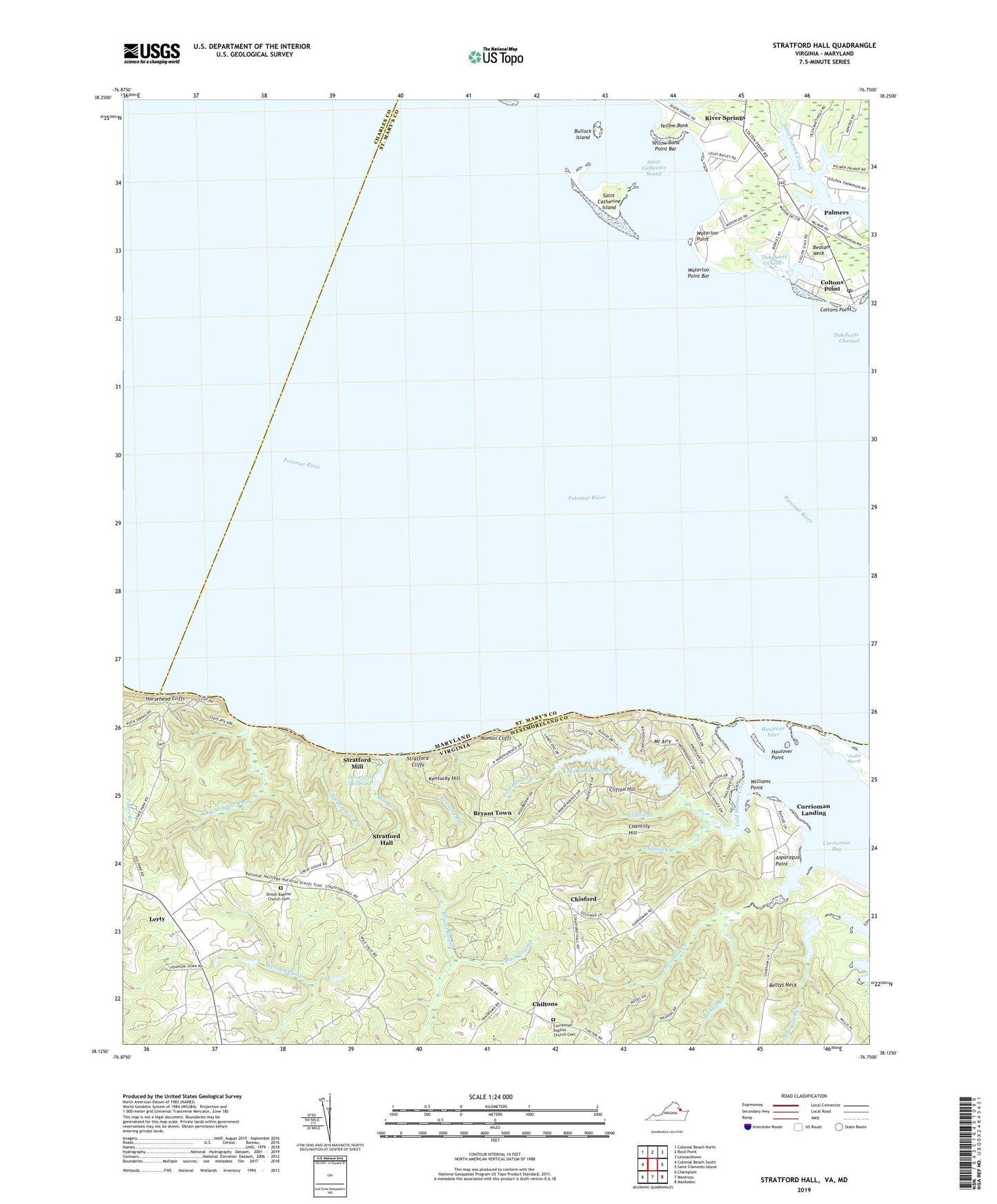
Stratford Hall Virginia US Topo Map
Couldn't load pickup availability
2019 topographic map quadrangle Stratford Hall in the states of Virginia, Maryland. Scale: 1:24000. Based on the newly updated USGS 7.5' US Topo map series, this map is in the following counties: Westmoreland, St. Mary's, Charles. The map contains contour data, water features, and other items you are used to seeing on USGS maps, but also has updated roads and other features. This is the next generation of topographic maps. Printed on high-quality waterproof paper with UV fade-resistant inks.
Quads adjacent to this one:
West: Colonial Beach South
Northwest: Colonial Beach North
North: Rock Point
Northeast: Leonardtown
East: Saint Clements Island
Southeast: Machodoc
South: Montross
Southwest: Champlain
Contains the following named places: Asparagus Point, Bettys Neck, Big Meadow Run, Big Meadow Trail, Broadhurst Plantation, Bryant Swamp, Bryant Town, Bullock Island, Chantilly Branch, Chantilly Hill, Chiltons, Chisford, Clifton Branch, Clifton Hill, Cobb Point Bar Lighthouse, Cold Harbor Creek, Coltons Point, Coltons Point Post Office, Currioman Baptist Church Cemetery, Currioman Bay, Currioman Creek, Currioman Landing, District 7 Milestown, Dukeharts Creek, Enfield, Friendly Hall, Gerard Chapel, Goodrich Farm, Grant Church, Haulover Inlet, Haulover Point, Hill School, Hollis Marsh, Horsehead Cliffs, Hummel Vineyards, Kentucky Hill, Kentucky Run, Lake Independence, Lake Independence Dam, Lerty, Little Hackley, Little Meadow Run, Mill Run, Mount Airy, Mount Airy Wharf, Nomini Cliffs, Old Mill Branch, Palmers, Providence Church, River Springs, Saint Agnes Chapel, Saint Catherine Island, Saint Catherine Sound, Saint Clements Island Historic District, Shiloh Baptist Church Cemetery, Shiloh Church, Stratford Cliffs, Stratford Hall, Stratford Landing, Stratford Mill, Stratford Millpond, Turkey Neck Trail, Waterloo, Waterloo Point, Waterloo Point Bar, Westmoreland State Park, Williams Point, Yellow Bank, Yellow Bank Point Bar, ZIP Code: 20626