MyTopo
Sussex Virginia US Topo Map
Couldn't load pickup availability
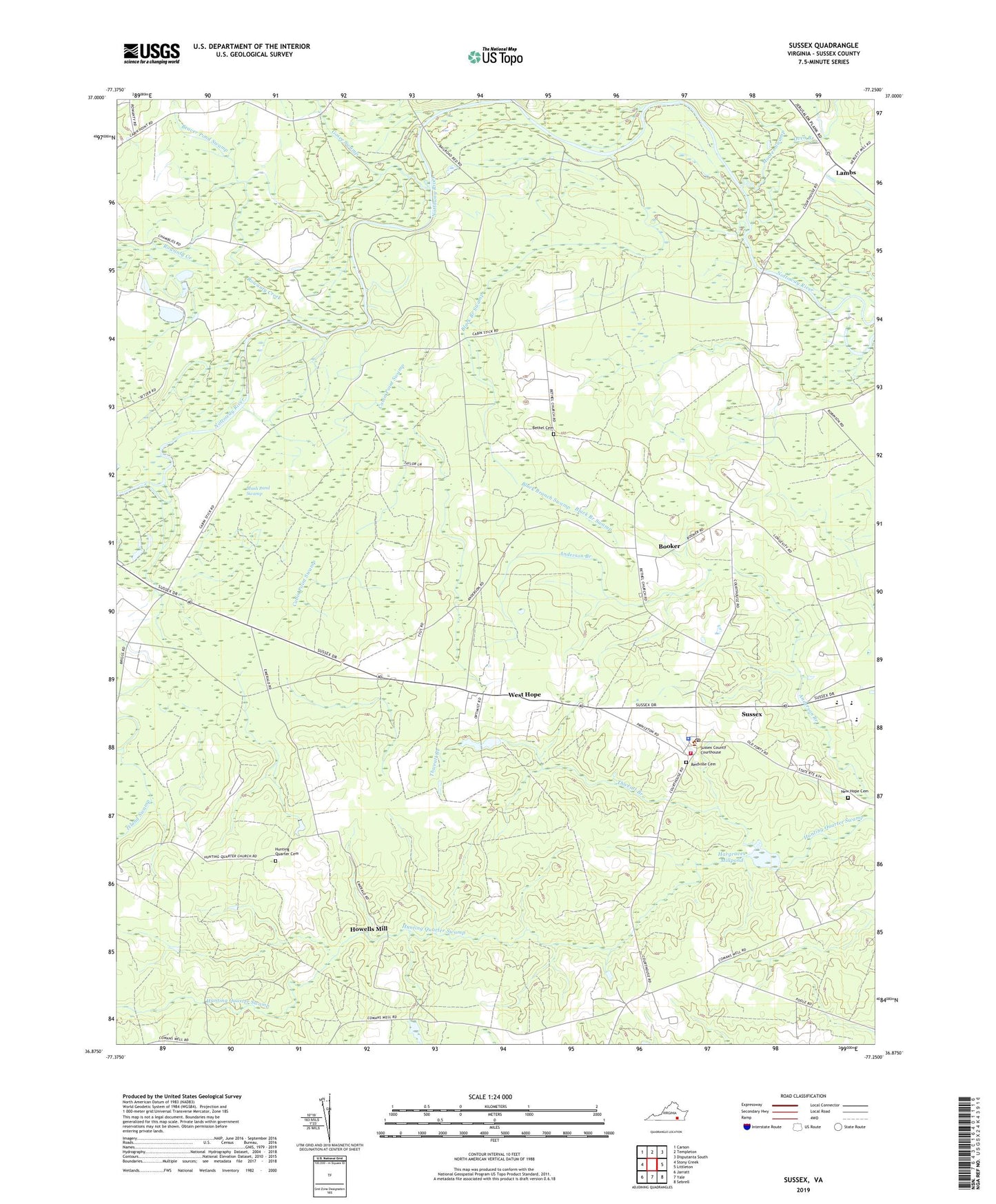
2019 topographic map quadrangle Sussex in the state of Virginia. Scale: 1:24000. Based on the newly updated USGS 7.5' US Topo map series, this map is in the following counties: Sussex. The map contains contour data, water features, and other items you are used to seeing on USGS maps, but also has updated roads and other features. This is the next generation of topographic maps. Printed on high-quality waterproof paper with UV fade-resistant inks.
Quads adjacent to this one:
West: Stony Creek
Northwest: Carson
North: Templeton
Northeast: Disputanta South
East: Littleton
Southeast: Sebrell
South: Yale
Southwest: Jarratt
Contains the following named places: Beaver Pond Swamp, Bethel Cemetery, Bethel Methodist Church, Black Branch Swamp, Booker, Booker School, Briggs Mill, Cabin Point Swamp, Comans Well, Courthouse District, Gosee Swamp, Hargraves Dam, Hargraves Millpond, Howells Mill, Hunting Quarter Cemetery, Hunting Quarter Church, Lambs, Moores Swamp, Mush Pond Swamp, New Hope Baptist Church, New Hope Cemetery, Oven Branch, Reidville Cemetery, Reidville Church, Rowanty Creek, Sharon Church, Sussex, Sussex Census Designated Place, Sussex Central High School, Sussex Central Middle School, Sussex Count Courthouse Historic District, Sussex County, Sussex County Courthouse, Sussex County Office of Public Safety, Sussex County Sheriff's Office, Sussex Courthouse Volunteer Fire Department, Sussex Post Office, Thweatt Branch, West Hope, ZIP Code: 23884