MyTopo
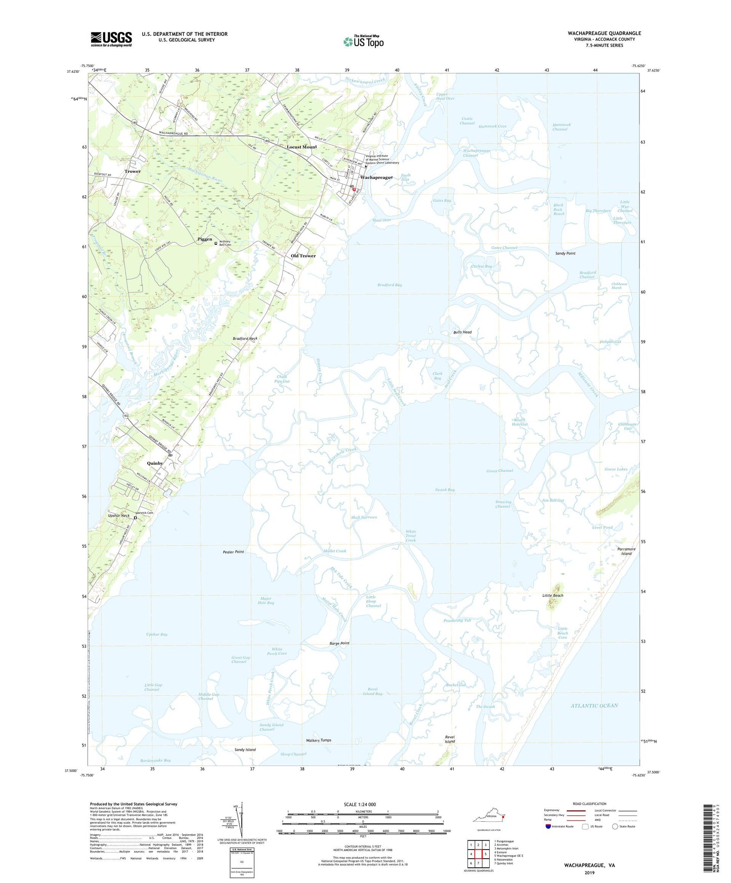
Wachapreague Virginia US Topo Map
Couldn't load pickup availability
2019 topographic map quadrangle Wachapreague in the state of Virginia. Scale: 1:24000. Based on the newly updated USGS 7.5' US Topo map series, this map is in the following counties: Accomack. The map contains contour data, water features, and other items you are used to seeing on USGS maps, but also has updated roads and other features. This is the next generation of topographic maps. Printed on high-quality waterproof paper with UV fade-resistant inks.
Quads adjacent to this one:
West: Exmore
Northwest: Pungoteague
North: Accomac
Northeast: Metompkin Inlet
East: Wachapreague OE E
South: Quinby Inlet
Southwest: Nassawadox
Contains the following named places: Anthony Bell Cemetery, Barge Point, Big Thorofare, Black Rock Reach, Bradford Bay, Bradford Channel, Bradford Neck, Bucket Gut, Bulls Head, Chalk Pipe Gut, Clark Bay, Clubhouse Gut, Clubhouse Marsh, Cockle Creek, Curlew Bay, Custis Channel, Drawing Channel, Ebb Tide Creek, Finney Creek, Fishpen Gut, Fools Gut, Frogstool, Frogstool Branch, Gates Bay, Gates Channel, Grangeville, Grassy Creek, Great Gap Channel, Green Channel, Haul Over, Herbert Church, Hog Creek, Hummock Channel, Hummock Cove, Jim Bell Gut, Level Pond, Little Beach, Little Beach Cove, Little Gap Channel, Little Seal Creek, Little Sloop Channel, Little Thorofare, Little Wye Channel, Locust Mount, Locust Mount Census Designated Place, Major Hole Bay, Major Hole Creek, Middle Gap Channel, Millstone Creek, Mullet Creek, Old Trower, Parramore Island, Pealer Point, Piggen, Powdering Tub, Quinby, Quinby Census Designated Place, Quinby Post Office, Revel Island Bay, Roach Hole Gut, Sandy Point, Seal Creek, Shell Narrows, Swash Bay, The Swash, Town of Wachapreague, Trower, Upper Haul Over, Upshur Bay, Upshur Creek, Wachapreague, Wachapreague Channel, Wachapreague Marina, Wachapreague Post Office, Wachapreague Volunteer Fire Company, Walkers Tumps, Warwick Cemetery, Waterhole Creek, White Perch Cove, White Perch Creek, White Trout Creek, Wire Creek, ZIP Codes: 23423, 23480