MyTopo
Whitmell Virginia US Topo Map
Couldn't load pickup availability
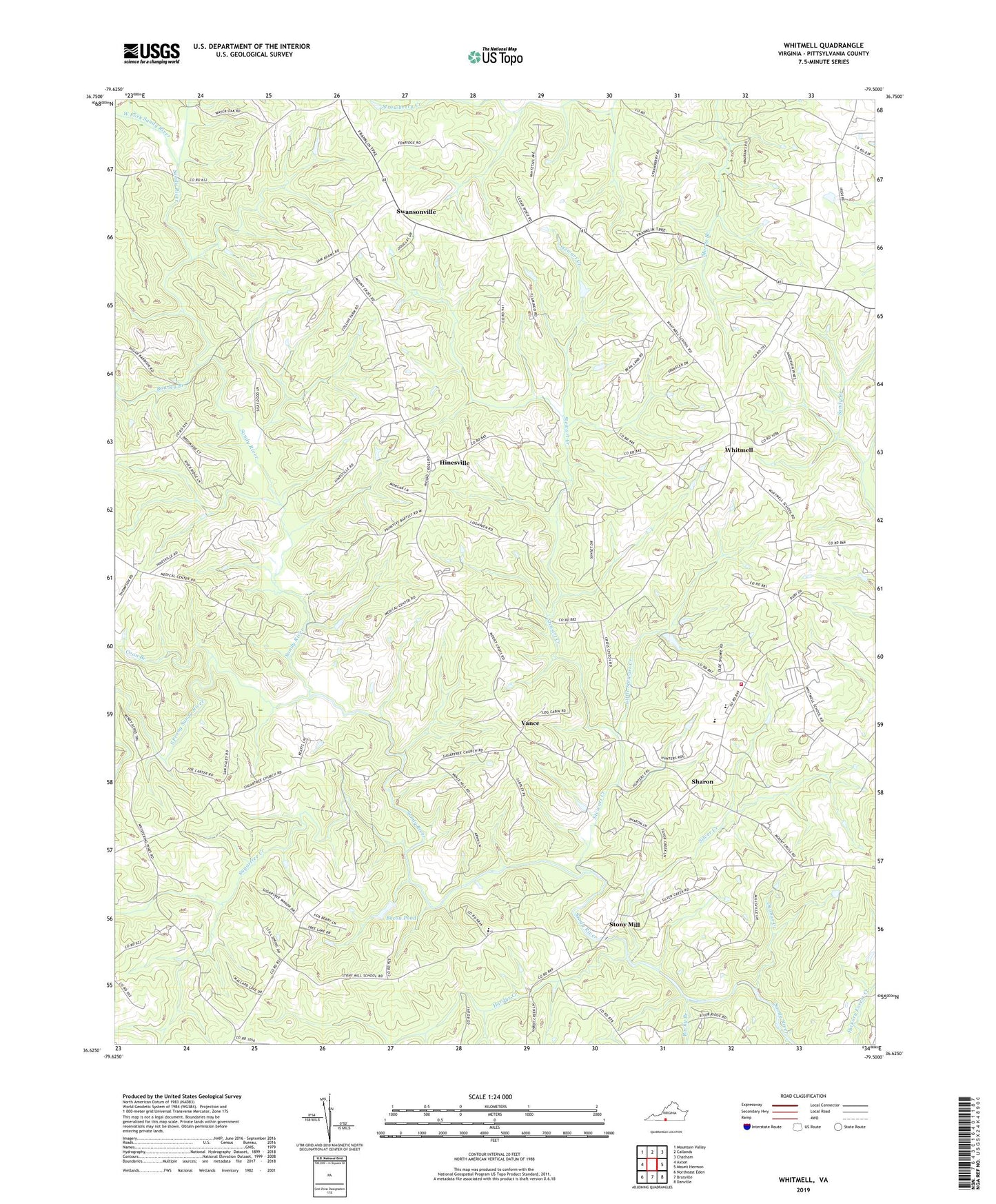
2022 topographic map quadrangle Whitmell in the state of Virginia. Scale: 1:24000. Based on the newly updated USGS 7.5' US Topo map series, this map is in the following counties: Pittsylvania. The map contains contour data, water features, and other items you are used to seeing on USGS maps, but also has updated roads and other features. This is the next generation of topographic maps. Printed on high-quality waterproof paper with UV fade-resistant inks.
Quads adjacent to this one:
West: Axton
Northwest: Mountain Valley
North: Callands
Northeast: Chatham
East: Mount Hermon
Southeast: Danville
South: Brosville
Southwest: Northeast Eden
This map covers the same area as the classic USGS quad with code o36079f5.
Contains the following named places: Adams School, Bacon Pond, Bawley Branch, Bethel Church, Bethlehem Church, Canaan Church, Carter School, Coon Branch, Dunbar Creek, Hardys Creek, Hinesville, Layton Bacon Dam, Little Stewart Creek, Oakes Dam, Pittsylvania County Riding Club Dam, Rocky Branch, Saint Johns Church, Saint Matthews Church, Sharon, Sharon Church, Sharon School, Silver Creek, Silver Creek Church, South Prong Sandy River, Stewart Creek, Stony Mill, Stony Mill Elementary School, Strawberry Church, Sugartree Church, Sugartree Creek, Swansonville, Swansonville Church, Tarpleys Chapel, Thompson School, Trelow School, Tunstall District, Tunstall High School, Tunstall Middle School, Tunstall Volunteer Fire and Rescue, Union Hall Church, Union Hill School, Unity School, Vance, West Fork Sandy River, Whitmell, Whitmell Church, Whitmell Elementary School, Woods Store, Wordens Chapel, ZIP Code: 24549