MyTopo
Callands Virginia US Topo Map
Couldn't load pickup availability
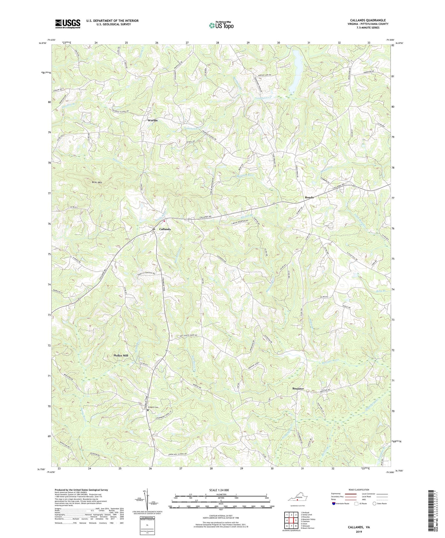
2022 topographic map quadrangle Callands in the state of Virginia. Scale: 1:24000. Based on the newly updated USGS 7.5' US Topo map series, this map is in the following counties: Pittsylvania. The map contains contour data, water features, and other items you are used to seeing on USGS maps, but also has updated roads and other features. This is the next generation of topographic maps. Printed on high-quality waterproof paper with UV fade-resistant inks.
Quads adjacent to this one:
West: Mountain Valley
Northwest: Penhook
North: Sandy Level
Northeast: Pittsville
East: Chatham
Southeast: Mount Hermon
South: Whitmell
Southwest: Axton
This map covers the same area as the classic USGS quad with code o36079g5.
Contains the following named places: Aaron Dam, Anderson Dam, Banister, Brier Mountain, Buckhorn Branch, Burton Lake, Callands, Callands Church, Callands Post Office, Callands Volunteer Fire and Rescue Department, Cherrystone Youth Camp, Christian Tabernacle, Gregory Cemetery, Hackberry Church, Hackberry School, High Point School, Hollys Mill, Liberty Church, Macedonia Church, Matthews Memorial Church, Mineola School, Mitchell Branch, Morris Branch, Mount Parris School, Mount Zion Church, Oak Ridge Church, Robins Branch, Rondo, Rondo School, Salem Church, Swansons Mill, Swansonville, Toler School, Tomahawk School, Triangle School, Trinity Church, Trinity School, Union Hall Elementary School, Wet Sleeve Creek, Worlds, ZIP Code: 24530