MyTopo
Woodville Virginia US Topo Map
Couldn't load pickup availability
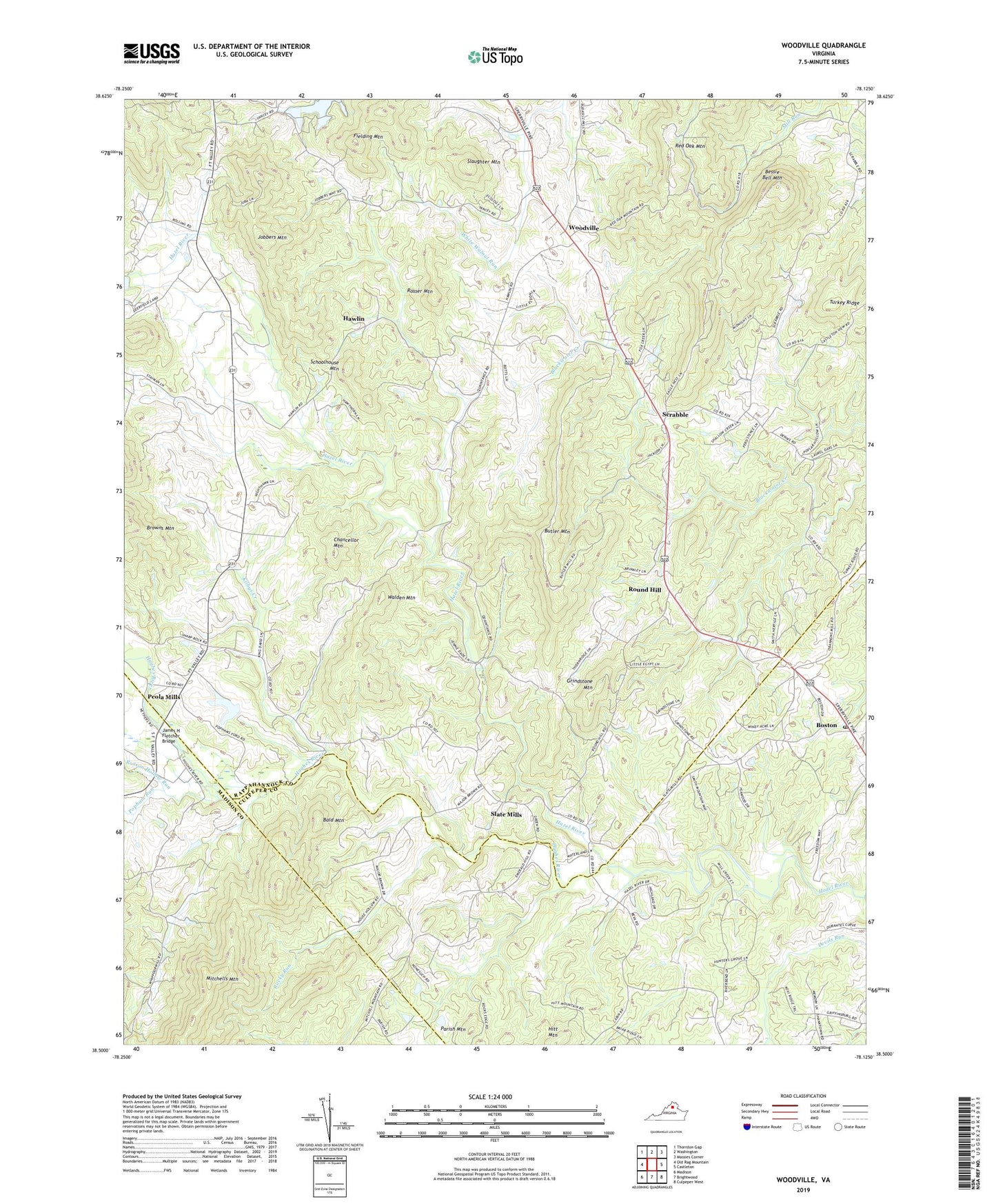
2022 topographic map quadrangle Woodville in the state of Virginia. Scale: 1:24000. Based on the newly updated USGS 7.5' US Topo map series, this map is in the following counties: Rappahannock, Culpeper, Madison. The map contains contour data, water features, and other items you are used to seeing on USGS maps, but also has updated roads and other features. This is the next generation of topographic maps. Printed on high-quality waterproof paper with UV fade-resistant inks.
Quads adjacent to this one:
West: Old Rag Mountain
Northwest: Thornton Gap
North: Washington
Northeast: Massies Corner
East: Castleton
Southeast: Culpeper West
South: Brightwood
Southwest: Madison
This map covers the same area as the classic USGS quad with code o38078e2.
Contains the following named places: Bald Mountain, Bessie Bell Mountain, Boston, Boston Post Office, Buckners Corner, Butler Mountain, Chancellor Mountain, Fielding Mountain, Grindstone Mountain, Hawlin, Hitt Mountain, Hughes River, James H Fletcher Bridge, Jenkins Orchard, Jobbers Mountain, Kilbys Creek, Mount Lebanon Church, Nazareth Church, Parish Mountain, Peola Mills, Popham Run, Revercombs Corner, Rocky Run, Rosser Mountain, Rosson Hollow Run, Round Hill, Schoolhouse Mountain, Scrabble, Shackelford Airport, Shiloh Baptist Church, Slate Mills, Slate Mills Baptist Church, Slaughter Mountain, Stevenson Church, Stonewall-Hawthorne District, Turkey Ridge, Walden Mountain, Woodville, Woodville Baptist Church, ZIP Code: 22749