MyTopo
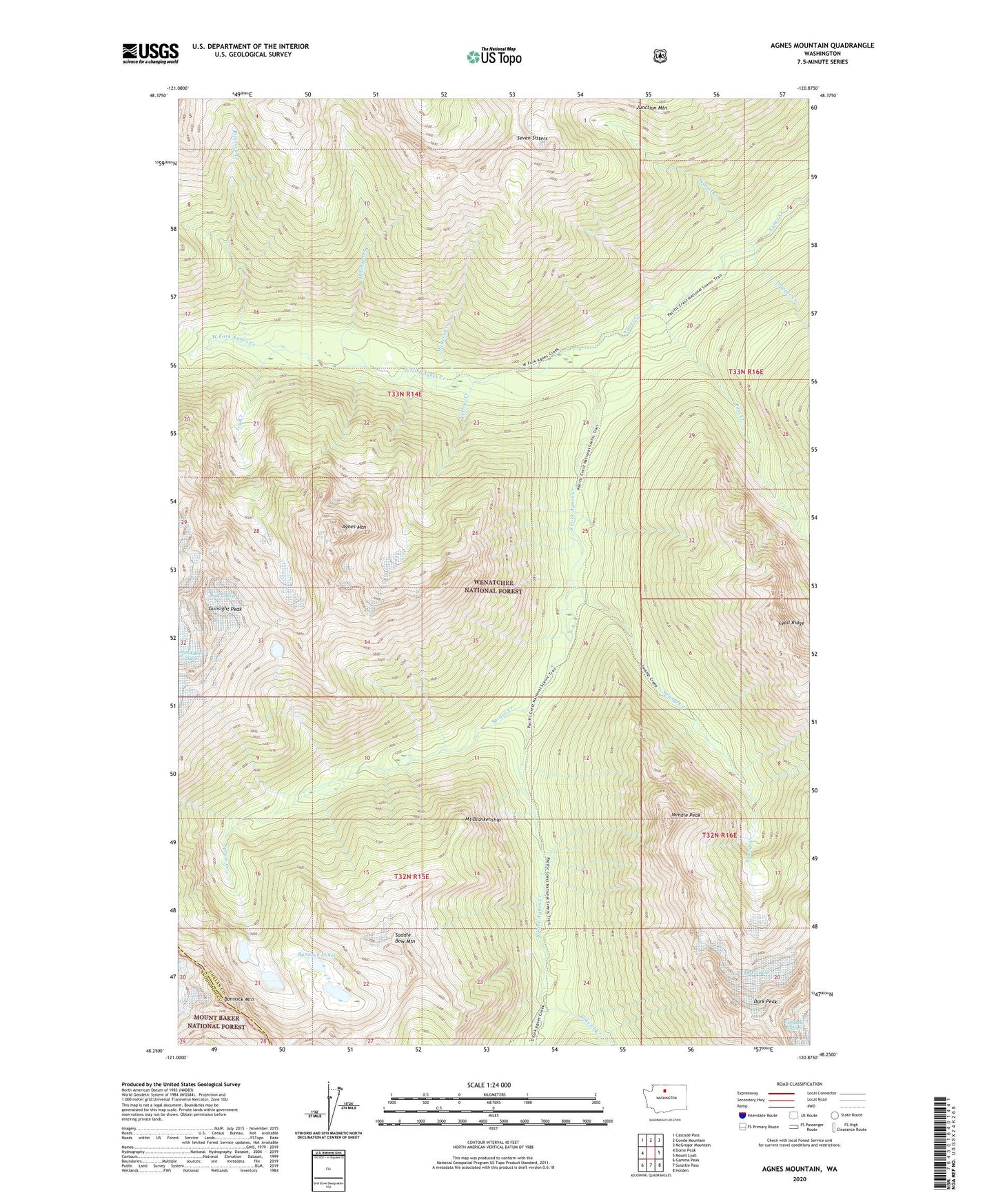
Agnes Mountain Washington US Topo Map
Couldn't load pickup availability
Also explore the Agnes Mountain Forest Service Topo of this same quad for updated USFS data
2023 topographic map quadrangle Agnes Mountain in the state of Washington. Scale: 1:24000. Based on the newly updated USGS 7.5' US Topo map series, this map is in the following counties: Chelan, Snohomish. The map contains contour data, water features, and other items you are used to seeing on USGS maps, but also has updated roads and other features. This is the next generation of topographic maps. Printed on high-quality waterproof paper with UV fade-resistant inks.
Quads adjacent to this one:
West: Dome Peak
Northwest: Cascade Pass
North: Goode Mountain
Northeast: McGregor Mountain
East: Mount Lyall
Southeast: Holden
South: Suiattle Pass
Southwest: Gamma Peak
This map covers the same area as the classic USGS quad with code o48120c8.
Contains the following named places: Agnes Mountain, Bannock Lakes, Bannock Mountain, Blue Glacier, Cedar Camp, Dark Glacier, Dark Peak, Fivemile Camp, Glacier Creek, Gunsight Peak, Helebore Creek, Hemlock Camp, Icy Creek, Lyall Ridge, Mount Blankenship, Needle Peak, Pass Creek, Rimrock Creek, Saddle Bow Mountain, Sisters Creek, South Fork Agnes Creek, Spruce Creek, Swamp Creek, Swamp Creek Camp, Trapper Creek, Weasel Creek, West Fork Agnes Creek, Yellow Creek