MyTopo
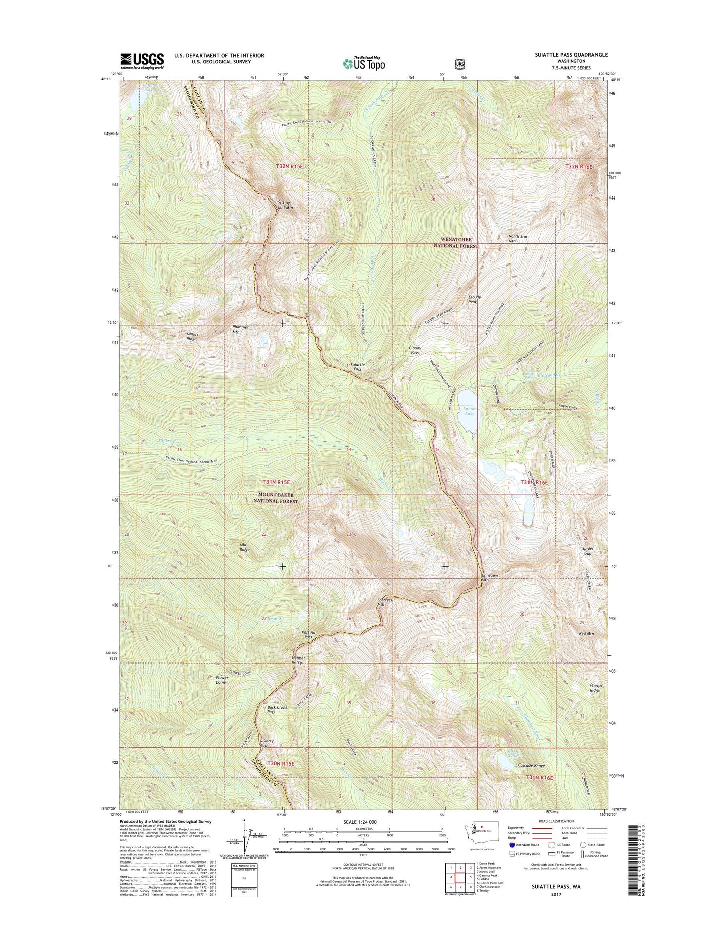
Suiattle Pass Washington US Topo Map
Couldn't load pickup availability
Also explore the Suiattle Pass Forest Service Topo of this same quad for updated USFS data
2023 topographic map quadrangle Suiattle Pass in the state of Washington. Scale: 1:24000. Based on the newly updated USGS 7.5' US Topo map series, this map is in the following counties: Chelan, Snohomish. The map contains contour data, water features, and other items you are used to seeing on USGS maps, but also has updated roads and other features. This is the next generation of topographic maps. Printed on high-quality waterproof paper with UV fade-resistant inks.
Quads adjacent to this one:
West: Gamma Peak
Northwest: Dome Peak
North: Agnes Mountain
Northeast: Mount Lyall
East: Holden
Southeast: Trinity
South: Clark Mountain
Southwest: Glacier Peak East
This map covers the same area as the classic USGS quad with code o48120b8.
Contains the following named places: Buck Creek Pass, Canyon Lake, Chiwawa Mountain, Cloudy Pass, Cloudy Peak, Crown Point Falls, Flower Dome, Fortress Mountain, Glacier Peak Mines, Grant Glacier, Helmet Butte, Lady Camp, Lake Wenatchee Ranger District, Liberty Cap, Lyman Glacier, Lyman Lake, Massie Lake, Middle Ridge, Miners Creek Trail, Miners Ridge, North Star Mountain, Pass No Pass, Phelps Ridge, Plummer Mountain, Red Mountain, Rubin Creek, Sitting Bull Mountain, Spider Gap, Spider Glacier, Suiattle Pass