MyTopo
Cascade Pass Washington US Topo Map
Couldn't load pickup availability
Also explore the Cascade Pass Forest Service Topo of this same quad for updated USFS data
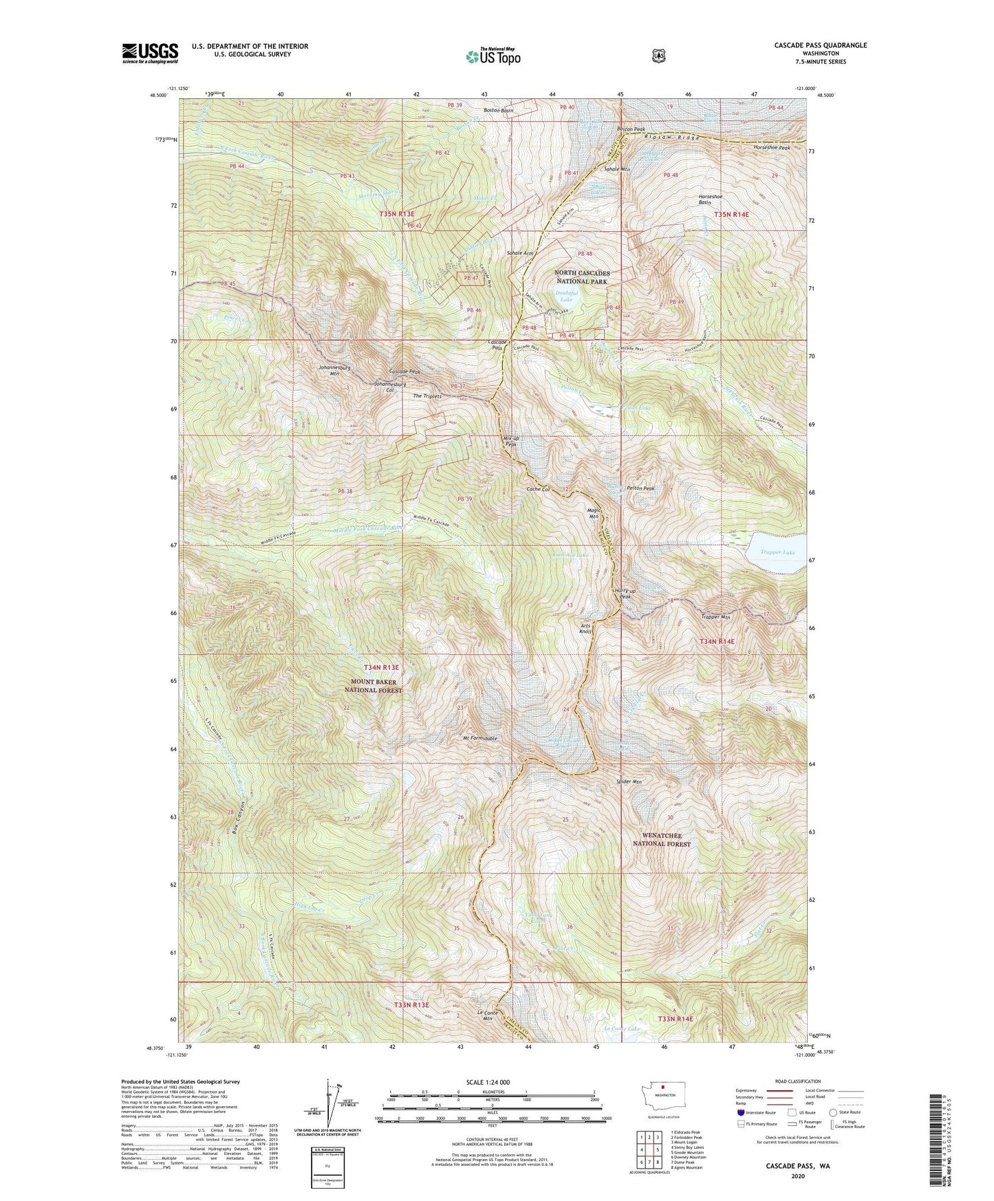
2023 topographic map quadrangle Cascade Pass in the state of Washington. Scale: 1:24000. Based on the newly updated USGS 7.5' US Topo map series, this map is in the following counties: Skagit, Chelan. The map contains contour data, water features, and other items you are used to seeing on USGS maps, but also has updated roads and other features. This is the next generation of topographic maps. Printed on high-quality waterproof paper with UV fade-resistant inks.
Quads adjacent to this one:
West: Sonny Boy Lakes
Northwest: Eldorado Peak
North: Forbidden Peak
Northeast: Mount Logan
East: Goode Mountain
Southeast: Agnes Mountain
South: Dome Peak
Southwest: Downey Mountain
This map covers the same area as the classic USGS quad with code o48121d1.
Contains the following named places: Arts Knoll, Basin Creek, Boston Creek, Boston Glacier Research Natural Area, Boston Peak, Box Canyon, Cache Col, Cascade Pass, Cascade Peak, Cleve Creek, Davenport Glacier, Diamond Mine, Doubtful Creek, Doubtful Lake, Drop Creek, Eldorado Creek, Gilbert Creek, High Log Creek, Horseshoe Basin, Horseshoe Peak, Hurry-up Peak, Johannesburg Col, Johannesburg Mountain, Kool-Aid Lake, Le Conte Lake, Le Conte Mountain, Magic Mountain, Midas Creek, Middle Cascade Glacier, Milt Creek, Mix-up Peak, Morning Star Creek, Mount Formidable, Pelton Creek, Pelton Lake, Pelton Peak, Quien Sabe Glacier, Ripsaw Ridge, S Glacier, Sahale Arm, Sahale Glacier, Sahale Mountain, Soldier Boy Creek, South Glacier, Spider Glacier, Spider Mountain, Sprenger Spires, The Triplets, Trapper Lake, Trapper Mountain, Yang Yang Lakes, Yawning Glacier