
MyTopo
Goode Mountain Washington US Topo Map
Couldn't load pickup availability
Also explore the Goode Mountain Forest Service Topo of this same quad for updated USFS data
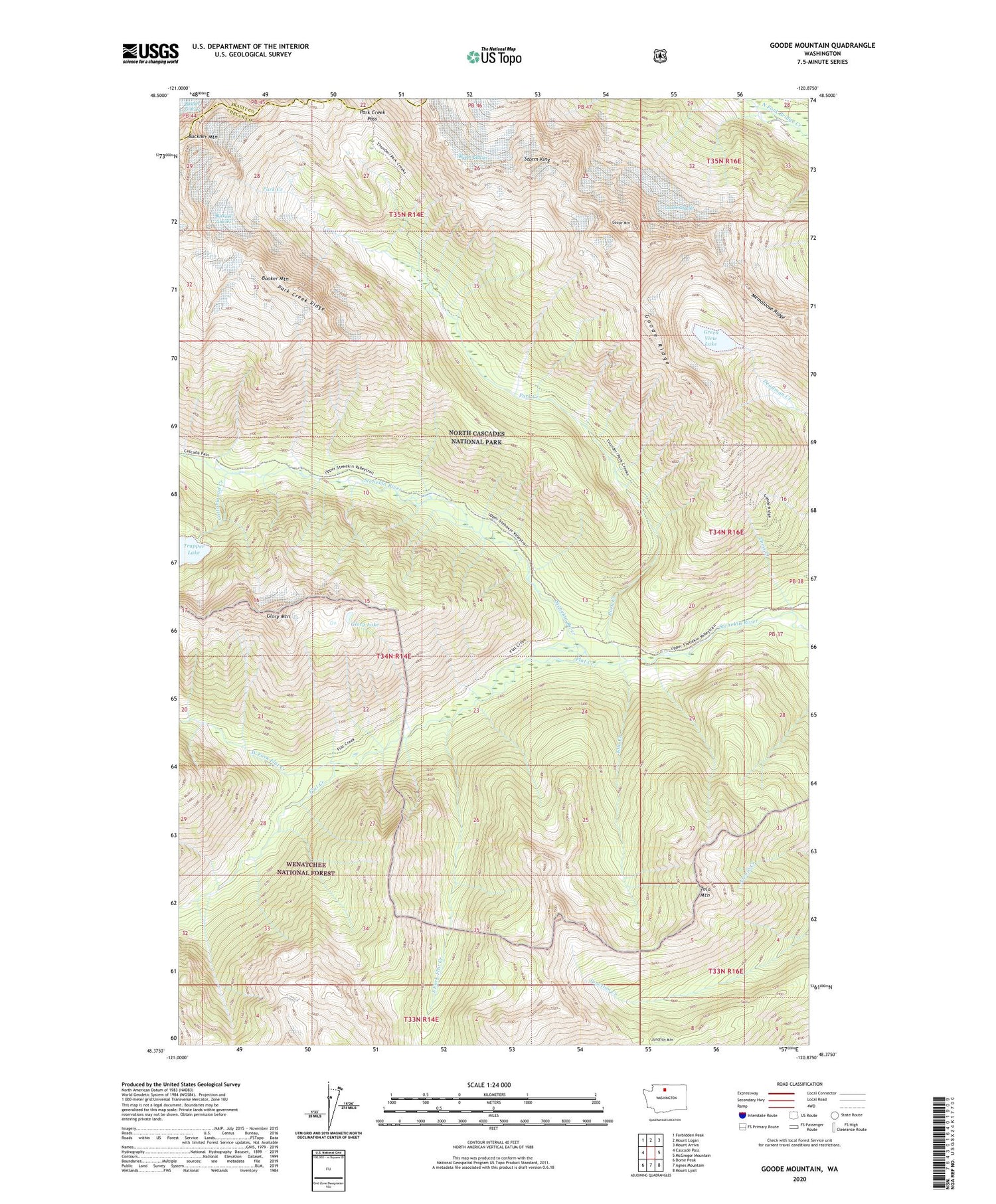
2023 topographic map quadrangle Goode Mountain in the state of Washington. Scale: 1:24000. Based on the newly updated USGS 7.5' US Topo map series, this map is in the following counties: Chelan, Skagit. The map contains contour data, water features, and other items you are used to seeing on USGS maps, but also has updated roads and other features. This is the next generation of topographic maps. Printed on high-quality waterproof paper with UV fade-resistant inks.
Quads adjacent to this one:
West: Cascade Pass
Northwest: Forbidden Peak
North: Mount Logan
Northeast: Mount Arriva
East: McGregor Mountain
Southeast: Mount Lyall
South: Agnes Mountain
Southwest: Dome Peak
This map covers the same area as the classic USGS quad with code o48120d8.
Contains the following named places: Booker Mountain, Buckner Glacier, Buckner Mountain, Cottonwood Camp, Cottonwood Creek, Flat Creek, Flat Creek Campsite, Glory Lake, Glory Mountain, Goode Glacier, Goode Mountain, Goode Ridge, Green View Lake, Junction Mountain, Memaloose Ridge, Park Creek, Park Creek Campsite, Park Creek Pass, Park Creek Pass Trail, Park Creek Ridge, Rimrock Ridge, Seven Sisters, South Fork Flat Creek, Storm King, Theis Creek, Tolo Creek, Tolo Mountain, Two Mile Campsite, West Fork Flat Creek, Wyeth Glacier


