MyTopo
Armstrong Creek Washington US Topo Map
Couldn't load pickup availability
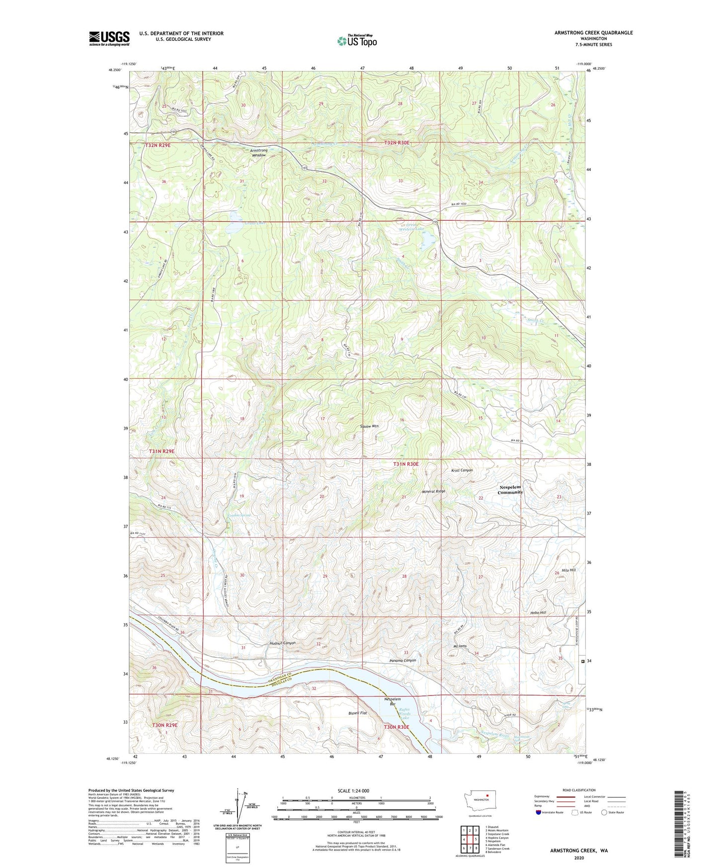
2023 topographic map quadrangle Armstrong Creek in the state of Washington. Scale: 1:24000. Based on the newly updated USGS 7.5' US Topo map series, this map is in the following counties: Okanogan, Douglas. The map contains contour data, water features, and other items you are used to seeing on USGS maps, but also has updated roads and other features. This is the next generation of topographic maps. Printed on high-quality waterproof paper with UV fade-resistant inks.
Quads adjacent to this one:
West: Hopkins Canyon
Northwest: Disautel
North: Moses Mountain
Northeast: Stepstone Creek
East: Nespelem
Southeast: Belvedere
South: Sanderson Creek
Southwest: Alameda Flat
This map covers the same area as the classic USGS quad with code o48119b1.
Contains the following named places: Anchor Mine, Apache Mine, Armstrong Creek, Armstrong Meadow, Bissell Flat, Condon Spring, Coyote Creek, Grant Lake, Great Western Lake, Hilo Hill, Hobo Hill, Hudnut Canyon, Little Johnny Mine, Little Nespelem River, Lost Creek, Mineral Ridge, Mount Iams, Multnomah Falls, Nespelem Bar, Nespelem Community Census Designated Place, Nespelem Con Mine, Nespelem River, Panama Canyon, Panama Mine, Sailor Boy Mine, Spray Falls, Squaw Mountain