MyTopo
Sanderson Creek Washington US Topo Map
Couldn't load pickup availability
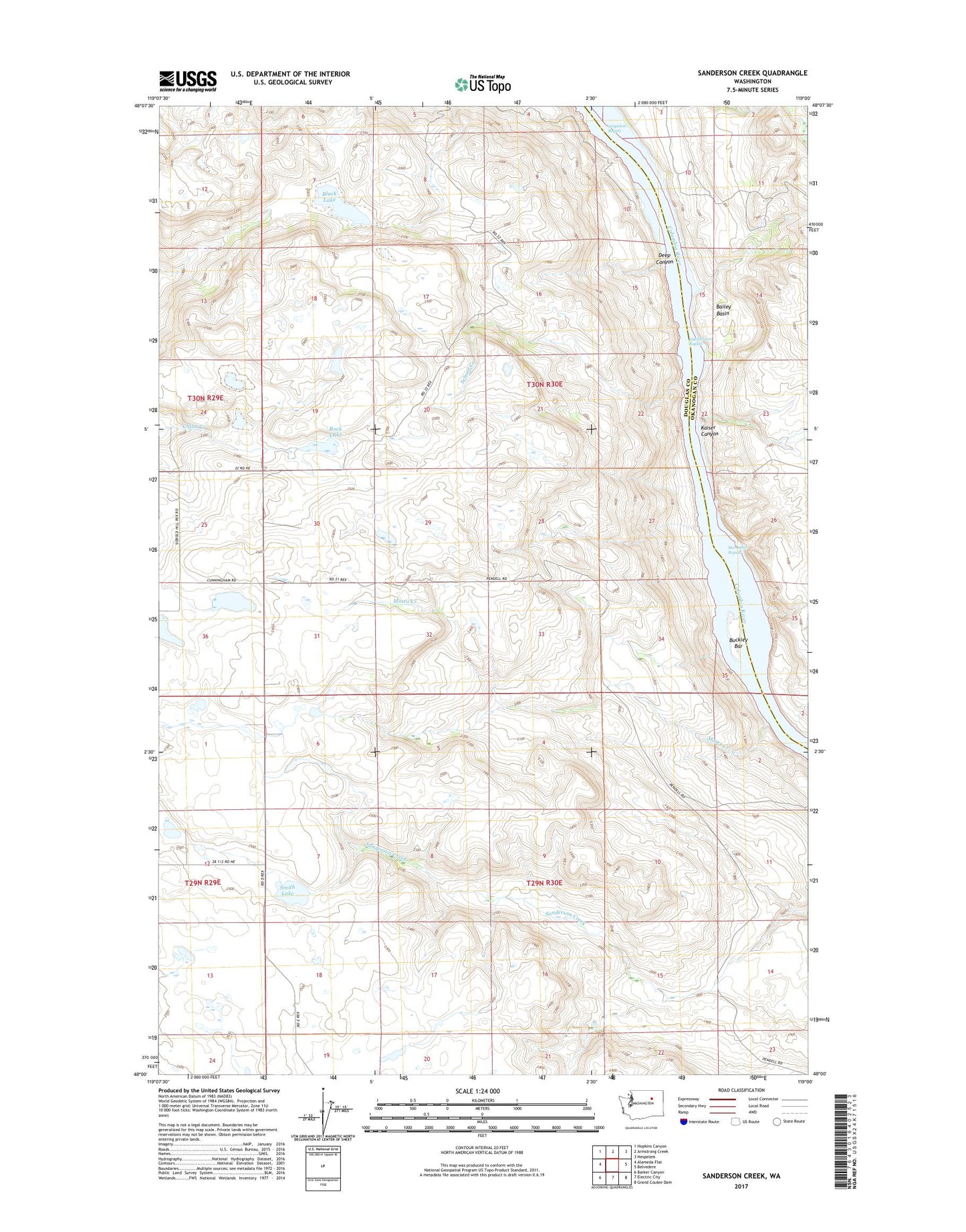
2023 topographic map quadrangle Sanderson Creek in the state of Washington. Scale: 1:24000. Based on the newly updated USGS 7.5' US Topo map series, this map is in the following counties: Douglas, Okanogan. The map contains contour data, water features, and other items you are used to seeing on USGS maps, but also has updated roads and other features. This is the next generation of topographic maps. Printed on high-quality waterproof paper with UV fade-resistant inks.
Quads adjacent to this one:
West: Alameda Flat
Northwest: Hopkins Canyon
North: Armstrong Creek
Northeast: Nespelem
East: Belvedere
Southeast: Grand Coulee Dam
South: Electric City
Southwest: Barker Canyon
This map covers the same area as the classic USGS quad with code o48119a1.
Contains the following named places: Bailey Basin, Barry School, Black Lake, Buckley Bar, Deep Canyon, Equilibrium Rapids, Kaiser Canyon, Monaghan Rapids, Moses Creek, Nespelem Rapids, Rex, Rex Grange Hall, Rock Lake, Rock Lake School, School Creek, Smith Lake, ZIP Code: 99133