MyTopo
Nespelem Washington US Topo Map
Couldn't load pickup availability
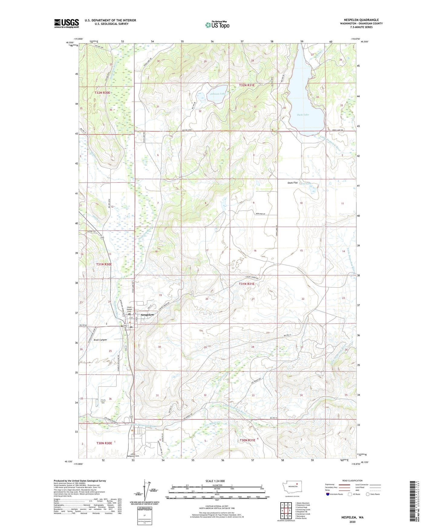
2023 topographic map quadrangle Nespelem in the state of Washington. Scale: 1:24000. Based on the newly updated USGS 7.5' US Topo map series, this map is in the following counties: Okanogan. The map contains contour data, water features, and other items you are used to seeing on USGS maps, but also has updated roads and other features. This is the next generation of topographic maps. Printed on high-quality waterproof paper with UV fade-resistant inks.
Quads adjacent to this one:
West: Armstrong Creek
Northwest: Moses Mountain
North: Stepstone Creek
Northeast: Central Peak
East: Nespelem NE
Southeast: Keller Butte
South: Belvedere
Southwest: Sanderson Creek
This map covers the same area as the classic USGS quad with code o48118b8.
Contains the following named places: Chief Joseph Cemetery, Colville Indian Agency, Colville Tribal Convalescent Center, Colville Tribal Emergency Medical Services, Cox Lake, Joe Moses Creek, Johnson Lake, Kroll Canyon, Mill Creek, Nespelem, Nespelem Elementary School, Nespelem Post Office, Owhi Creek, Owhi Flat, Owhi Lake, Owhi Lake Dam, Parmenter Creek, Poween Creek, Smith Creek, Town of Nespelem, ZIP Code: 99155