MyTopo
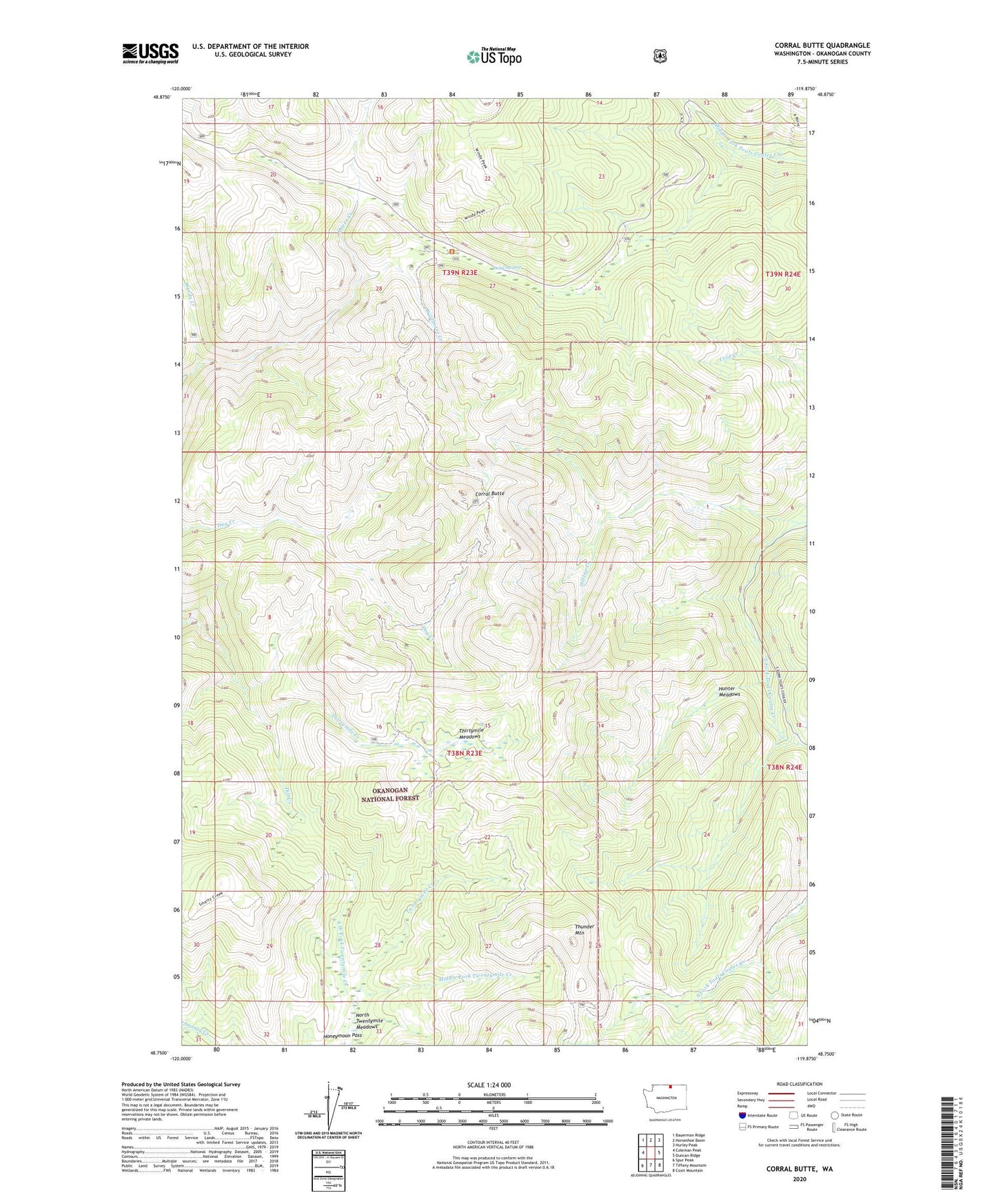
Corral Butte Washington US Topo Map
Couldn't load pickup availability
Also explore the Corral Butte Forest Service Topo of this same quad for updated USFS data
2023 topographic map quadrangle Corral Butte in the state of Washington. Scale: 1:24000. Based on the newly updated USGS 7.5' US Topo map series, this map is in the following counties: Okanogan. The map contains contour data, water features, and other items you are used to seeing on USGS maps, but also has updated roads and other features. This is the next generation of topographic maps. Printed on high-quality waterproof paper with UV fade-resistant inks.
Quads adjacent to this one:
West: Coleman Peak
Northwest: Bauerman Ridge
North: Horseshoe Basin
Northeast: Hurley Peak
East: Duncan Ridge
Southeast: Coxit Mountain
South: Tiffany Mountain
Southwest: Spur Peak
This map covers the same area as the classic USGS quad with code o48119g8.
Contains the following named places: Chow Creek, Corral Butte, Crosby Camp, Crosby Creek, Dill Creek, Four Point Corral, Hilltop Creek, Hunter Meadows, Inlow Camp, Irenes Camp, Lightning Camp, Long Swamp, Long Swamp Campground, Long Swamp Trail, Long Swamp Trailhead, Lost Spoon Camp, Middle Fork Twentymile Creek, North Twentymile Meadows, North Twentymile Peak Trail, Queer Creek, Skull Camp, Thirtymile Meadows, Thirtymile Trail, Thunder Camp, Thunder Mountain, Twentymile Camp, West Fork Twentymile Creek, Wildhorse Camp, Wildhorse Creek