
MyTopo
Big Huckleberry Mountain Washington US Topo Map
Couldn't load pickup availability
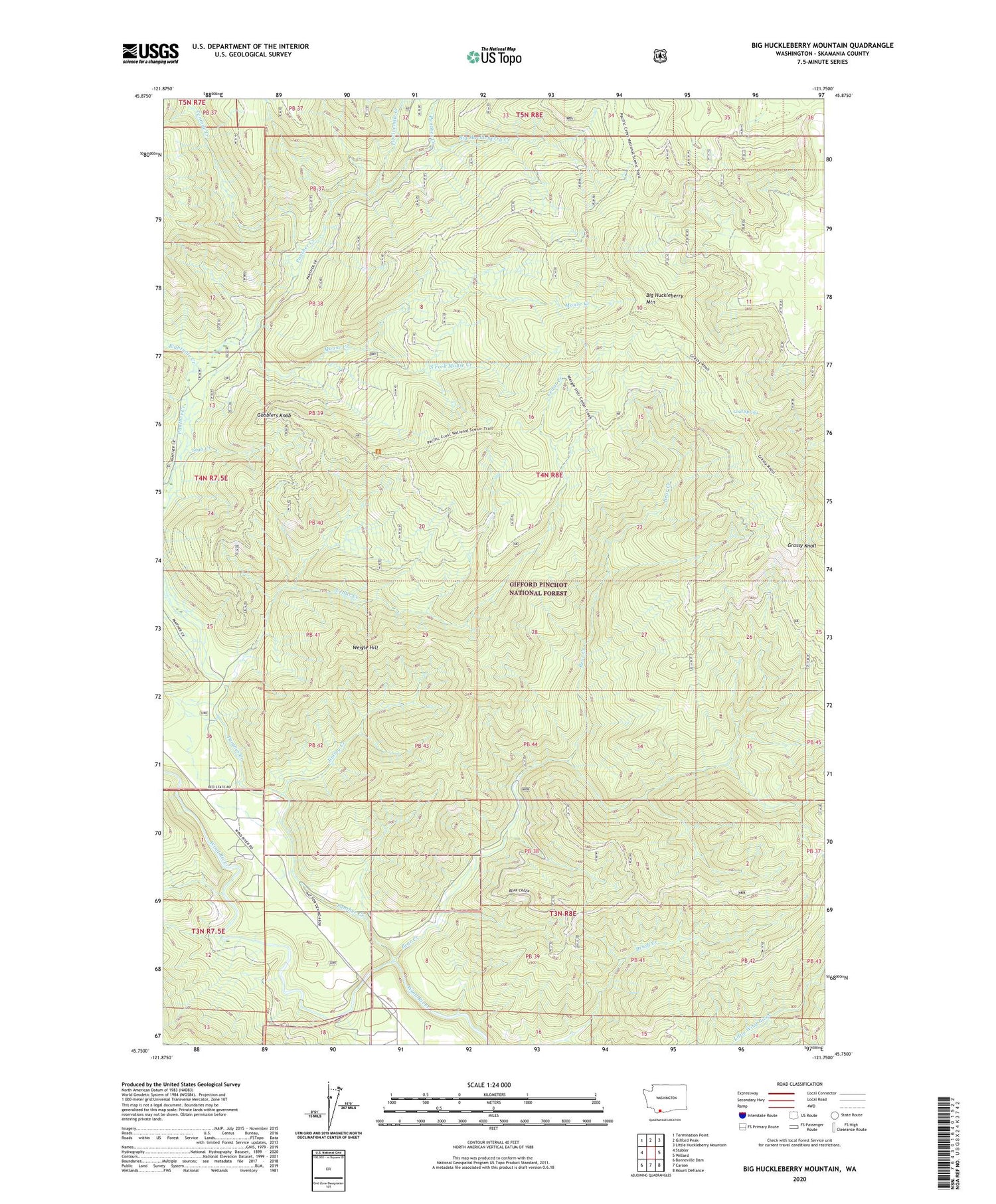
2020 topographic map quadrangle Big Huckleberry Mountain in the state of Washington. Scale: 1:24000. Based on the newly updated USGS 7.5' US Topo map series, this map is in the following counties: Skamania. The map contains contour data, water features, and other items you are used to seeing on USGS maps, but also has updated roads and other features. This is the next generation of topographic maps. Printed on high-quality waterproof paper with UV fade-resistant inks.
Quads adjacent to this one:
West: Stabler
Northwest: Termination Point
North: Gifford Peak
Northeast: Little Huckleberry Mountain
East: Willard
Southeast: Mount Defiance
South: Carson
Southwest: Bonneville Dam
Contains the following named places: Bear Creek, Big Huckleberry Creek, Big Huckleberry Mountain, Brush Creek Trail, Cedar Creek, Cedar Creek Trail, Cold Spring, Eightmile Creek, Gobblers Knob, Grassy Knoll, Huckleberry Trail, Jimmy Creek, Mouse Creek, Panther Creek, South Fork Mouse Creek, Stub Creek, Tenmile Creek, Twelvemile Creek, Weigle Hill


