MyTopo
Little Huckleberry Mountain Washington US Topo Map
Couldn't load pickup availability
Also explore the Little Huckleberry Mountain Forest Service Topo of this same quad for updated USFS data
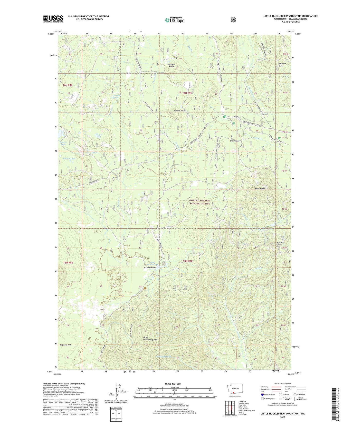
2023 topographic map quadrangle Little Huckleberry Mountain in the state of Washington. Scale: 1:24000. Based on the newly updated USGS 7.5' US Topo map series, this map is in the following counties: Skamania. The map contains contour data, water features, and other items you are used to seeing on USGS maps, but also has updated roads and other features. This is the next generation of topographic maps. Printed on high-quality waterproof paper with UV fade-resistant inks.
Quads adjacent to this one:
West: Gifford Peak
Northwest: Lone Butte
North: Sleeping Beauty
Northeast: Trout Lake
East: Guler Mountain
Southeast: Penny Ridge
South: Willard
Southwest: Big Huckleberry Mountain
This map covers the same area as the classic USGS quad with code o45121h6.
Contains the following named places: Big Lava Bed, Big Trench, Cougar Way, Coyote Creek, Dry Creek, Grouse Butte, Huckle Lookout, Ice Cave Campground, Little Huckleberry Mountain, Little Huckleberry Mountain Lookout, Little Huckleberry Trail, Lost Creek, Lost Creek Ditch, Lost Creek Spring, Lost Meadow Creek, Lusk Creek Trail, Mann Butte, Peterson Butte, Peterson Guard Station, Peterson Prairie Campground, Peterson Prairie Guard Station, South Prairie, South Prairie Lake, Trail Peak