MyTopo
Blaney Creek Washington US Topo Map
Couldn't load pickup availability
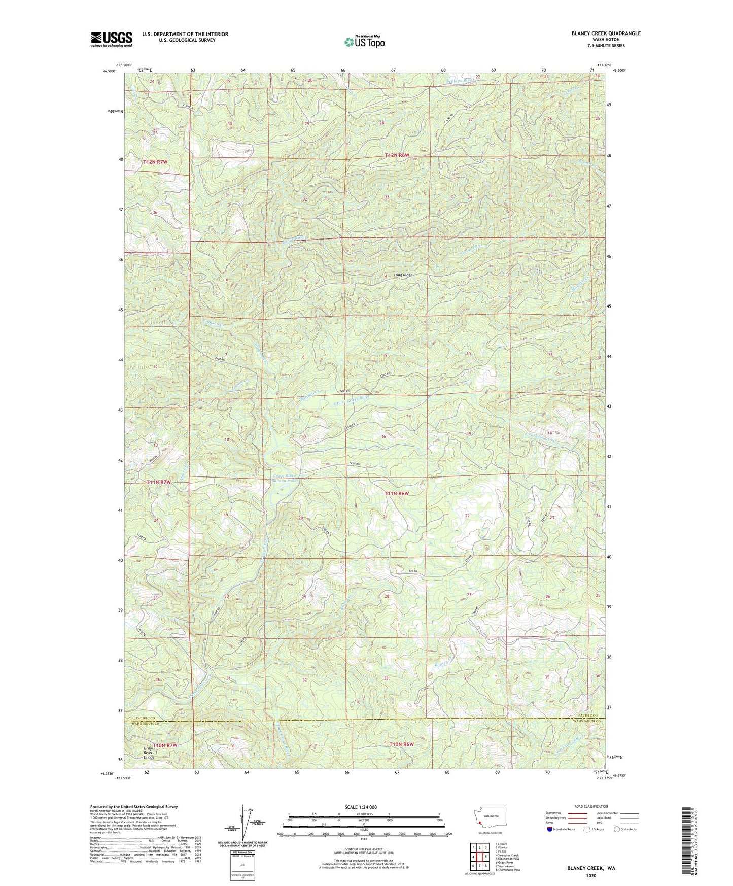
2020 topographic map quadrangle Blaney Creek in the state of Washington. Scale: 1:24000. Based on the newly updated USGS 7.5' US Topo map series, this map is in the following counties: Pacific, Wahkiakum. The map contains contour data, water features, and other items you are used to seeing on USGS maps, but also has updated roads and other features. This is the next generation of topographic maps. Printed on high-quality waterproof paper with UV fade-resistant inks.
Quads adjacent to this one:
West: Sweigiler Creek
Northwest: Lebam
North: Pluvius
Northeast: Pe Ell
East: Elochoman Pass
Southeast: Skamokawa Pass
South: Skamokawa
Southwest: Grays River
Contains the following named places: Alder Creek, Blaney Creek, Blaney Lookout, Cabin Creek, East Fork Grays River, Grays River Salmon Pond, Johnson Creek, Long Ridge, Mitchell Creek, South Fork Grays River