MyTopo
Blewett Washington US Topo Map
Couldn't load pickup availability
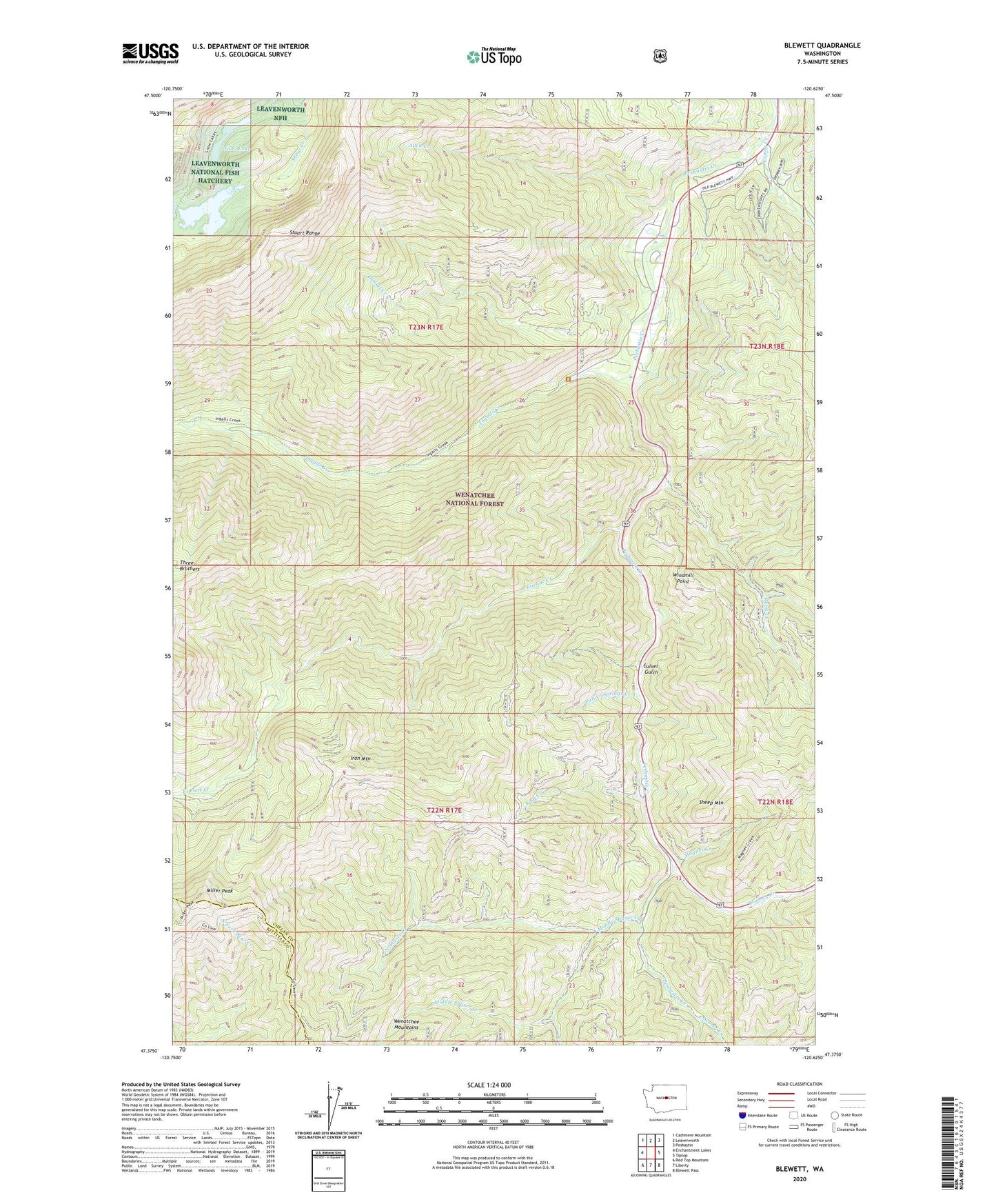
2020 topographic map quadrangle Blewett in the state of Washington. Scale: 1:24000. Based on the newly updated USGS 7.5' US Topo map series, this map is in the following counties: Chelan, Kittitas. The map contains contour data, water features, and other items you are used to seeing on USGS maps, but also has updated roads and other features. This is the next generation of topographic maps. Printed on high-quality waterproof paper with UV fade-resistant inks.
Quads adjacent to this one:
West: Enchantment Lakes
Northwest: Cashmere Mountain
North: Leavenworth
Northeast: Peshastin
East: Tiptop
Southeast: Blewett Pass
South: Liberty
Southwest: Red Top Mountain
Contains the following named places: Allen Creek, Blewett, Caldo Mine, Camas Creek, Cedar Grove Campground, Culver Gulch, Culver Springs Creek, Etienne Creek, Hansel Creek, Ingalls Creek, Ingalls Creek Guard Station, Iron Mountain, King Creek, Leavenworth National Fish Hatchery, Magnet Creek, Magnet Creek Trail, Middle Shaser Creek, Middle Shaser Trail, Mill Ingalls Creek Trail, Miller Peak, Nada Lake, North Shaser Creek, North Shaser Trail, Ruby Creek, Scotty Creek, Scotty Creek Campground, Sheep Mountain, South Shaser Creek, Three Brothers Trail, Tronsen Creek, Windmill Point, ZIP Code: 98847