MyTopo
Red Top Mountain Washington US Topo Map
Couldn't load pickup availability
Also explore the Red Top Mountain Forest Service Topo of this same quad for updated USFS data
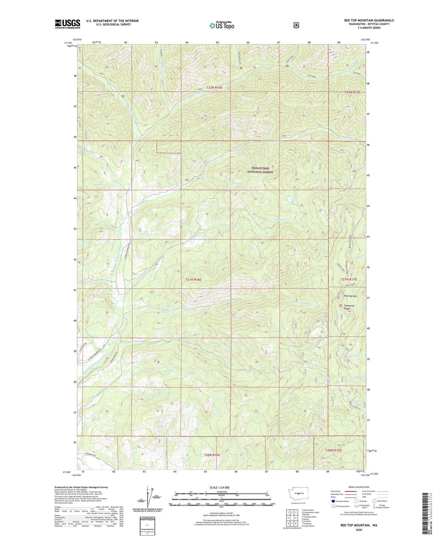
2023 topographic map quadrangle Red Top Mountain in the state of Washington. Scale: 1:24000. Based on the newly updated USGS 7.5' US Topo map series, this map is in the following counties: Kittitas. The map contains contour data, water features, and other items you are used to seeing on USGS maps, but also has updated roads and other features. This is the next generation of topographic maps. Printed on high-quality waterproof paper with UV fade-resistant inks.
Quads adjacent to this one:
West: Teanaway Butte
Northwest: Mount Stuart
North: Enchantment Lakes
Northeast: Blewett
East: Liberty
Southeast: Swauk Prairie
South: Teanaway
Southwest: Cle Elum
This map covers the same area as the classic USGS quad with code o47120c7.
Contains the following named places: Bear Creek, Dickey Creek, Dickey Creek Campground, Dickey Creek Trail, Indian Creek, Jack Creek, Jungle Creek, Middle Creek, Miller Creek, North Fork Bear Creek, Red Top Agate Beds, Red Top Mountain, Red Top Mountain Lookout, Rye Creek, Ryepatch, Shirk Creek, South Fork Bear Creek, Stafford Creek, Stafford Creek Recreation Area, Stafford Lookout, Standup Creek, Story Creek, Teanaway Ridge, Twentynine Pines Campground