MyTopo
Enchantment Lakes Washington US Topo Map
Couldn't load pickup availability
Also explore the Enchantment Lakes Forest Service Topo of this same quad for updated USFS data
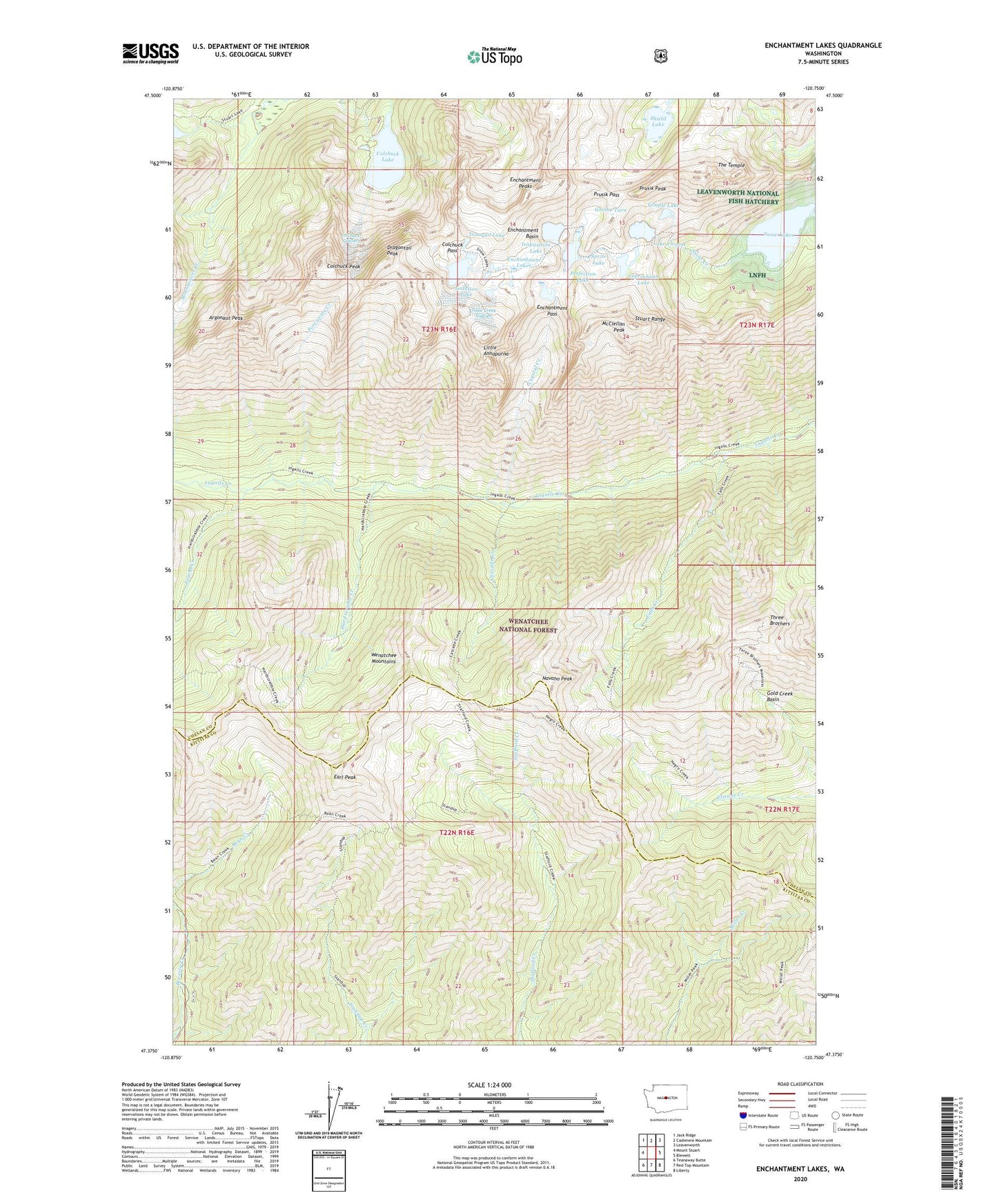
2023 topographic map quadrangle Enchantment Lakes in the state of Washington. Scale: 1:24000. Based on the newly updated USGS 7.5' US Topo map series, this map is in the following counties: Chelan, Kittitas. The map contains contour data, water features, and other items you are used to seeing on USGS maps, but also has updated roads and other features. This is the next generation of topographic maps. Printed on high-quality waterproof paper with UV fade-resistant inks.
Quads adjacent to this one:
West: Mount Stuart
Northwest: Jack Ridge
North: Cashmere Mountain
Northeast: Leavenworth
East: Blewett
Southeast: Liberty
South: Red Top Mountain
Southwest: Teanaway Butte
This map covers the same area as the classic USGS quad with code o47120d7.
Contains the following named places: Argonaut Peak, Cascade Creek, Colchuck Glacier, Colchuck Lake, Colchuck Lake Dam, Colchuck Pass, Colchuck Peak, Colchuck Trail, County Line Trail, Crystal Creek, Dragontail Peak, Earl Peak, Enchantment Basin, Enchantment Lakes, Enchantment Pass, Enchantment Peaks, Falls Creek, Fourth Creek, Gnome Tarn, Gold Creek Basin, Hardscrable Creek, Inspiration Lake, Isolation Lake, Lake Stuart Trail, Lake Viviane, Leprechaun Lake, Little Annapurna, Lower Enchantment Lakes, McClellan Peak, Miller Peak Trail, Navaho Peak, Perfection Lake, Porcupine Creek, Prusik Pass, Prusik Peak, Shield Lake, Snow Creek Glacier, Snow Lakes, Sprite Lake, Stuart Range, Temple Lake, The Temple, Three Brothers, Tranquil Lake, Upper Enchantment Lakes, Wenatchee Mountains