MyTopo
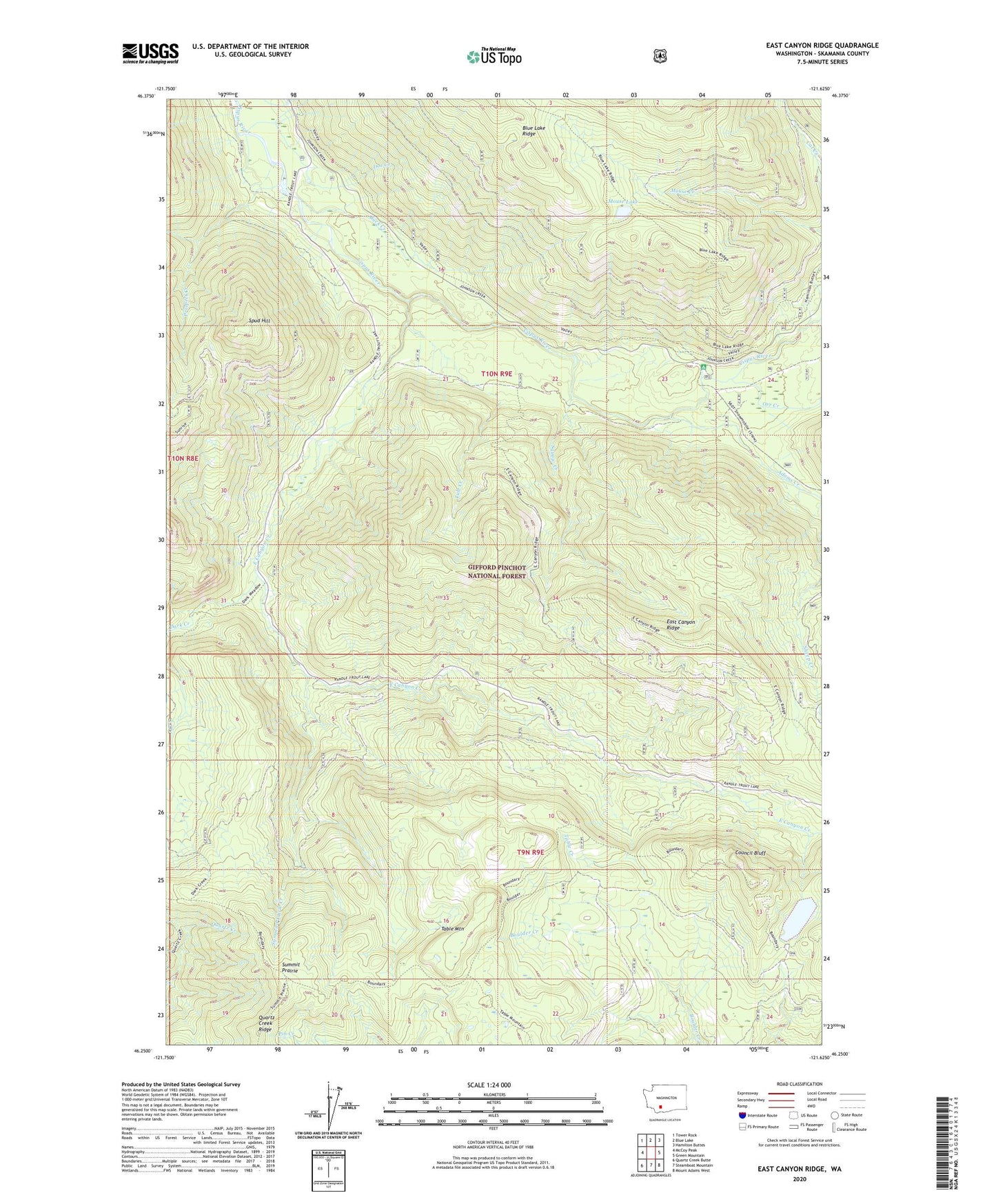
East Canyon Ridge Washington US Topo Map
Couldn't load pickup availability
Also explore the East Canyon Ridge Forest Service Topo of this same quad for updated USFS data
2023 topographic map quadrangle East Canyon Ridge in the state of Washington. Scale: 1:24000. Based on the newly updated USGS 7.5' US Topo map series, this map is in the following counties: Skamania. The map contains contour data, water features, and other items you are used to seeing on USGS maps, but also has updated roads and other features. This is the next generation of topographic maps. Printed on high-quality waterproof paper with UV fade-resistant inks.
Quads adjacent to this one:
West: McCoy Peak
Northwest: Tower Rock
North: Blue Lake
Northeast: Hamilton Buttes
East: Green Mountain
Southeast: Mount Adams West
South: Steamboat Mountain
Southwest: Quartz Creek Butte
This map covers the same area as the classic USGS quad with code o46121c6.
Contains the following named places: Adams Creek, Adams Fork Campground, Buck Creek, Council Bluff, Council Bluff Lookout, Council Lake, Council Lake Campground, Dark Creek, Doe Creek, East Canyon Creek, East Canyon Ridge, Mouse Lake, Orr Creek, Prospect Creek, Spud Hill, Squaw Creek, Summit Prairie, Summit Prairie Creek, Summit Prairie Lookout, Table Creek, Table Mountain, Tule Creek