MyTopo
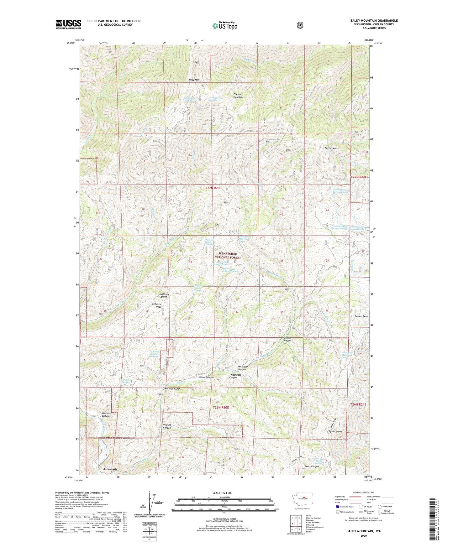
Baldy Mountain Washington US Topo Map
Couldn't load pickup availability
Also explore the Baldy Mountain Forest Service Topo of this same quad for updated USFS data
2023 topographic map quadrangle Baldy Mountain in the state of Washington. Scale: 1:24000. Based on the newly updated USGS 7.5' US Topo map series, this map is in the following counties: Chelan. The map contains contour data, water features, and other items you are used to seeing on USGS maps, but also has updated roads and other features. This is the next generation of topographic maps. Printed on high-quality waterproof paper with UV fade-resistant inks.
Quads adjacent to this one:
West: Tyee Mountain
Northwest: Brief
North: Stormy Mountain
Northeast: Manson
East: Winesap
Southeast: Entiat
South: Ardenvoir
Southwest: Chumstick Mountain
This map covers the same area as the classic USGS quad with code o47120g3.
Contains the following named places: Baldy Mountain, Baldy Spring Number 1, Baldy Spring Number 2, Bisping Canyon, Byers Canyon Spring Number 3, Corral Canyon, Forest Mountain, Forest Mountain Spring Number 1, Forest Mountain Spring Number 2, Forest Mountain Spring Number 3, Gene Creek, Goman Peak, Harris Creek, Harris Creek Spring Number 1, Harris Creek Spring Number 2, McKenzie Ridge, Medsker Canyon, Medsker Spring, Murdock Gulch, Murdock Spring Number 1, Murdock Spring Number 2, Murdock Spring Number 3, North Fork Mud Creek, North Fork Mud Creek Spring, Palmich Canyon, South Fork Mud Creek, South Fork Mud Creek Spring, Switchback Canyon, Wilkinson Canyon