MyTopo
Cashmere Washington US Topo Map
Couldn't load pickup availability
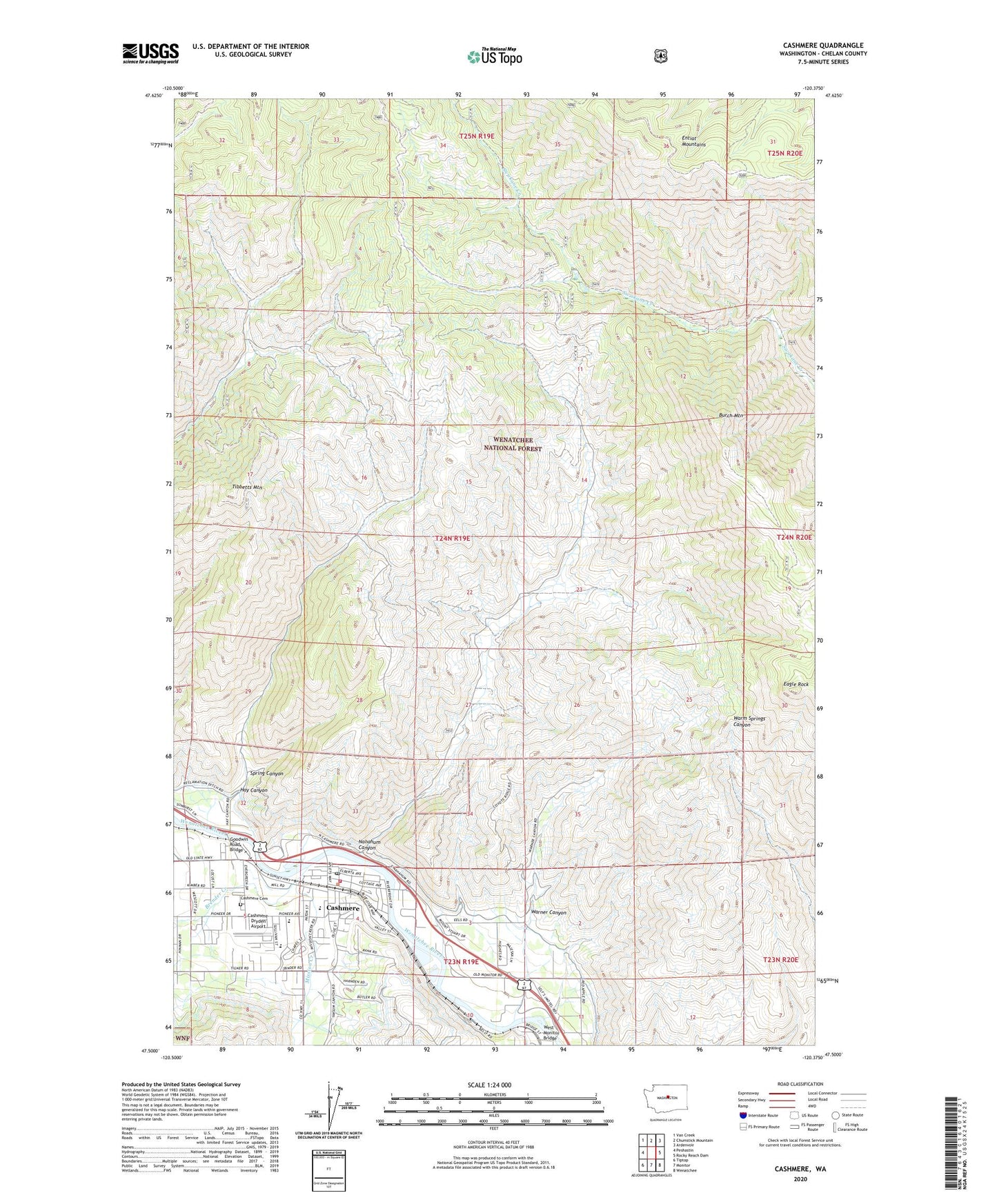
2020 topographic map quadrangle Cashmere in the state of Washington. Scale: 1:24000. Based on the newly updated USGS 7.5' US Topo map series, this map is in the following counties: Chelan. The map contains contour data, water features, and other items you are used to seeing on USGS maps, but also has updated roads and other features. This is the next generation of topographic maps. Printed on high-quality waterproof paper with UV fade-resistant inks.
Quads adjacent to this one:
West: Peshastin
Northwest: Van Creek
North: Chumstick Mountain
Northeast: Ardenvoir
East: Rocky Reach Dam
Southeast: Wenatchee
South: Monitor
Southwest: Tiptop
Contains the following named places: Ardetta Park, Brender Creek, Burch Mountain, Cascade Heliport, Cashmere, Cashmere Avenue Park, Cashmere Cemetery, Cashmere Church of Christ, Cashmere Convalescent Center, Cashmere High School, Cashmere Landfill, Cashmere Middle School, Cashmere Post Office, Cashmere Presbyterian Church, Cashmere Seventh Day Adventist Church, Cashmere Sewage Treatment Plant, Cashmere United Methodist Church, Cashmere-Dryden Airport, Chelan County Exposition Center, City of Cashmere, Eagle Rock, Evergreen Baptist Church, Faith Church of God, Goodwin Road Bridge, Grace Lutheran Church, Hay Canyon, Hay Canyon Mobile Home Park, Icicle Canal, John Simpson Memorial Park, Life Trac Family Ministries, Middle School, Mission Creek, Nahahum Canyon, Natatoruim Park, Saint Francis Xavier Catholic Church, Selfs Trailer Park, Spring Canyon, Tibbetts Mountain, United Methodist Foundation of the Northwest, Vale Elementary School, Warner Canyon, West Monitor Bridge, Willis Carey Historical Museum