MyTopo
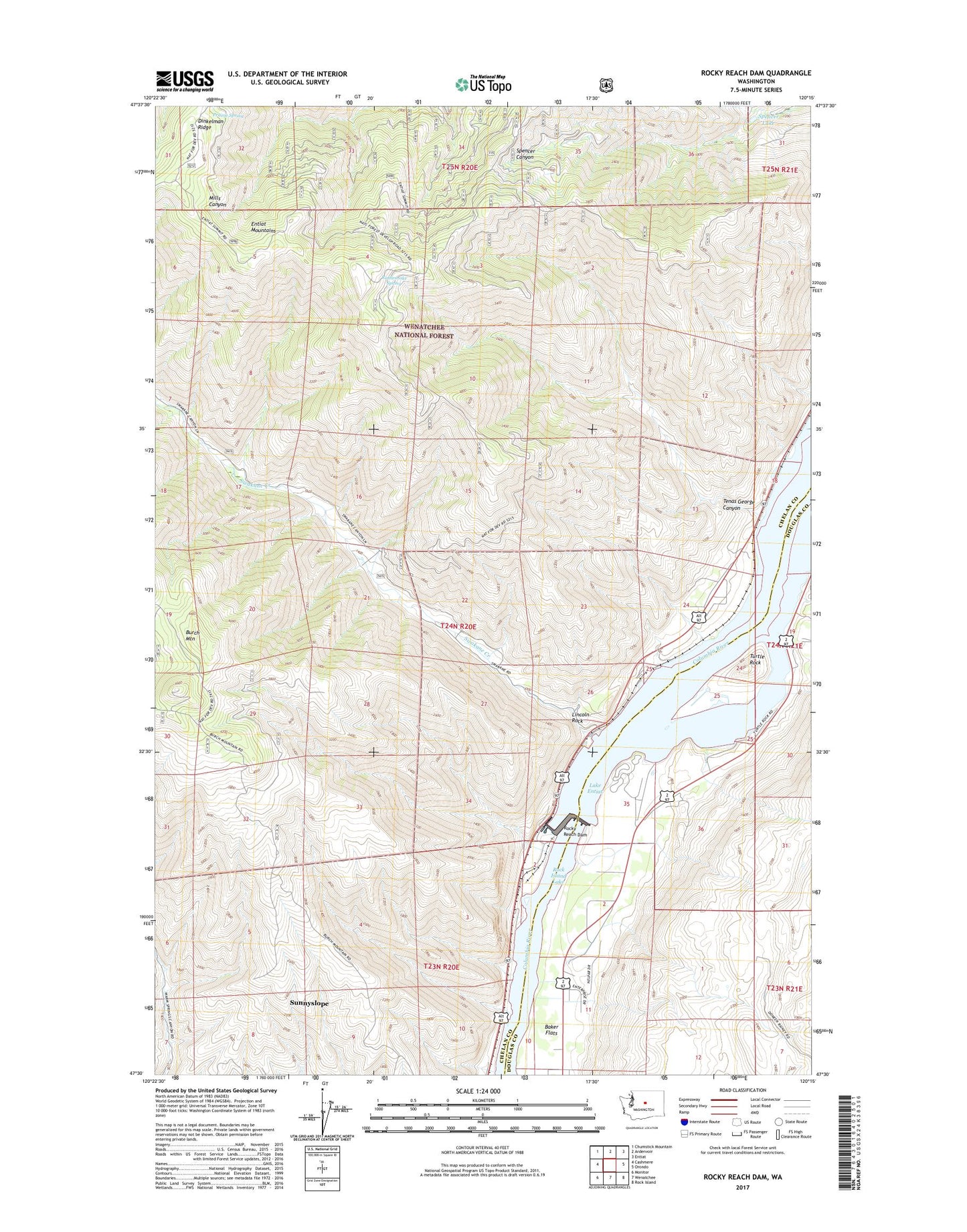
Rocky Reach Dam Washington US Topo Map
Couldn't load pickup availability
Also explore the Rocky Reach Dam Forest Service Topo of this same quad for updated USFS data
2023 topographic map quadrangle Rocky Reach Dam in the state of Washington. Scale: 1:24000. Based on the newly updated USGS 7.5' US Topo map series, this map is in the following counties: Chelan, Douglas. The map contains contour data, water features, and other items you are used to seeing on USGS maps, but also has updated roads and other features. This is the next generation of topographic maps. Printed on high-quality waterproof paper with UV fade-resistant inks.
Quads adjacent to this one:
West: Cashmere
Northwest: Chumstick Mountain
North: Ardenvoir
Northeast: Entiat
East: Orondo
Southeast: Rock Island
South: Wenatchee
Southwest: Monitor
This map covers the same area as the classic USGS quad with code o47120e3.
Contains the following named places: Dinkelman Ridge, Lincoln Rock, Prairie Spring, Prairie Spring Campground, Rattlesnake Spring, Rocky Reach Dam, Spencer Lake, Swakane Creek, Swakane State Wildlife Area, Tenas George Canyon, Turtle Rock, Wenatchee Boat Club, Wenatchee Division, Zena