MyTopo
Ardenvoir Washington US Topo Map
Couldn't load pickup availability
Also explore the Ardenvoir Forest Service Topo of this same quad for updated USFS data
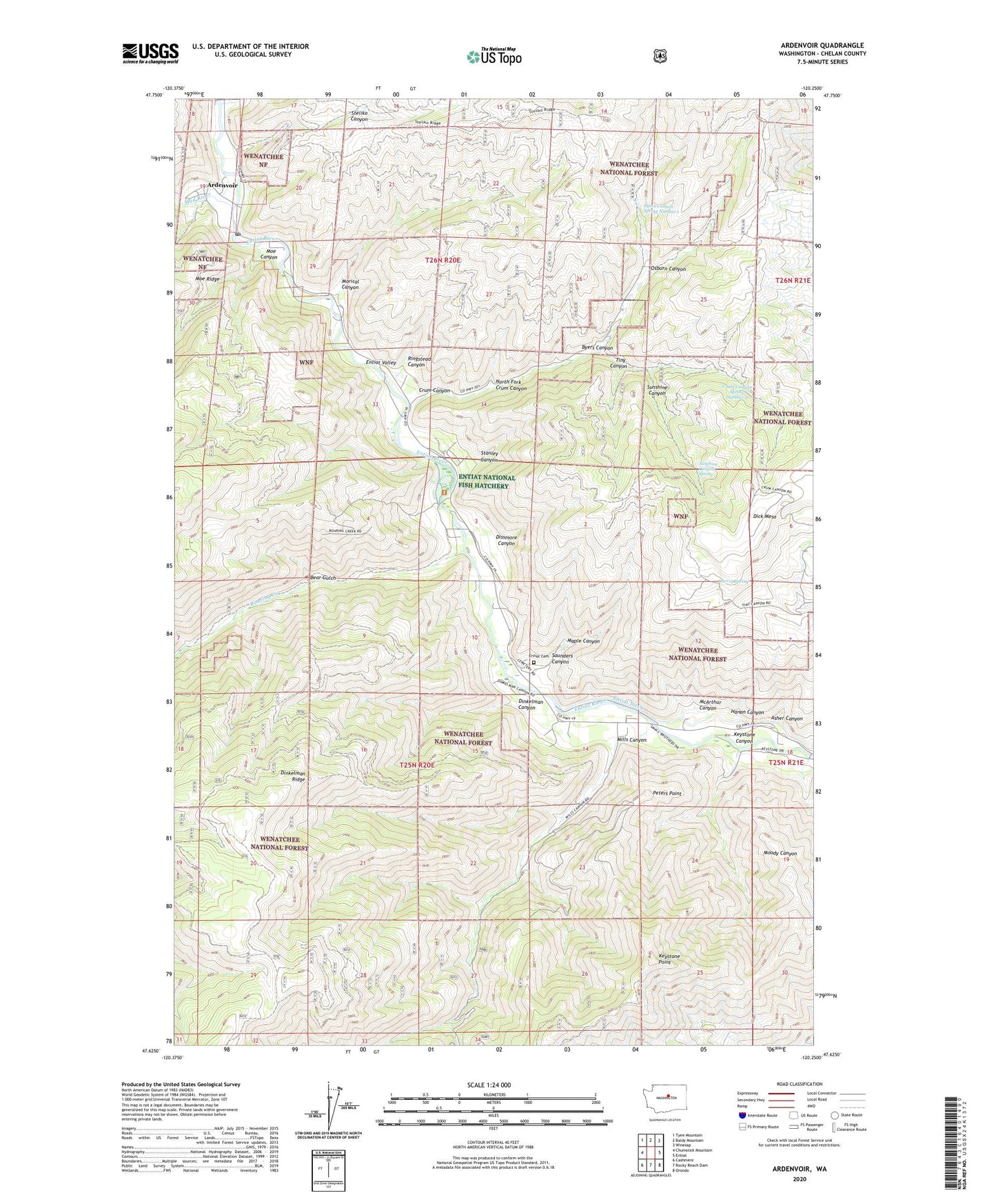
2023 topographic map quadrangle Ardenvoir in the state of Washington. Scale: 1:24000. Based on the newly updated USGS 7.5' US Topo map series, this map is in the following counties: Chelan. The map contains contour data, water features, and other items you are used to seeing on USGS maps, but also has updated roads and other features. This is the next generation of topographic maps. Printed on high-quality waterproof paper with UV fade-resistant inks.
Quads adjacent to this one:
West: Chumstick Mountain
Northwest: Tyee Mountain
North: Baldy Mountain
Northeast: Winesap
East: Entiat
Southeast: Orondo
South: Rocky Reach Dam
Southwest: Cashmere
This map covers the same area as the classic USGS quad with code o47120f3.
Contains the following named places: Ardenvoir, Ardenvoir Post Office, Asher Canyon, Bear Gulch, Byers Canyon, Byers Canyon Spring Number 1, Cherry Spring, Crum Canyon, Crum Canyon Spring Number 2, Dick Mesa, Dinkelman Canyon, Dissmore Canyon, Entiat Cemetery, Entiat National Fish Hatchery, Farris, Hanan Canyon, Keystone Canyon, Keystone Point, Mad River, Maple Canyon, McArthur Canyon, Mills Canyon, Moe Canyon, Moody Canyon, Morical Canyon, Mud Creek, North Fork Crum Canyon, Osburn Canyon, Peters Point, Ringstead Canyon, Roaring Creek, Saunders Canyon, Stanley Canyon, Steliko, Steliko Canyon, Sunshine Canyon, Sunshine Canyon Spring, Tiny Canyon