MyTopo
Cedonia Washington US Topo Map
Couldn't load pickup availability
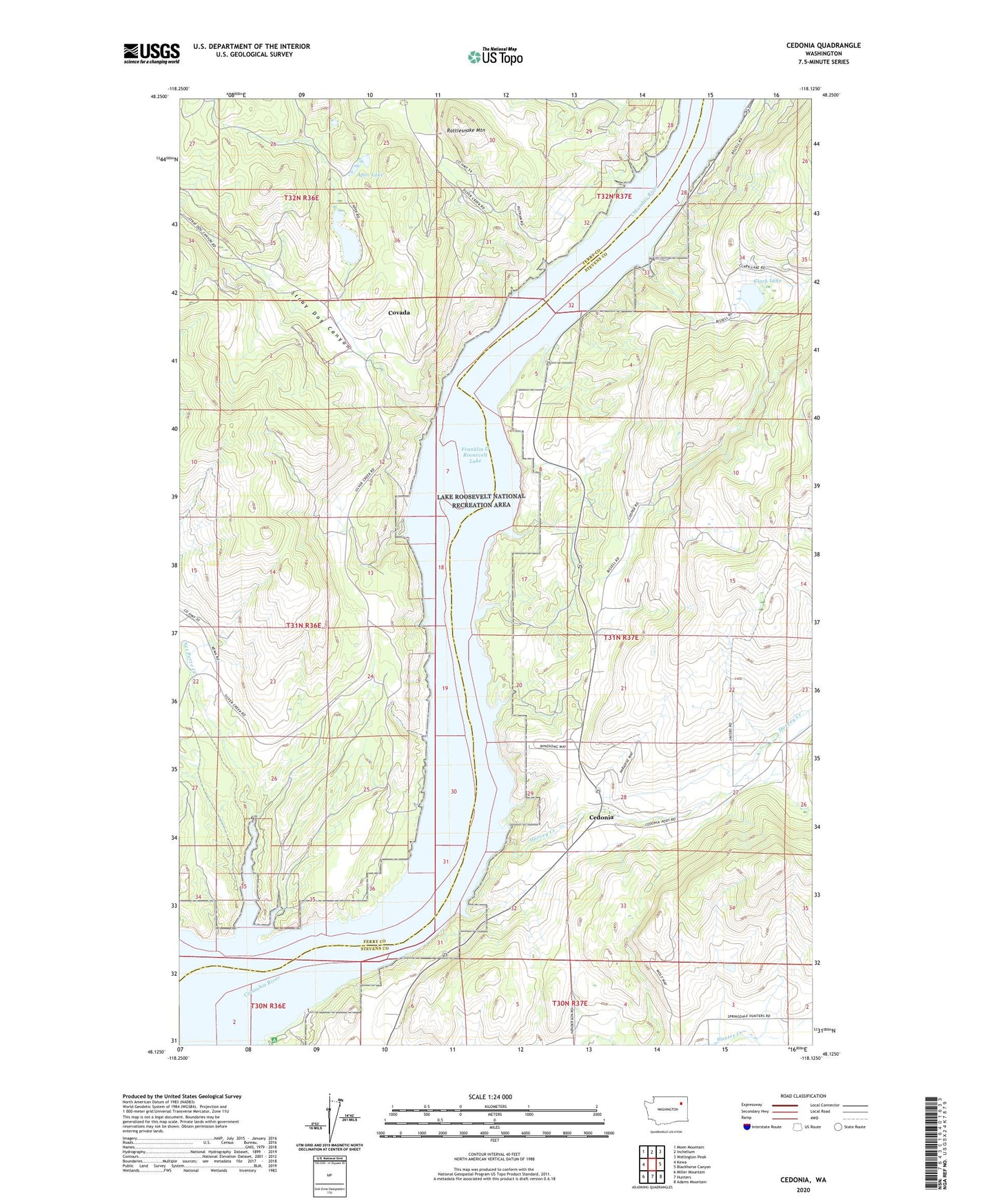
2020 topographic map quadrangle Cedonia in the state of Washington. Scale: 1:24000. Based on the newly updated USGS 7.5' US Topo map series, this map is in the following counties: Stevens, Ferry. The map contains contour data, water features, and other items you are used to seeing on USGS maps, but also has updated roads and other features. This is the next generation of topographic maps. Printed on high-quality waterproof paper with UV fade-resistant inks.
Quads adjacent to this one:
West: Kewa
Northwest: Moon Mountain
North: Inchelium
Northeast: Wellington Peak
East: Blackhorse Canyon
Southeast: Adams Mountain
South: Hunters
Southwest: Miller Mountain
Contains the following named places: Apex Lake, Bissel, Bissel School, Bourgeau Lake, Cedonia, Cedonia Community Church, Cedonia School, Clark Lake, Covada, Greenwood Grange, Harvey Creek, Hunters Landing, Longstreet Mine, Nez Perce Creek, Rattlesnake Mountain, Silver Leaf Mine, Stray Dog Canyon