MyTopo
Hunters Washington US Topo Map
Couldn't load pickup availability
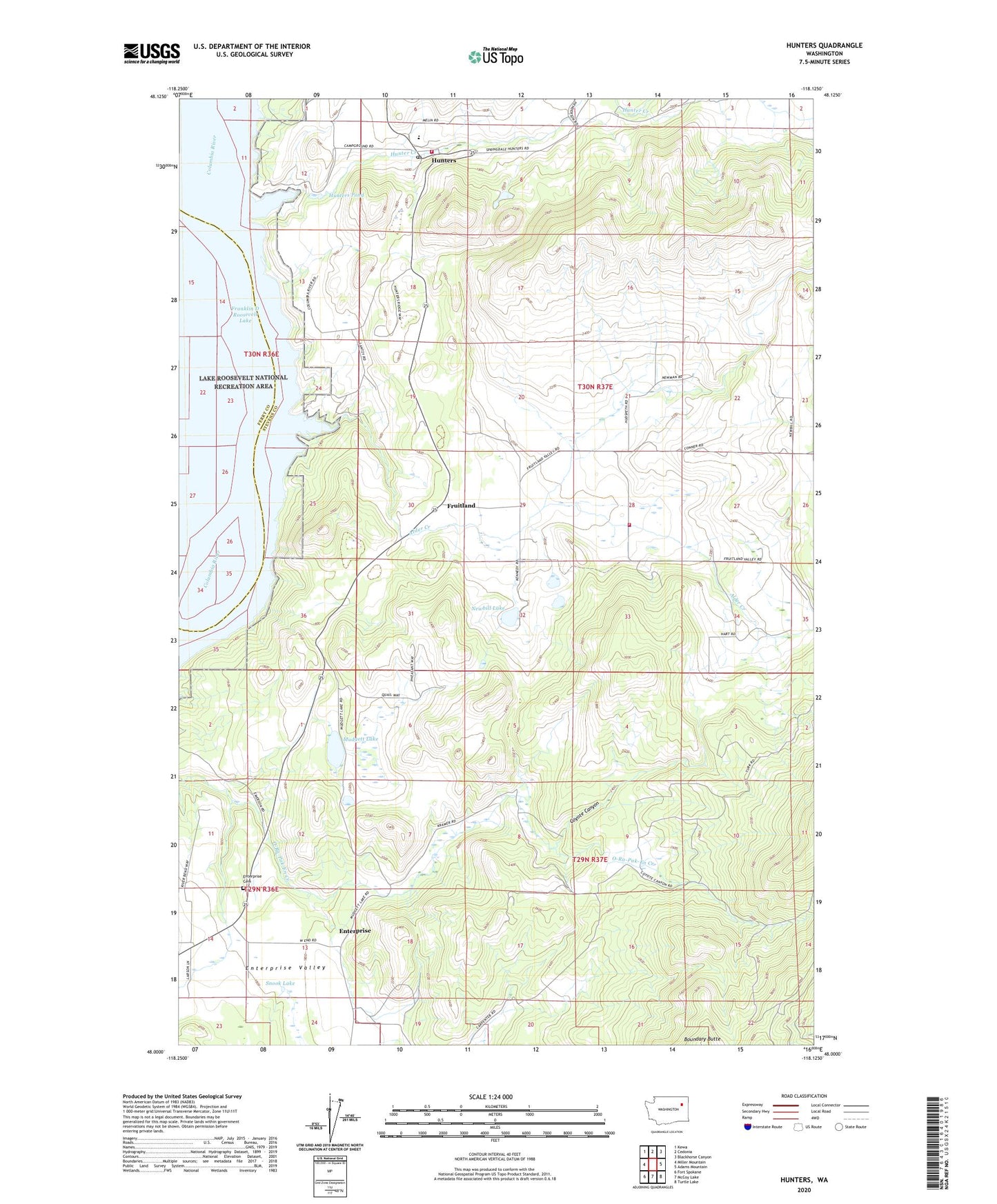
2023 topographic map quadrangle Hunters in the state of Washington. Scale: 1:24000. Based on the newly updated USGS 7.5' US Topo map series, this map is in the following counties: Stevens, Ferry. The map contains contour data, water features, and other items you are used to seeing on USGS maps, but also has updated roads and other features. This is the next generation of topographic maps. Printed on high-quality waterproof paper with UV fade-resistant inks.
Quads adjacent to this one:
West: Miller Mountain
Northwest: Kewa
North: Cedonia
Northeast: Blackhorse Canyon
East: Adams Mountain
Southeast: Turtle Lake
South: McCoy Lake
Southwest: Fort Spokane
This map covers the same area as the classic USGS quad with code o48118a2.
Contains the following named places: Advent Church, Alder Creek, Columbia Heights Assembly Church, Columbia High and Elementary School, Coyote Canyon, Enterprise, Enterprise Cemetery, Enterprise Church, Fruitland, H and B Mine, Hunter Creek, Hunter Dam, Hunters, Hunters Landing, Hunters Pond, Hunters Pond Dam, Hunters Post Office, Hunters Public Library, Mudgett Lake, Newbill Lake, Snook Lake, Snook Lake Dam, Stevens County Fire District 2 Station 210, Stevens County Fire District 2 Station 230, ZIP Code: 99129