MyTopo
Moon Mountain Washington US Topo Map
Couldn't load pickup availability
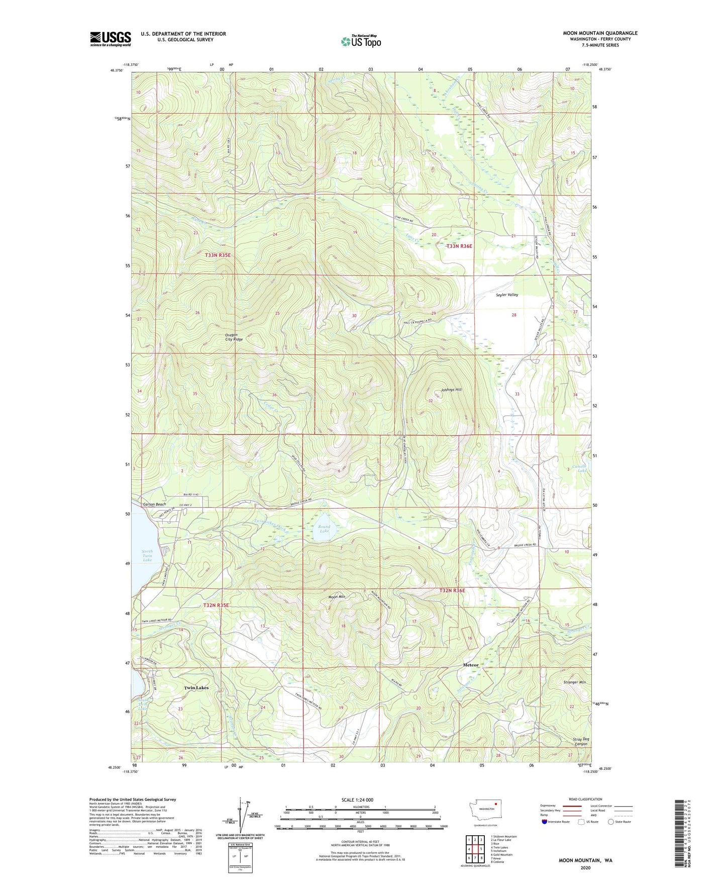
2023 topographic map quadrangle Moon Mountain in the state of Washington. Scale: 1:24000. Based on the newly updated USGS 7.5' US Topo map series, this map is in the following counties: Ferry. The map contains contour data, water features, and other items you are used to seeing on USGS maps, but also has updated roads and other features. This is the next generation of topographic maps. Printed on high-quality waterproof paper with UV fade-resistant inks.
Quads adjacent to this one:
West: Twin Lakes
Northwest: Sitdown Mountain
North: La Fleur Lake
Northeast: Rice
East: Inchelium
Southeast: Cedonia
South: Kewa
Southwest: Gold Mountain
This map covers the same area as the classic USGS quad with code o48118c3.
Contains the following named places: Abraham Creek, Carson Beach, Cedar Creek, Cornstalk Creek, Hall Ranch, Hidden Beach Campground, Johhnys Hill, Lakeside Grange, Lynx Creek, Meteor, Moon Mountain, Moon Mountain Lookout, Round Lake, Seyler Valley, Spring Creek, Twin Lakes Census Designated Place, Twin Lakes Ditch