MyTopo
Wellington Peak Washington US Topo Map
Couldn't load pickup availability
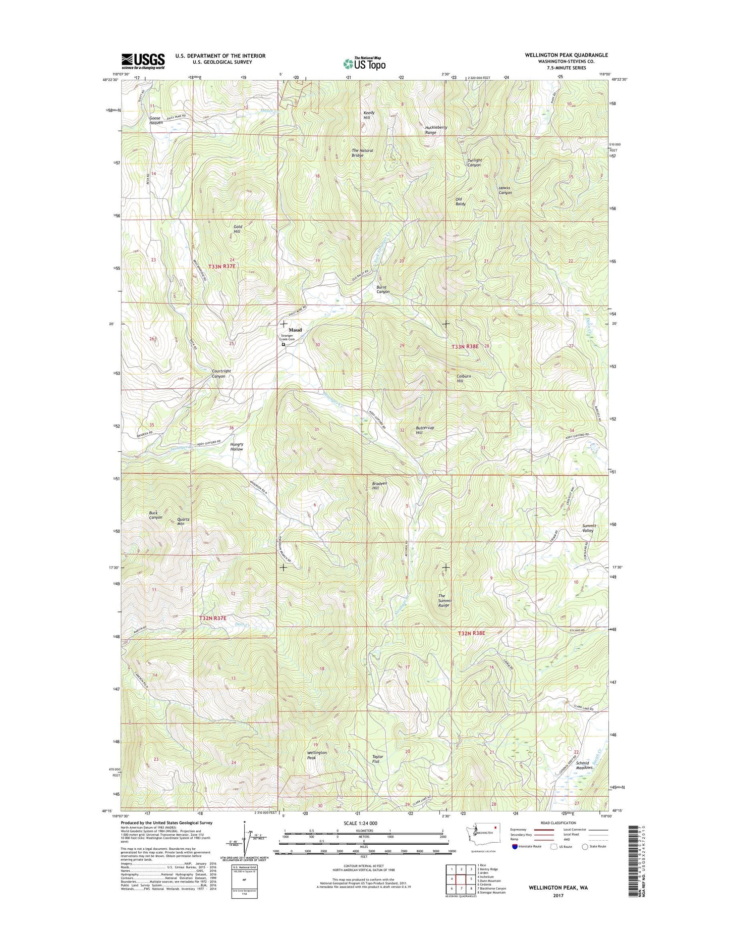
2023 topographic map quadrangle Wellington Peak in the state of Washington. Scale: 1:24000. Based on the newly updated USGS 7.5' US Topo map series, this map is in the following counties: Stevens. The map contains contour data, water features, and other items you are used to seeing on USGS maps, but also has updated roads and other features. This is the next generation of topographic maps. Printed on high-quality waterproof paper with UV fade-resistant inks.
Quads adjacent to this one:
West: Inchelium
Northwest: Rice
North: Kentry Ridge
Northeast: Arden
East: Dunn Mountain
Southeast: Stensgar Mountain
South: Blackhorse Canyon
Southwest: Cedonia
This map covers the same area as the classic USGS quad with code o48118c1.
Contains the following named places: Bradeen Hill, Burnt Canyon, Buttercup Hill, Colburn Hill, Columbia Tungsten Mine, Courtright Canyon, Glendale School, Gold Hill, Goose Heaven, Hungry Hollow, Keedy Hill, Maud, North Fork Stranger Creek, Old Baldy, Quartz Mountain, Schmid Meadows, Silver Summit Mine, Stranger Creek Cemetery, Summit Valley, Taylor Flat, Tempest Mine, The Natural Bridge, The Summit Range, Waterloo, Waterloo School, Wellington Peak