MyTopo
Miller Mountain Washington US Topo Map
Couldn't load pickup availability
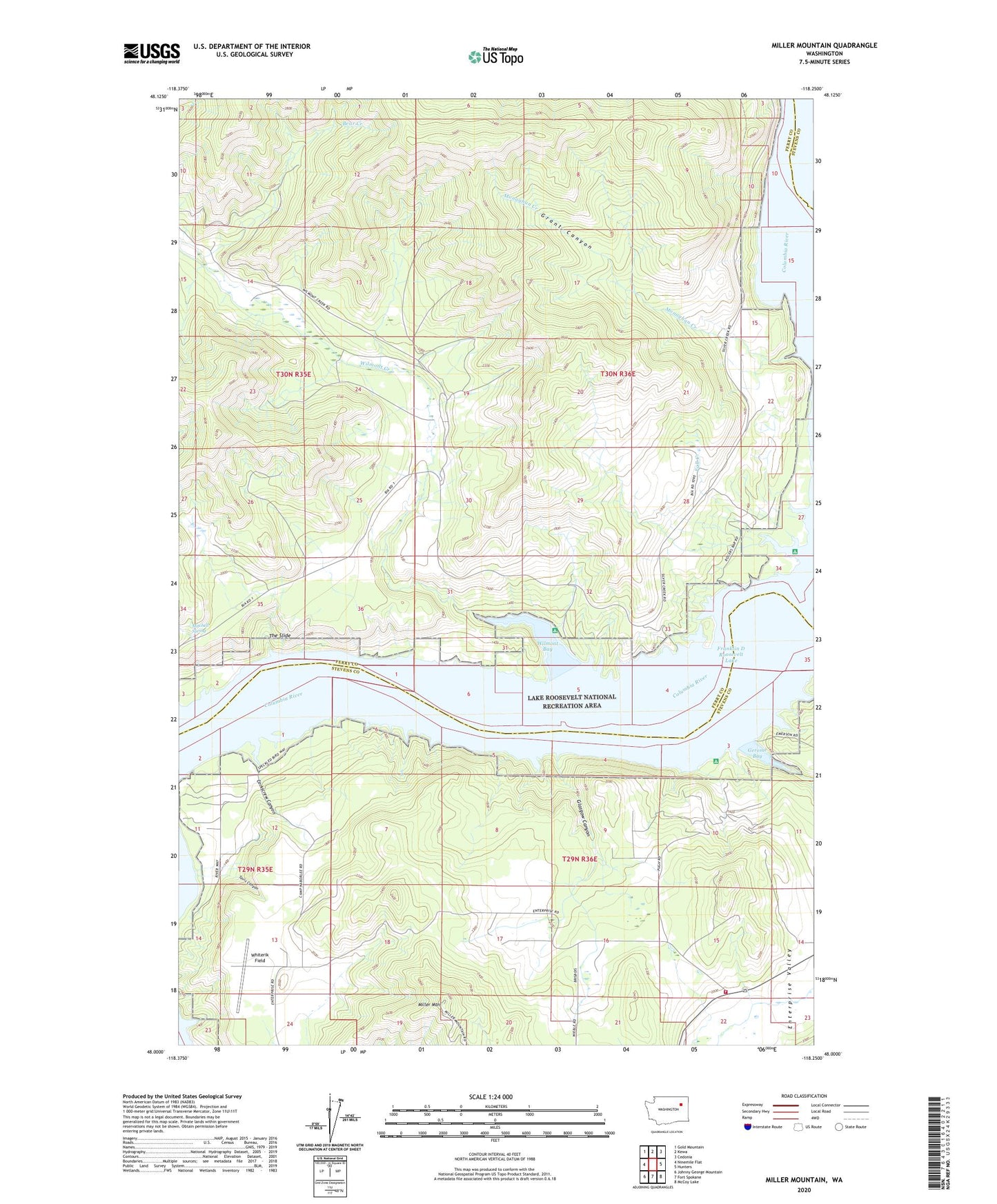
2023 topographic map quadrangle Miller Mountain in the state of Washington. Scale: 1:24000. Based on the newly updated USGS 7.5' US Topo map series, this map is in the following counties: Ferry, Stevens. The map contains contour data, water features, and other items you are used to seeing on USGS maps, but also has updated roads and other features. This is the next generation of topographic maps. Printed on high-quality waterproof paper with UV fade-resistant inks.
Quads adjacent to this one:
West: Ninemile Flat
Northwest: Gold Mountain
North: Kewa
Northeast: Cedonia
East: Hunters
Southeast: McCoy Lake
South: Fort Spokane
Southwest: Johnny George Mountain
This map covers the same area as the classic USGS quad with code o48118a3.
Contains the following named places: Bear Creek, Corkscrew Canyon, Enterprise Camp, Fall Creek, Gerome Bay, Gerome Landing, Glasgow Canyon, Grant Canyon, Hazelmere, Hazelmere Elementary School, Miller Mountain, Mitchell Spring, Monaghan Creek, Monahans, O-Ra-Pak-En Creek, Rogers Bar Church, Rogers Bar School, Stevens County Fire District 2 Station 240, Tavis Canyon, The Slide, Whiterik Field, Wilmont Bay, Wilmont Creek