MyTopo
Center Washington US Topo Map
Couldn't load pickup availability
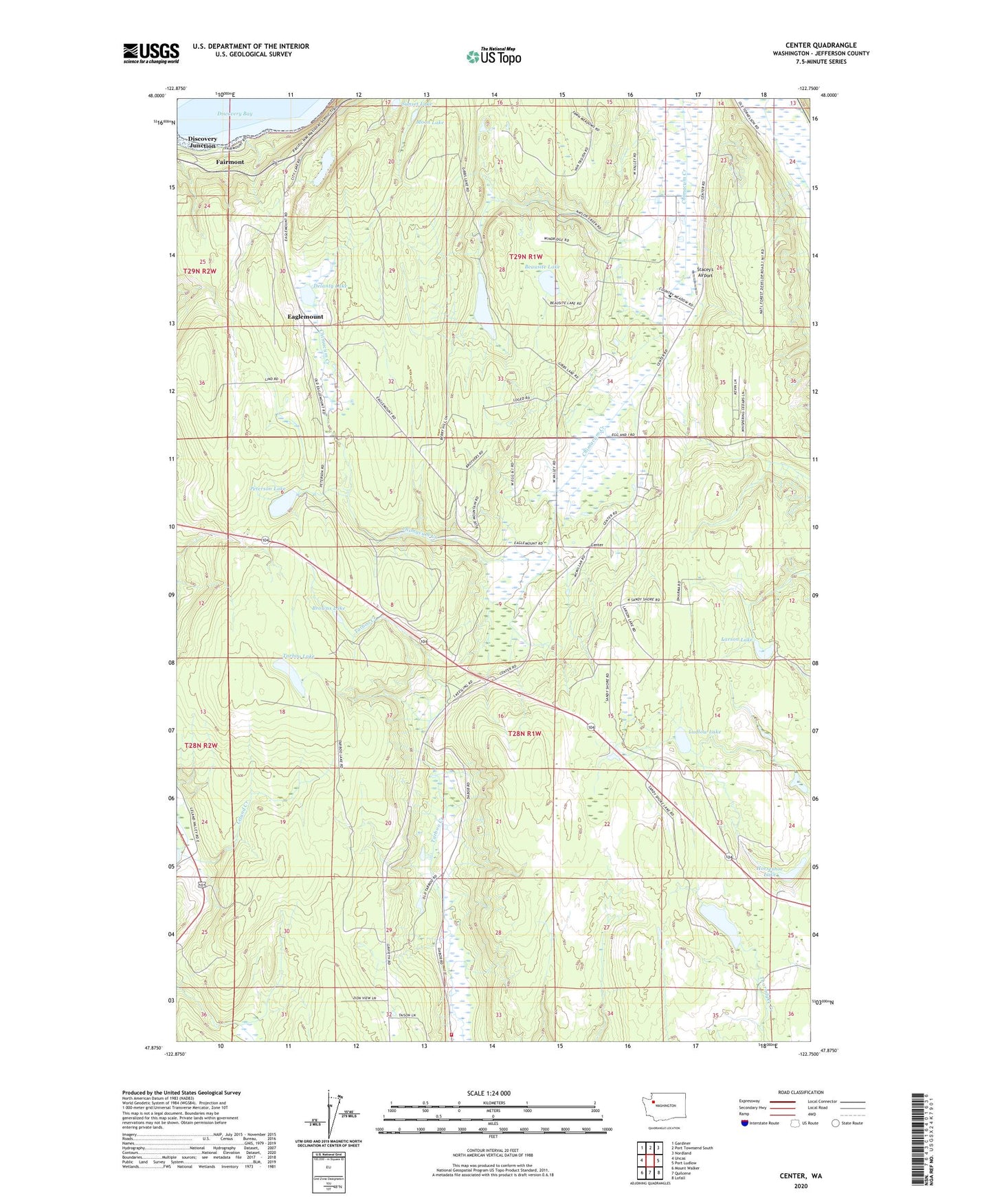
2023 topographic map quadrangle Center in the state of Washington. Scale: 1:24000. Based on the newly updated USGS 7.5' US Topo map series, this map is in the following counties: Jefferson. The map contains contour data, water features, and other items you are used to seeing on USGS maps, but also has updated roads and other features. This is the next generation of topographic maps. Printed on high-quality waterproof paper with UV fade-resistant inks.
Quads adjacent to this one:
West: Uncas
Northwest: Gardiner
North: Port Townsend South
Northeast: Nordland
East: Port Ludlow
Southeast: Lofall
South: Quilcene
Southwest: Mount Walker
This map covers the same area as the classic USGS quad with code o47122h7.
Contains the following named places: Beausite Lake, Browns Lake, Center, City Lakes Dam, Dabob School, Delanty Lake, Discovery Junction, Eaglemount, Fairmont, Gibbs Lake, Horseshoe Lake, Jefferson County Fire District 2 Quilcene Fire Rescue Station 23, Kingdom Hall of Jehovahs Witnesses, Larson Lake, Leland Lake Campground, Ludlow Lake, Moon Lake, Peterson Lake, Sandy Shore Lake, Stacey's Airport, Sunset Lake, Tarboo Lake, Timberline Quarter Horse Farm Airport, ZIP Code: 98325