MyTopo
Quilcene Washington US Topo Map
Couldn't load pickup availability
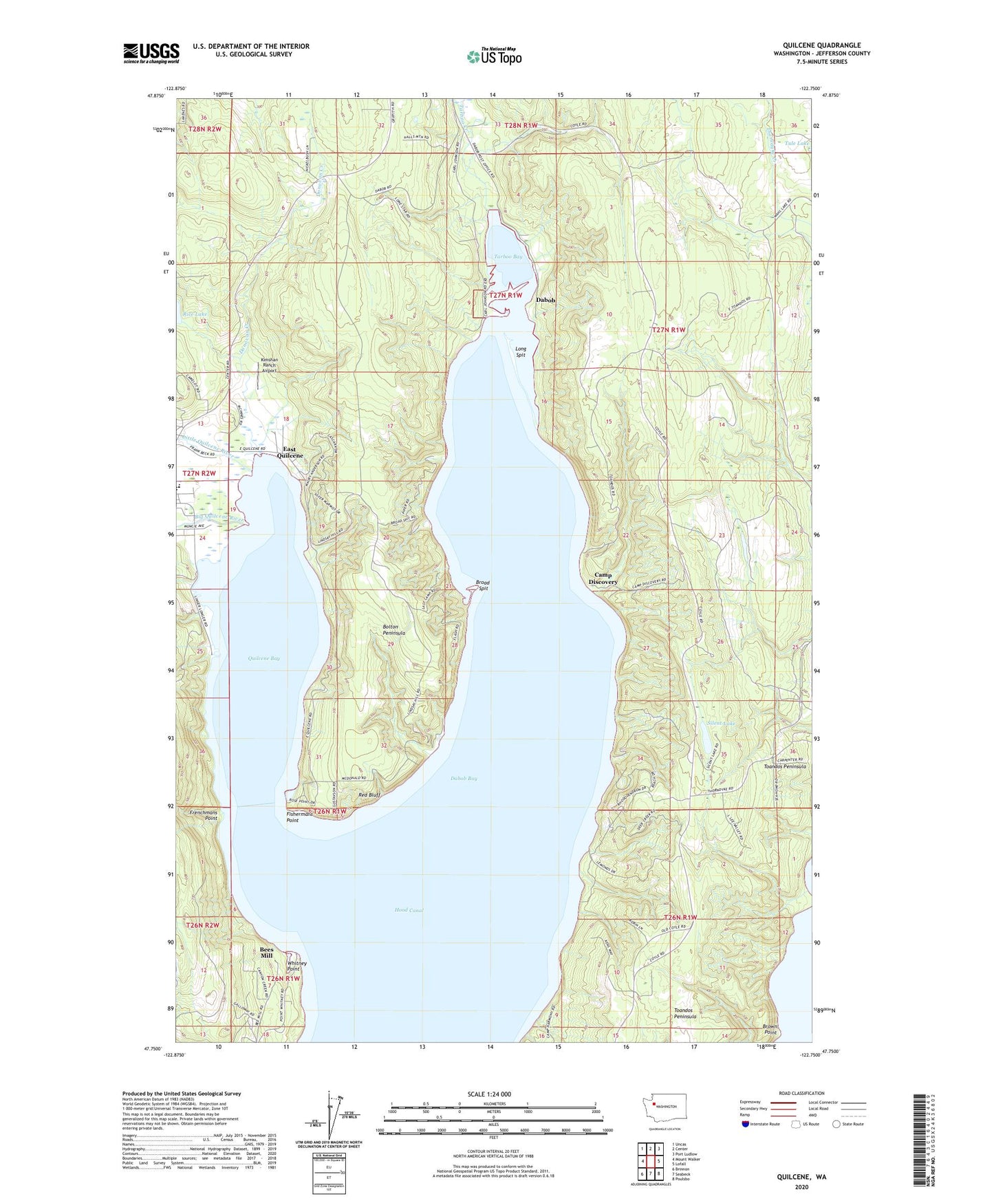
2023 topographic map quadrangle Quilcene in the state of Washington. Scale: 1:24000. Based on the newly updated USGS 7.5' US Topo map series, this map is in the following counties: Jefferson. The map contains contour data, water features, and other items you are used to seeing on USGS maps, but also has updated roads and other features. This is the next generation of topographic maps. Printed on high-quality waterproof paper with UV fade-resistant inks.
Quads adjacent to this one:
West: Mount Walker
Northwest: Uncas
North: Center
Northeast: Port Ludlow
East: Lofall
Southeast: Poulsbo
South: Seabeck
Southwest: Brinnon
This map covers the same area as the classic USGS quad with code o47122g7.
Contains the following named places: Bees Mill, Big Quilcene River, Bolton Peninsula, Broad Spit, Brown Point, Camp Discovery, Camp Harmony, Crossroads Community School, Dabob, Donovan Creek, East Quilcene, Fishermans Point, Frenchmans Point, Herb Beck Marina, Hood Canal Light, Indian George Creek, Kimshan Ranch Airport, Lindsays Beach, Lingerlonger Boat Launch Ramp, Little Quilcene River, Long Spit, Quilcene Bay, Quilcene Boat Haven, Quilcene Elementary and High School, Quilcene Elementary School, Red Bluff, Scalzo Dam, Silent Lake, Tarboo Bay, Tarboo Creek, Toandos Peninsula, Whitney Point, Whitney Point Boat Launch Ramp, ZIP Code: 98376