MyTopo
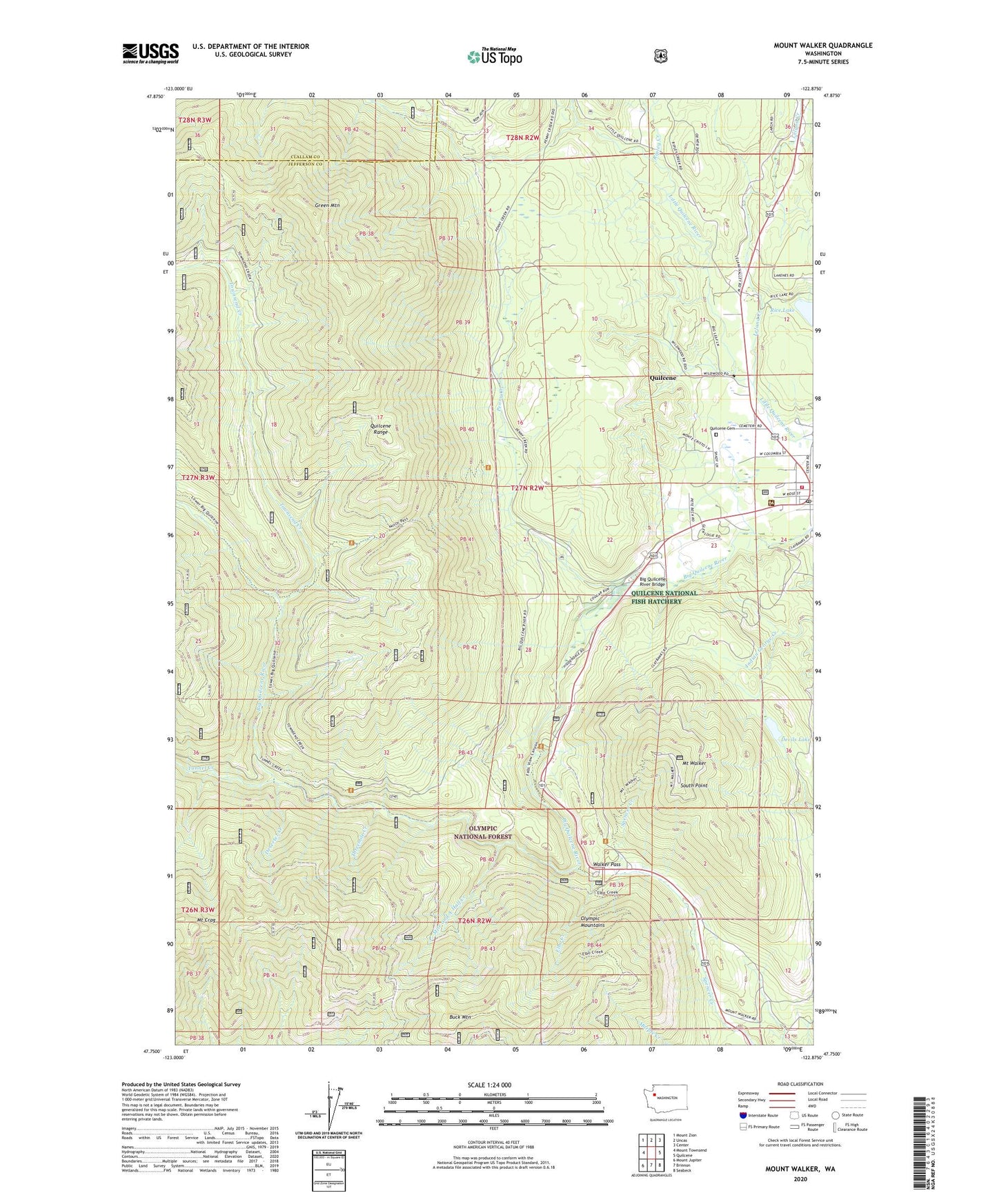
Mount Walker Washington US Topo Map
Couldn't load pickup availability
Also explore the Mount Walker Forest Service Topo of this same quad for updated USFS data
2023 topographic map quadrangle Mount Walker in the state of Washington. Scale: 1:24000. Based on the newly updated USGS 7.5' US Topo map series, this map is in the following counties: Jefferson, Clallam. The map contains contour data, water features, and other items you are used to seeing on USGS maps, but also has updated roads and other features. This is the next generation of topographic maps. Printed on high-quality waterproof paper with UV fade-resistant inks.
Quads adjacent to this one:
West: Mount Townsend
Northwest: Mount Zion
North: Uncas
Northeast: Center
East: Quilcene
Southeast: Seabeck
South: Brinnon
Southwest: Mount Jupiter
This map covers the same area as the classic USGS quad with code o47122g8.
Contains the following named places: Bark Shanty Shelter, Big Quilcene Dam, Big Quilcene River Bridge, Buck Mountain, Deserter Creek, Devils Lake, Elbo Creek, Falls View Campground, First Presbyterian Church, Green Mountain, Hood Canal Ranger District - Quilcene Office, Howe Creek, Jefferson County Fire District 2 Quilcene Fire Rescue Bob Wilson Station 21 Headquarters, Leland Creek, Little Quilcene River Dam, Mile and A Half Creek, Mount Crag, Mount Walker, Penny Creek, Penny Creek Quarry, Quilcene, Quilcene Assembly of God Church, Quilcene Bible Church, Quilcene Cemetery, Quilcene Census Designated Place, Quilcene National Fish Hatchery, Quilcene Post Office, Quilcene Quarry, Quilcene Range, Rainbow Camp Guard Station, Rice Lake, Ripley Creek, South Point, Threemile Creek, Townsend Creek, Tunnel Creek, United States Fish Hatchery, Walker Pass