MyTopo
Chester Morse Lake Washington US Topo Map
Couldn't load pickup availability
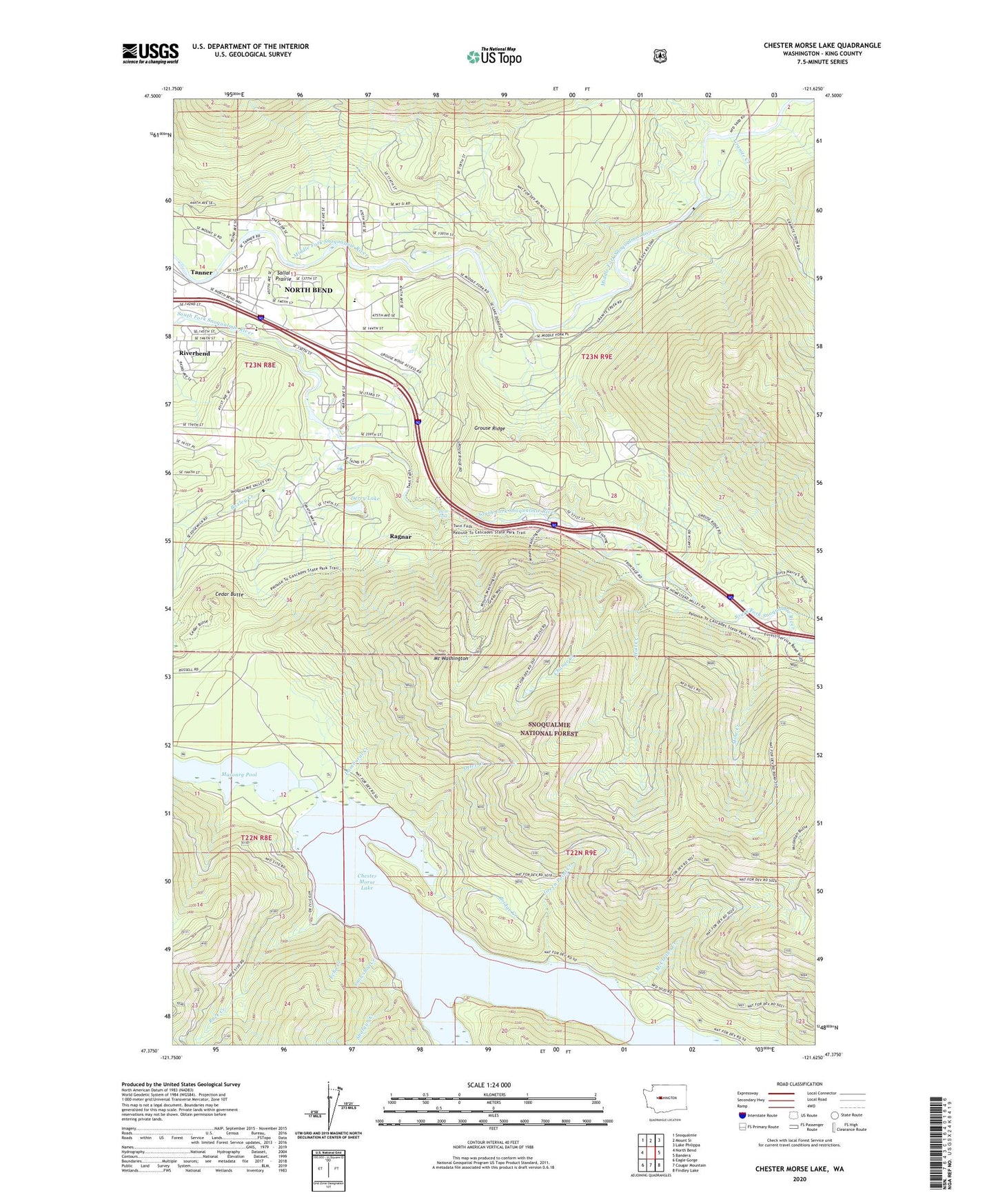
2020 topographic map quadrangle Chester Morse Lake in the state of Washington. Scale: 1:24000. Based on the newly updated USGS 7.5' US Topo map series, this map is in the following counties: King. The map contains contour data, water features, and other items you are used to seeing on USGS maps, but also has updated roads and other features. This is the next generation of topographic maps. Printed on high-quality waterproof paper with UV fade-resistant inks.
Quads adjacent to this one:
West: North Bend
Northwest: Snoqualmie
North: Mount Si
Northeast: Lake Philippa
East: Bandera
Southeast: Findley Lake
South: Cougar Mountain
Southwest: Eagle Gorge
Contains the following named places: Boxley Creek, Bridge Creek, Camp Waskowitz, Cedar Butte, Change Creek, Chester Morse Lake, Chester Morse Monument, Crib Dam, Damburat Creek, Derry Lake, Echo Creek, Edgewick, Granite Creek, Green Point Creek, Grouse Ridge, Hall Creek, Horseshoe Mine, Masonry Pool, McClellan Creek, Mine Creek, Mount Washington, North Bend Airstrip, Otter Creek, Rack Creek, Ragnar, Rex River, Riverbend Census Designated Place, Riverpoint, Riverpoint Census Designated Place, Sallal Prairie, Shotgun Creek, Snowshoe Creek, Tanner, Tanner Census Designated Place, Twin Falls, Twin Falls Middle School, Twin Falls State Park, Washington Fire Training Academy