MyTopo
Lake Philippa Washington US Topo Map
Couldn't load pickup availability
Also explore the Lake Philippa Forest Service Topo of this same quad for updated USFS data
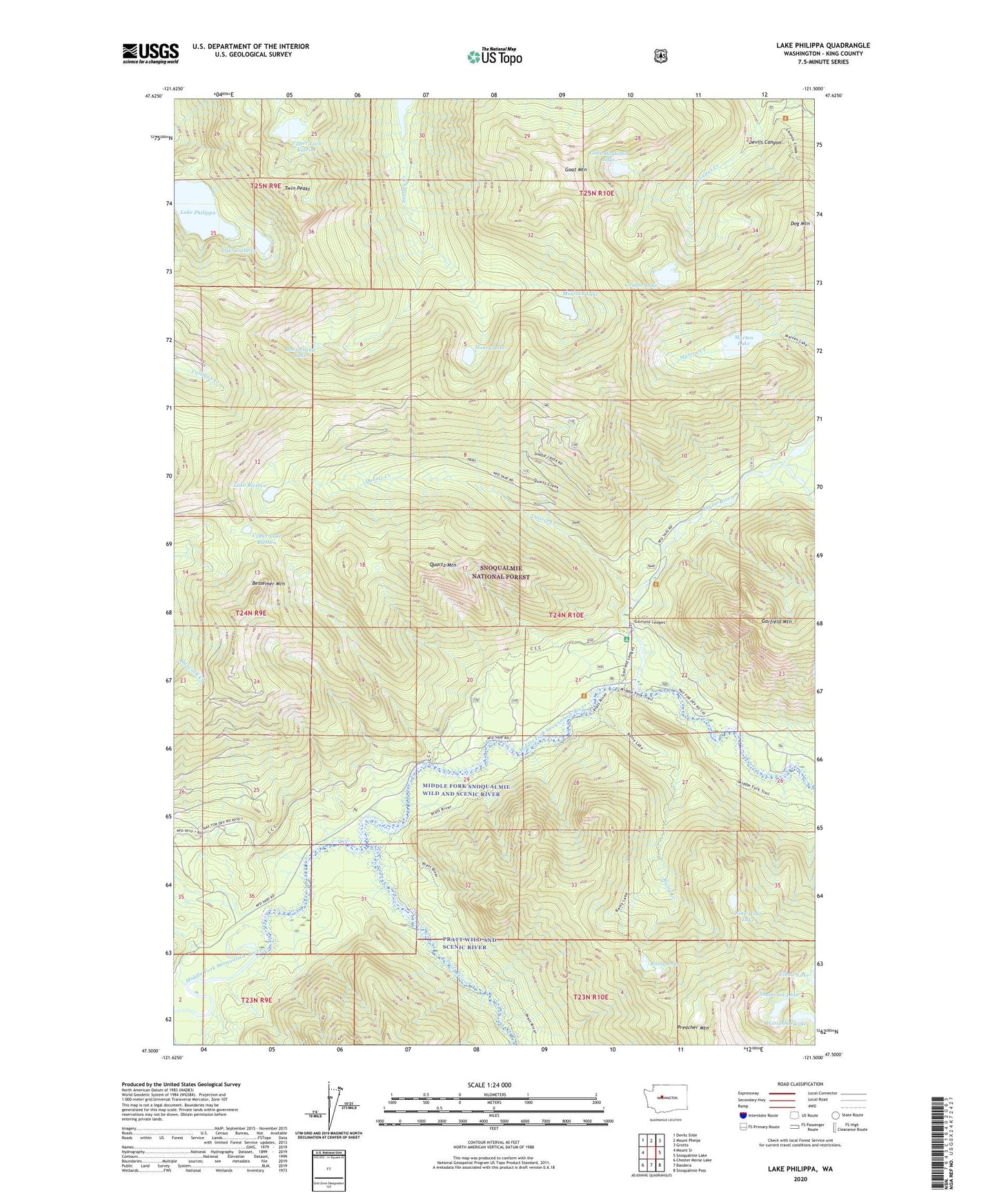
2023 topographic map quadrangle Lake Philippa in the state of Washington. Scale: 1:24000. Based on the newly updated USGS 7.5' US Topo map series, this map is in the following counties: King. The map contains contour data, water features, and other items you are used to seeing on USGS maps, but also has updated roads and other features. This is the next generation of topographic maps. Printed on high-quality waterproof paper with UV fade-resistant inks.
Quads adjacent to this one:
West: Mount Si
Northwest: Devils Slide
North: Mount Phelps
Northeast: Grotto
East: Snoqualmie Lake
Southeast: Snoqualmie Pass
South: Bandera
Southwest: Chester Morse Lake
This map covers the same area as the classic USGS quad with code o47121e5.
Contains the following named places: Bessemer Mountain, Boomerang Lake, Camp Brown Guard Station, Cougar Lake, Devils Canyon, Dog Mountain, Elbow Lake, Goat Mountain, Goat Mountain Lake, Honey Lake, Horseshoe Lake, Lake Blethen, Lake Isabella, Lake Philippa, Marten Lake, Mowitch Lake, Nine Hour Lake, Nordrum, Nordrum Lookout, Pratt River, Quartz Creek, Quartz Mountain, Rainy Creek, Rainy Lake, Shamrock Lake, Snoqualmie Valley Division, Taylor River, Taylor River Forest Camp, Twin Peaks, Upper Lake Blethen, Upper Loch Katrine